This is part four of our Nakasendo Hike. Read parts one, two, or three.
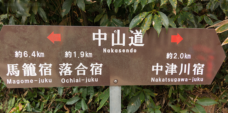
My schematic map of the Nakasendo Way only sent as far as Magome. At the tourist info in Magome I had picked up a map of the Nakasendo Way through the Gifu Prefecture, but this was a topographic map at large scale, and some of the details were not as clear.
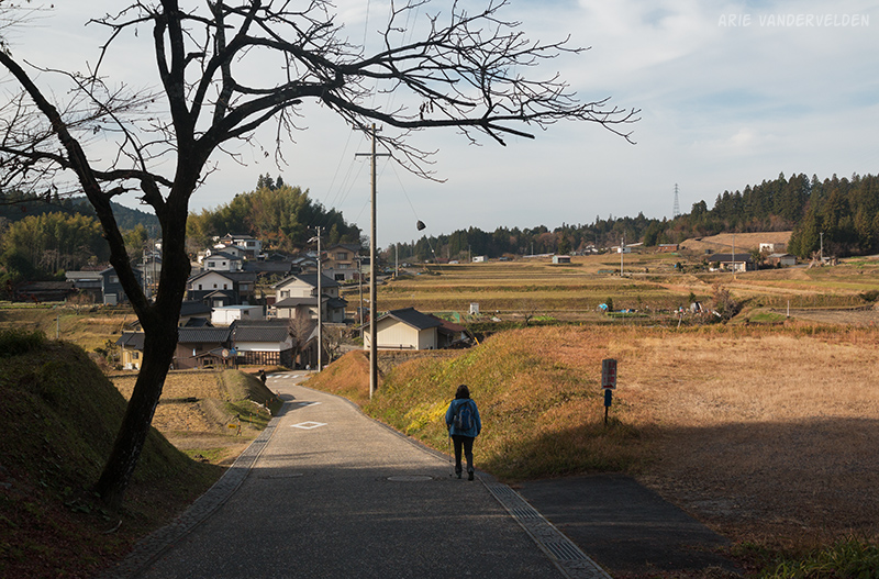
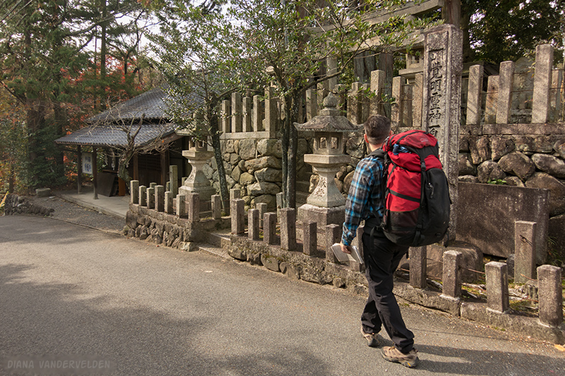
We set off down the road on yet another perfect fall day.
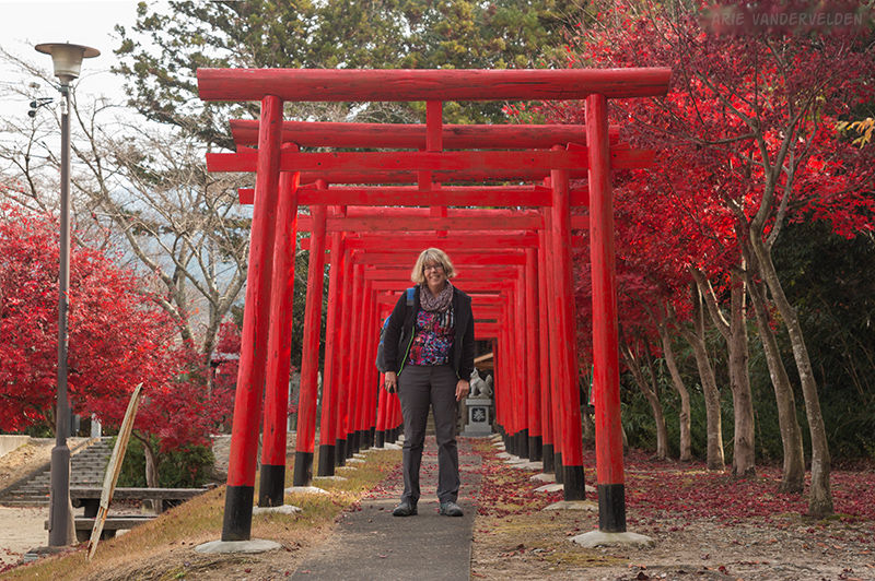
A torii gate beside the road marked the entrance to a village shrine in the forest.
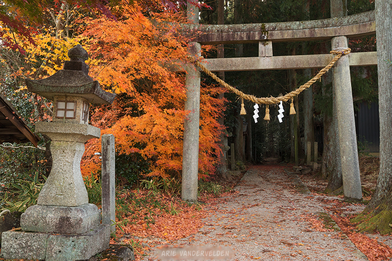
We detoured into the forest to look at the shrine.
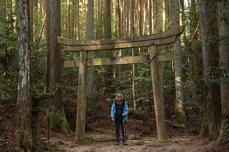
After having a look around we went back to the road, and followed it downhill past houses and small farms.
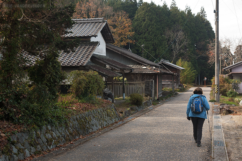
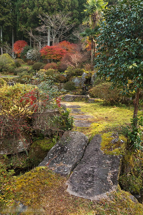
Many of these houses had pretty gardens, and I enjoyed looking. Japanese gardens make use of grey rocks, green mosses, and a lot of leafy shrubs.
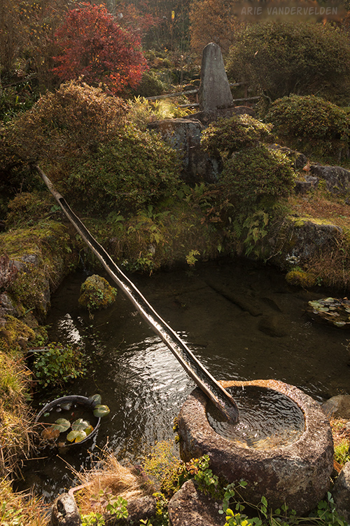
Japanese gardens almost always have water features.
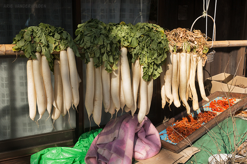
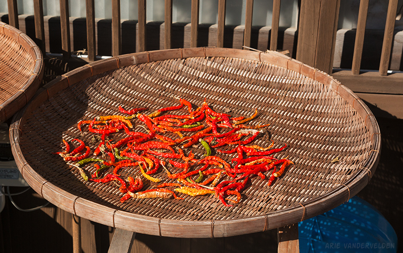
Given the recent frost, farmers and people with vegetable gardens were busy harvesting. Vegetables were hung to dry on sunny aspects.
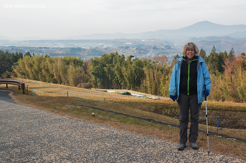
The road continued downhill, at times steeply, into a broad and more densely populated valley.
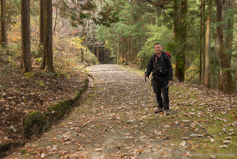
On the way down through a forest, a section of the original Nakasendo Way is preserved. It’s called the Ochiai Pavement, after a nearby village.
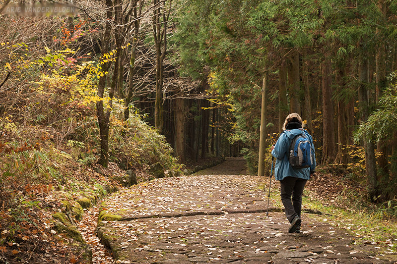
I’m sure the Edo-era engineers meant well, but the stones were extremely slimy and slick, and walking across them was treacherous. Thank goodness for the hiking poles.
At the bottom of the Ochiai Pavement was a small village. We continued downhill and decided to turn left at an unmarked junction. This was the correct way. The trail led down to a bridge and into a village. There were a few signs indicating 中 山 道 (Nakasendo Way) so we knew we were in the right place. Until we missed a turn-off. A kind gentleman spotted me looking puzzled at my map, and he pointed in the right direction.
We soon got lost again, and I asked an old lady hoeing her field. She spoke to me in rapid-fire Japanese and did lots of pointing, the latter of which helped a lot. Soon we were following markers again, up and down some steep hills, through some villages not far from a busy highway.
We stopped at a small shrine.
Diana spotted some flowering trees beside the road, and stopped to take some pictures. A man with a white bandana came out and started talking to us in Japanese. He broke off two branches off of the tree, proceeded to remove most of the leaves and flowers, leaving only the flower buds. Diana took them all the way to Kyoto where she put them into a vase (well, actually a used water bottle) and sure enough the flower buds opened up. There are so many kind people here in Japan. Everyone has been so nice to us.
Logistics
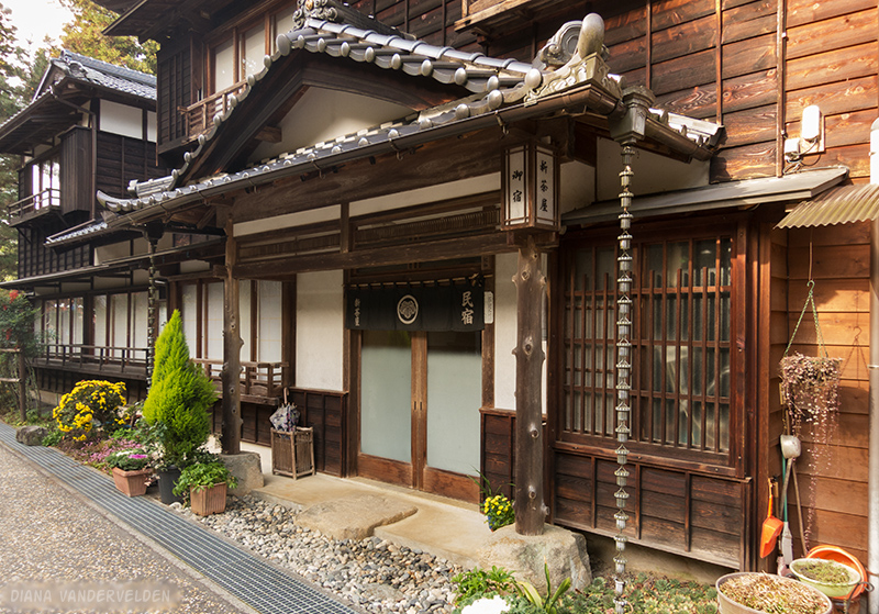
We did not stay in Nakatsugawa. It does seem like a nice town, and there are hotel listings on major booking sites.
We took the train to Nagoya, where we connected to Kyoto.