The Kii Peninsula in west-central Japan is an area of rugged mountains. In these mountains are three grand Shinto shrines: at Hongu, Shingu, and Nachisan. There is also Koyasan, a center of Buddhist learning, established by a monk called Kobo Daishi in the 9th century. Connecting these religious places is a network of pilgrimage trails collectively referred to as the Kumano Kodo.
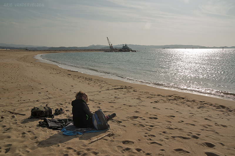
The most popular segment of the Kumano Kodo is called the Nakahechi route. The staging area for this walk is in the coastal town of Kii-Tanabe. We took a train to Kii-Tanabe where we stopped by the tourist office to get maps. We sent a heavy bag ahead with Takkyubin (see logistics). We stopped by a bakery and bought some stuffed buns for lunch on the trail, and the elderly couple who ran the bakery bowed and smiled extensively. We bowed and smiled in return. Then we walked to the beach. It was a nice sunny day and we relaxed on the sand for a while.
Kii-Tanabe was a very quiet town and most of the shops were closed. I’m guessing it must get busy here in the summer months. The pubs, however, were very lively at night and we found a good one for dinner. We feasted on a set meal with miso soup, rice, tempura, a variety of pickles, and beer.
Takijiri to Chikatsuyu
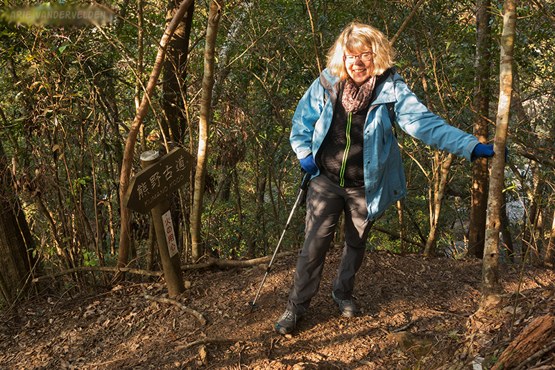
We got up very early and caught a bus to Takijiri, a little hamlet where the start of the trail is located.
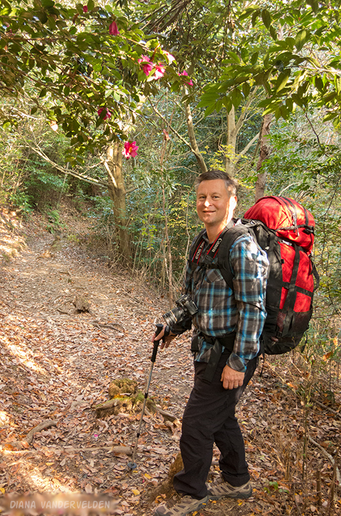
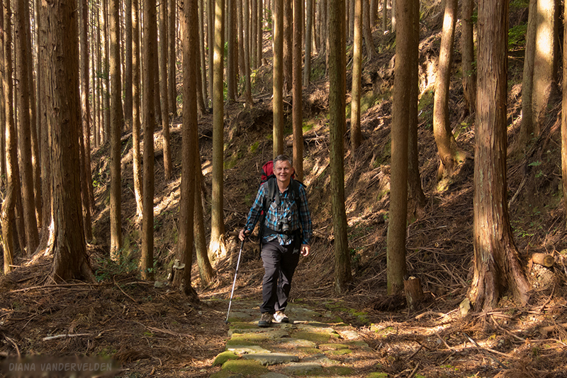
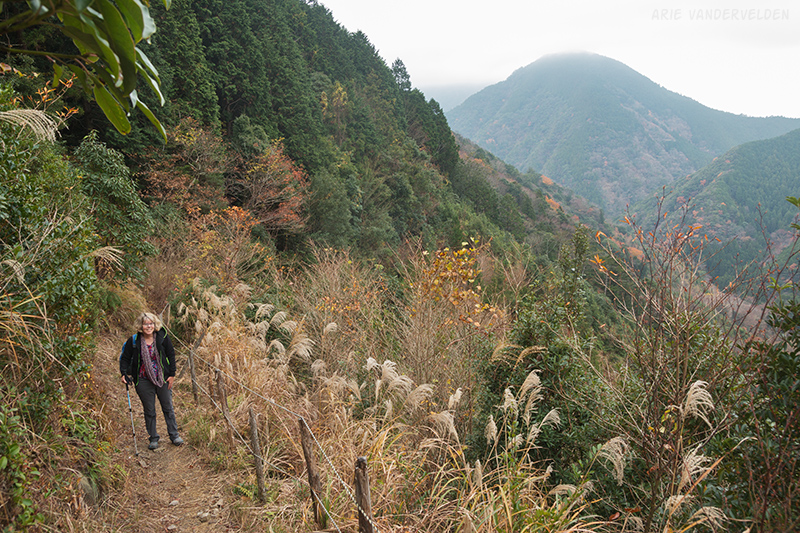
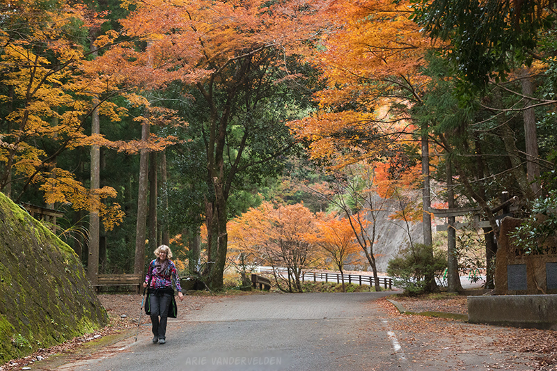
The first bit of trail was very steep. The trail was essentially a staircase with treads made of stones and tree roots. Soon I was shedding jackets and other warm clothes.
After about a kilometer of relentless climbing, the trail leveled off and followed a ridgetop.
We were pleased to see some flowering shrubs. At home we don’t have flowers in December.
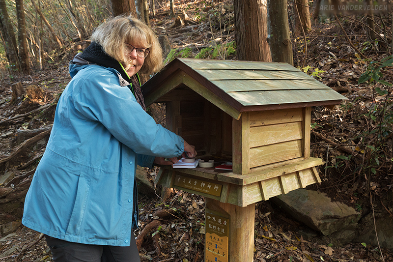
Along the trail are a number of holy rocks, small Shinto shrines called oji, and ruins of teahouses. To commemorate these points of interest there are boxes with stamps inside. You press the stamp on an inkpad and then stamp your book. A book full of stamps is a nice souvenir to have.
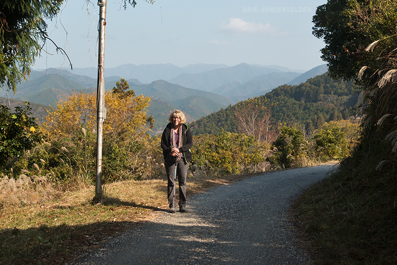
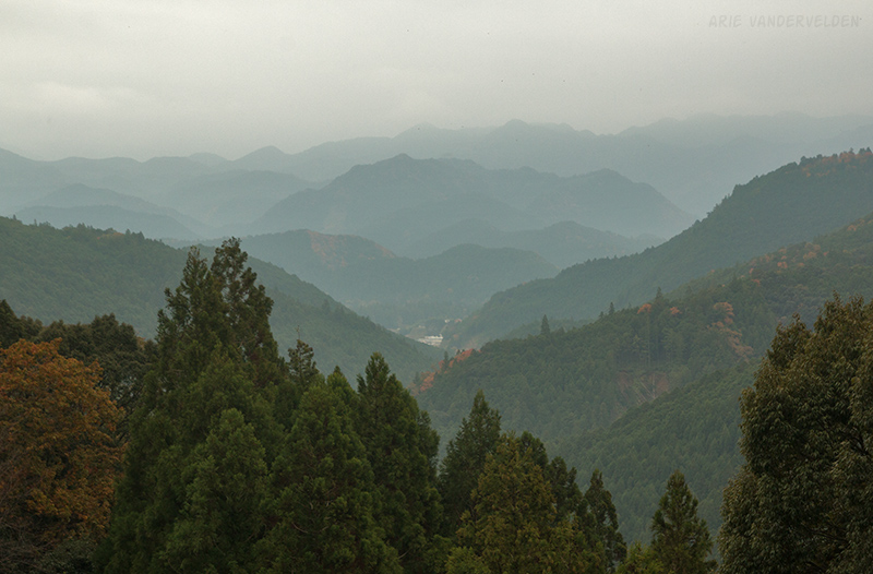
Soon the trail started climbing again. However the uphill was not as long or as steep as the previous one. At the top of the hill the trail met up with a road, and there were views of the mountains.
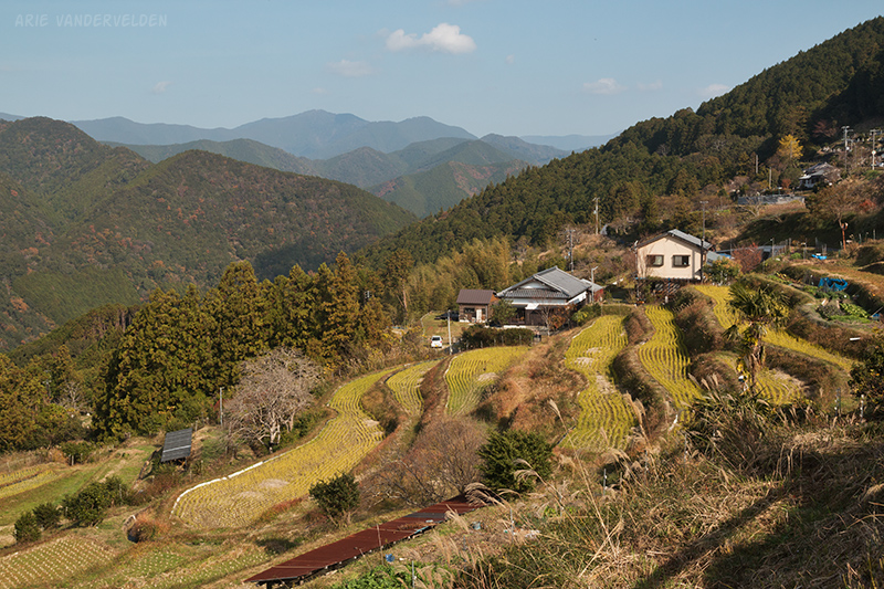
The road led to the village of Takahara. Takahara is a lovely place. We stopped for a coffee and sat on a bench enjoying the vista. There are magnificent views across the rice paddies and farmhouses to the mountains beyond.
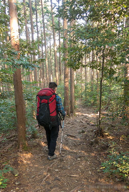
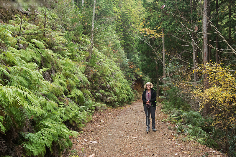
After Takahara the trail entered a second-growth cypress forest. Initially the trail was quite steep, but it then leveled off and undulated as it wound its way around hillsides and forested ridges. We walked through cypress forest for mile after mile.
We passed a hill known for its moon-viewing. Once a three-fold moon was observed here, and people come to this hill with hopes of seeing it again. After reading the interpretive signs, it sounds like they may have been moon-dogs.
Eventually the trail emerged from the cypress forest near a highway. In this area there were some pretty maple trees.
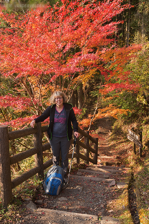
The trail re-entered the cypress forest and wound around one more hillside before finally emerging at the village of Chikatsuyu. It had been a full day of hiking, and we were happy to drop our packs for the night.
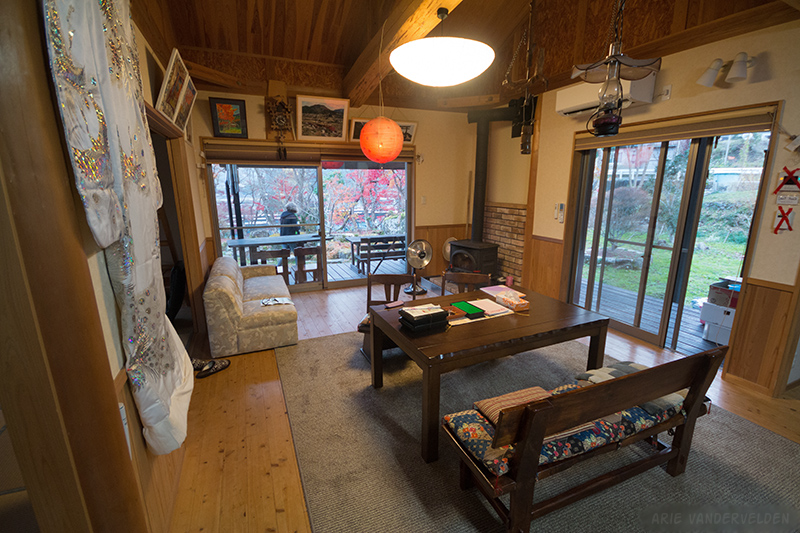
In Chikatsuyu we had rented a house for the night. It was a beautiful house with a large garden around it. The house was light and airy with great views of the surrounding countryside. Some very elaborate kimonos graced the walls.
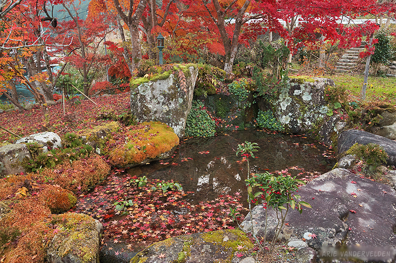
The garden had a pretty water feature surrounded by mossy stones. A bright-red maple tree leaned over the pond and was dropping its leaves into the water, where they gently swirled around. Happiness Chikatsuyu is a magical place, and I was wishing I would have booked a second night here.
In the shed were some bicycles, and I cycled to the store to get some beers. A lady from the village stopped by the house and brought us some bento boxes for dinner.
Chikatsuyu to Hongu
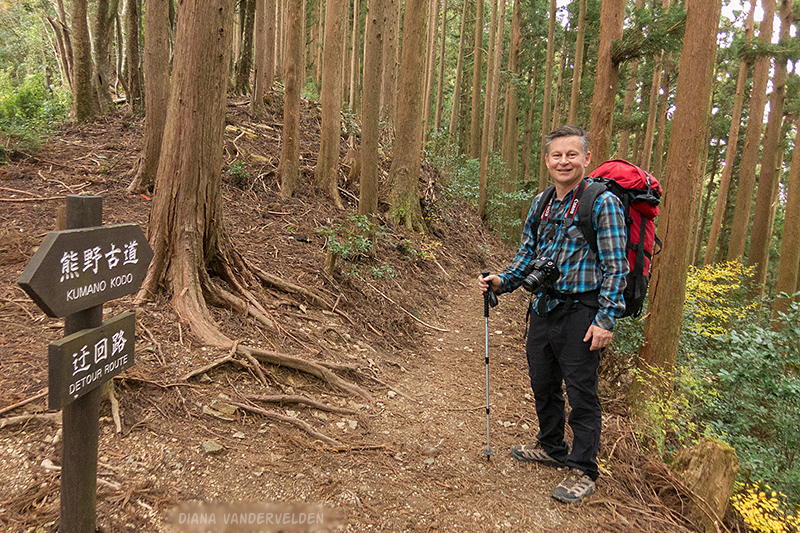
The next morning we took a short bus ride to shorten the day. Even so, we still had 18 km to cover. We started out with a hefty uphill climb to a place called Detour Pass.
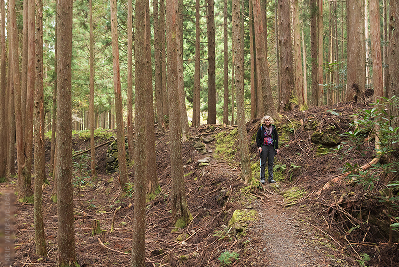
On the other side of the pass the trail descended through cypress forest.
In the next valley the trail met up with an old logging road, and we followed it for a while.
The trail then went right back up another pass, the Mikoshi-toge Pass, where we crossed a roadway. We ate our lunch at a shelter beside the road.
On the other side of the Mikoshi-toge Pass we followed a drainage downward through cypress forest, where intersected another logging road. The logging road went gently upward, and we made quick progress because the footing was good. The logging road met up with a paved road with very little traffic on it, and we booted down this road to a shrine called Hosshinmon-oji.
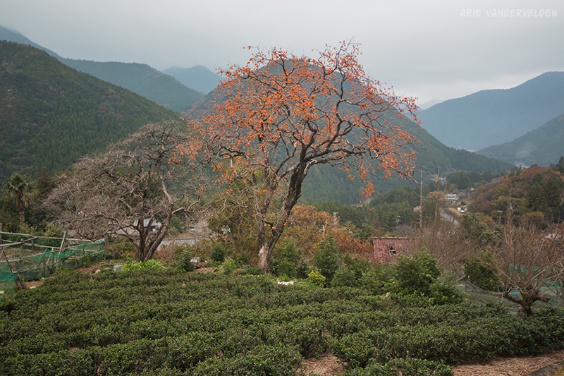
The next few kilometers presented some wonderful and much more interesting hiking. The trail led through a village, and there were some farms with tea plantations. We now had views of the countryside and the mountains.
Dark clouds were gathering in the sky. Earlier in the day I had been concerned about reaching our destination before dark, but as we approached Hongu I knew we’d get there just in time. The question now was: would we get there before the rain?
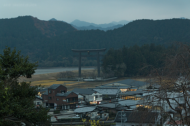
The trail re-entered the forest, and we descended down the rocky and rooty path as darkness began to fall. At the top of Hongu we could see our destination: the giant Torii gate. Hongu’s Torii gate is the largest in Japan, and we had rented a house right beside it.
We stumbled down the last remaining steps, bought some groceries at the local shop, and located the house. We were sitting at the kitchen table with the owner going through the check-in details. Suddenly there was a rumble and the house shook briefly. “Earthquake!” the owner said, and jumped up to look out the window. He then shrugged and said it happens all the time. To us it wasn’t routine…
After the owner left we cooked up some dinner. Just then a massive downpour came down, pounding on the roof of the house. We were happy to be snug inside.
Continue to part two of the hike.
Logistics
The Kii peninsula is south of Osaka and Kyoto, and juts out into the Pacific Ocean. There are frequent trains around the perimeter of the peninsula, originating in Osaka. In the interior of the peninsula there is some bus service. Ask for a bus schedule at the tourist office or your guesthouse because some of these buses only run a few times per day. Kii-Tanabe has a friendly tourist office.
There is a local community-based travel agency called Kumano Travel that can help you organize a Kumano Kodo hiking trip. They have a guidebook posted online with maps and travel tips, and they can book accommodation for you. Their map booklet is available as a free .pdf download. It’s not easy to find on their website, so here is a link. Find the link “complete map booklet” to download the map set. It’s extremely detailed. I studied the .pdf booklet prior to departure, and the day before our hike I picked up a hardcopy at Kumano Travel’s Kii-Tanabe office.
Judging by guestbook entries at guesthouses, most people hike the trail in the summertime. Be aware that Japan is very hot in the summertime, and afternoon downpours are common. We hiked the trail in early December when the weather is much cooler. In December, however, daylight hours are limited and it’s important to plan for this. Plan for reasonable-length days, and be sure to get an early start.
The folks at Kumano Travel are aware of this and will help you with planning. I asked them to book Chikatsuyu Happiness for me, and they made sure we started out from Kii-Tanabe with an early morning bus. They would have refused the reservation if we had we said we’re starting from Osaka that day. They don’t want innkeepers to be searching for you in the dark. In Japanese culture this is not overbearing; they’re simply looking out for your well-being.
We sent our heavy bag ahead to Kii Katsuura, and hiked with a light pack for a week. We used the Takkyubin service. I wrote about Takkyubin in my Nakasendo writeup (see logistics section). Kumano Travel offers a same-day luggage transfer so that your bag will be at your next hotel; this service is quite expensive.
Once on the trail it’s nearly impossible to get lost. There are lots of signs, and if you take a wrong turn there will be a sign saying “not Kumano Kodo”. On top of that there are numbered mileposts along the trail every 500 m, and these are marked on the map. This way you know exactly where you are, and you can keep track of progress.
Takijiri to Chikatsuyu is about 14 km. It doesn’t sound very far but it’s steep and rugged. The guidebook suggests 6-8 hours.
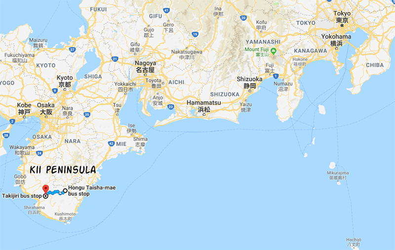
Chikatsuyu to Hongu is about 25 km. In the wintertime this would require a pre-dawn start. We shortened our day to 18 km by taking a bus to Kobiro-toge and hiking to Hongu from there. If I were to do this hike again I’d book Happiness Chikatsuyu for two nights. Arrival on the first day, the second day I’d take the bus to Kobiro-toge and hike back to Chikatsuyu. This would be a short 7 km hike, allowing one to relax at the house in the afternoon. The third day I’d take the bus to Kobiro-toge, and hike on to Hongu.
- In Tanabe we stayed at Guesthouse Ogawaya. It’s inexpensive and the owner is friendly, but the futons were very thin. Okay.
- In Chikatsuyu we stayed at Happiness Chikatsuyu. I wish I could buy this house and retire there. Breakfast was so-so. Highly recommended.
- In Hongu we stayed at Hoshi no Jikan. It’s a very comfortable house with great views, and it even has a meditation room. There are beds with memory-foam mattresses, which were divine after having slept on futons for the past few days. However the house is beside a busy road and there’s some road noise. The owner is very friendly. Highly recommended.