Hongu
In part one of this series I describe our hike from Takijiri to Hongu. We arrived in Hongu just before a big downpour, and we were snug in our beds with memory-foam mattresses and fluffy duvet covers as the rain pounded on the roof.
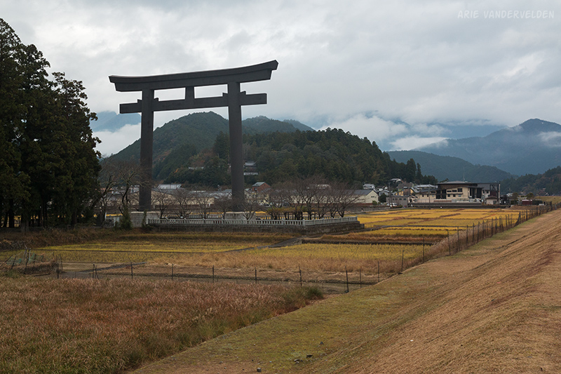
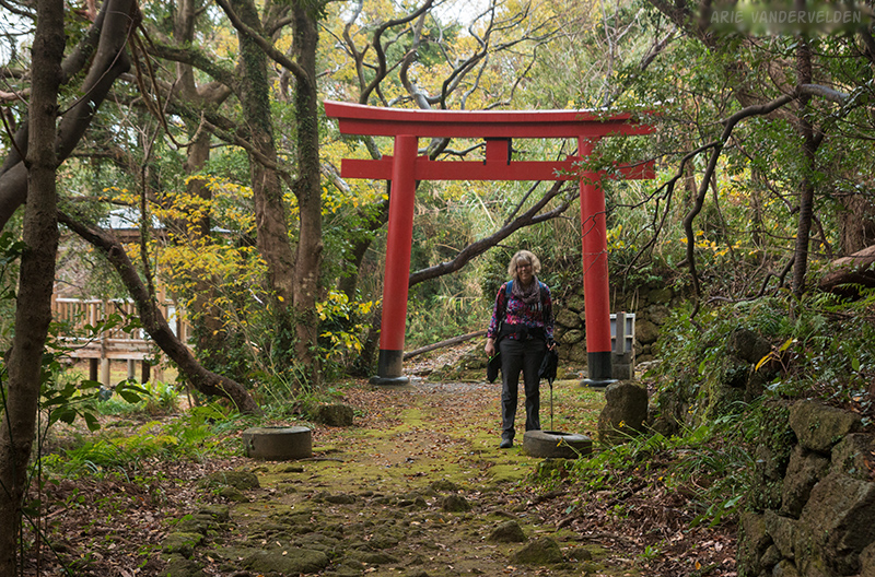
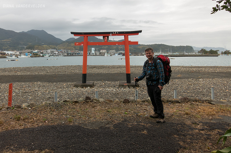
The next morning we woke up and looked out the window. Japan’s biggest Torii gate was there to greet us.

We had booked the house for two nights, allowing us a day to explore Hongu. After a leisurely breakfast we walked to the Torii gate. The Torii gate is set in an area of rice paddies on a floodplain of a river.

Between the rice paddies and the riverbed was a dike. A path on top of the dike offered great views of the Torii gate, the mountains, and clouds swirling around the mountaintops.
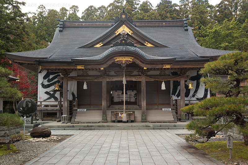
Hongu has one of the three “grand Shinto shrines” of the Kii Peninsula. We walked into town and had a look.

At the top of the stairs we stopped at a cleansing station. You pick up the dipper with your right hand, scoop up some water, and rinse your left hand. You then switch hands and wash the right hand. You then switch sides once more, put some water in your left hand, and use it to rinse your mouth.

At one of the temples, the abbot had drawn some calligraphy characters on some cotton sheets. He draws them by dipping a string mop into a bucket of paint. I believe the kanji characters summarize the past year.
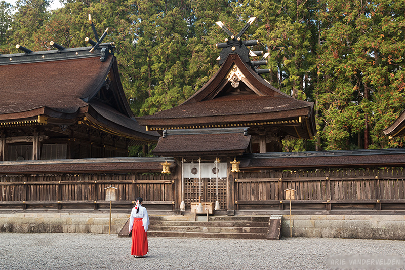
Also note the three-legged crow in the previous picture. He’s on the left. The crow is called Yatagarasu, and he’s the symbol of the Kumano Kodo pilgrimage trail, just like the scallop is the symbol of the Way of St. James.

Some people were saying their prayers at the main temple.
After our temple visit we had a nice lunch at a restaurant, and then we went back to the house to relax. There was a stack of origami paper but there were no instructions, so we looked it up online. We amused ourselves by folding the crane. My crane came out a bit lopsided, and Diana’s had a kink in its neck. I suppose this is another instance where Japanese perfectionism pays off. Again it rained for several hours after sunset.
Hongu to Koguchi
We woke up to sunny weather. We had breakfast, checked out, and then took a bus to a little village called Ukegawa. As we were waiting for the bus an elderly Japanese gentleman approached us and started talking, mostly in Japanese. He looked a little like David Suzuki, with long hair, a moustache, and a beard the shape of a shaving brush. He told us he was seventy years old but still strong. I think he was trying to tell us that his wife had died but I’m not sure about that. When he ran out of English words to say he started talking about music, naming bands, the Beatles, Paul Anka. We nodded, smiled, and tried to decipher what he was saying. Then the bus pulled up, we all got in, and we all got off at the same stop. He was headed a different way than we were, and we said our goodbyes. He seemed like a really nice man.
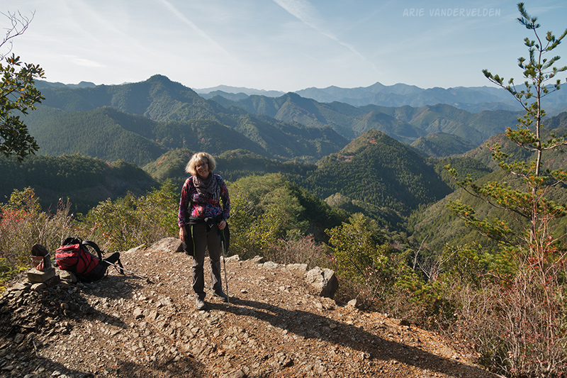
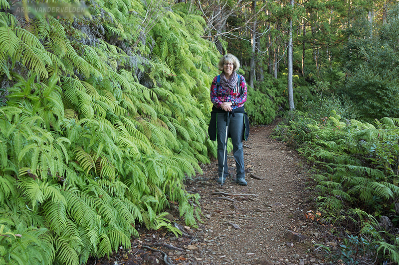
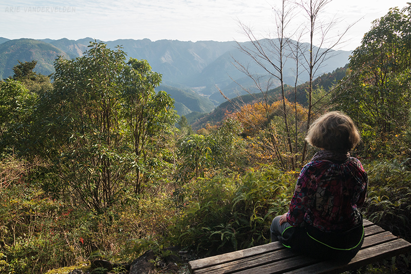
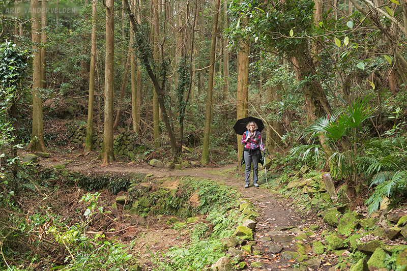
Today’s hike was a bit more gentle than the previous two days. The steep bits were shorter and the overall gradient was less. Much of the trail was crushed gravel rather than roots, and we made quick progress through the forest. At a place called Hyakken-gura the trail suddenly emerged from the forest and there were wonderful views. It is said that from this location you can see 3,600 mountains. I think this is a slight exaggeration, but the views are enjoyable nonetheless.
Just ahead there was a fallen tree across the trail. I was about to step over the log when I spotted a small snake perched on the log, sunning itself. It looked a lot like a Japanese mamushi snake, a type of venomous pit-viper. I poked at it with a long stick and it slithered away. A short distance ahead there was another snake on the trail, a black one this time, probably a keelback. And then we saw a third snake. And then there were two more trees across the trail.
Later on in our travels through Japan I spoke with some monks. I told them I had seen three snakes and three fallen trees across our path on the third day of hiking the pilgrimage trail. I think much of my story was lost in translation, but the monks told me that snakes aren’t necessarily a bad sign.
At the ruins of a teahouse there was a picnic shelter and a stamp box. We stopped to have some lunch.
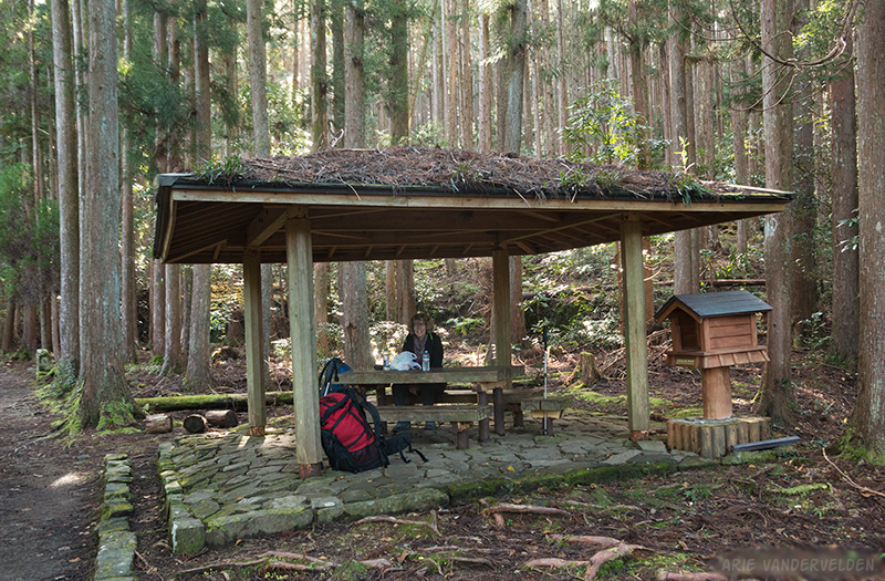
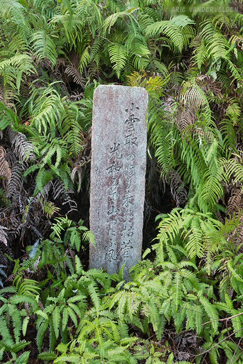
My map indicated some “poem monuments” along the trail. I’d like to think of these poems as being haiku, but that’s just my assumption.
The trail now started to descend.
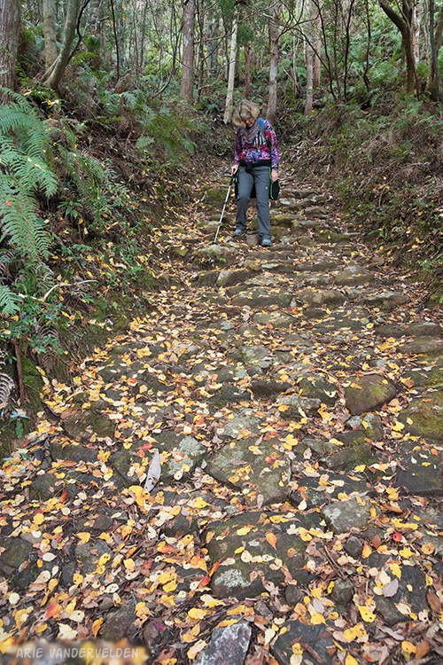
Some sections were smooth, as seen above, and others were rooty, rocky, and eroded.

There were some sections of stone pavement as well. I’m sure the trail-builders meant well, but the stones are very slick and we were careful not to twist an ankle.
We took a short break at a teahouse ruin where there was a view of the valley below.
We continued downhill and emerged from the forest at a small village along a river. By now the sun was quite low and we were in deep shade. We walked to the main road and followed it through a short tunnel to arrive at Koguchi.
In Koguchi we stayed at a place called Koguchi Shizen-no-ie, a former schoolhouse that has been converted in a guesthouse for walkers. We soaked in the onsen (spa) which was very hot, and then dined in the former school cafeteria/gym. They had cooked up a storm even though we were the only guests for the night.

From the village of Koguchi there is a route that goes over a high mountain ridge and ends up at Nachisan, one of the three grand shrines. It has a reputation as being one of the the toughest sections of the Kumano Kodo. It is supposed to be very steep, rugged, and remote. This hike requires a 7 am start. After some thought we decided against this hike for the following reasons:
- There was rain in the forecast for the next day, and this would make things even more treacherous.
- The lodge owner told us that part of the trail had been taken out by a rockside, and that the detour required an extra 45 minutes of hiking.
- We wanted to have time to enjoy Nachisan, rather than ending up there exhausted in near-dark and just looking for the first bus out.
- We’d seen plenty of cypress forest already; and
- We had an alternative, a coastal section of the Kumano Kodo that sounded entirely different in character.
Shingu to Miwasaki
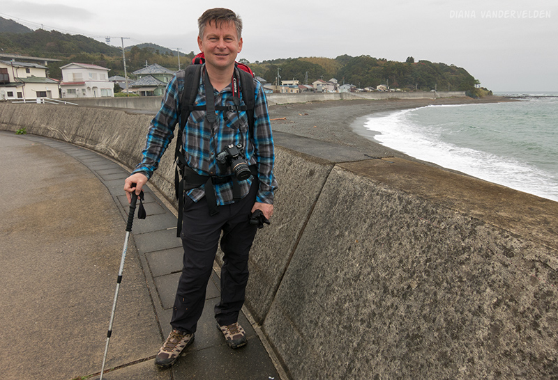
In the morning we took a bus to Shingu, a larger coastal town. Steady rain was coming down as we trundled through a valley with steep walls and a wide riverbed. We were glad we weren’t hiking across the mountains. In Shingu itself there was off-and-on-again light rain. From the bus station we walked to the coast, where there was a seawall overlooking a brown-sand beach.

As we walked along the seawall we met a group of giggling schoolkids. We said konichiwa and hello which they returned in kind. The seawall ended and railroad tracks started paralleling the beach. We moved onto the beach and continued southward. At the south end the beach was pebbly.

Just before the headland there was an underpass beneath the tracks leading to a trailhead. The trail led up onto the headland into a jungly forest. The vegetation was very lush, with bamboo, wild ginger, and a few palms.

There was some stone pavement, probably part of the old Kumano Kodo pilgrimage trail. With the rain it was very slick and treacherous.
Near a little shrine we found a covered gazebo. It was a perfect spot to eat our bento-box lunches.
Past the shrine the trail descended on slick stone pavement through vegetable gardens and orchards.

The trail led to the the town of Miwasaki, where there was a seawall facing a small beach.
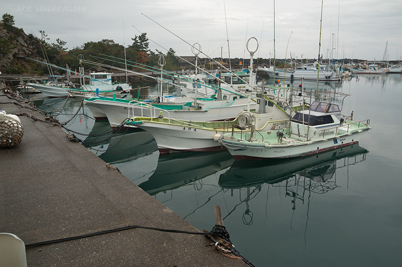
Miwasaki has a huge harbour. A set of breakwaters connects a series of skerries and offshore islands to create a big protected bay.
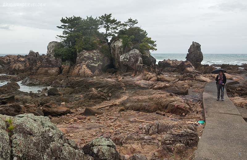
At one of the skerries there were sedimentary rocks, probably composed of volcanic ash. The rocks were fractured and there was evidence of fluid flow through the fractures. Fractured rocks are a big topic in unconventional oil and gas, so I took some pictures.

I like harbours. It’s fun to look at fishing boats, ropes, nets, traps, and other fishing gear.
There were some wonderful views back to the mountains.

At the far end of the harbour there was a small but well-tended shrine. Fishermen must come here to pray for a safe journey and a good catch.
We hiked back to Miwasaki where we caught a local train to Kii-Kaatsura, another town with a big fishing port.
In part three of our Kumano Kodo hike, we attend a tuna auction in Kii-Kaatsura, we day-trip to Nachisan grand shrine, and we stay overnight in a temple at Koyasan.
Logistics
Ukegawa to Koguchi is 13 km of hiking.
Shingu bus station to Miwasaka is about 7 km. To get to the far end of the breakwater and back, add about 2 km. There is a coastal railway with frequent local stations, so it’s possible to hike as far as you like and then pick up a train. Shingu to Kii-Kaatsura would be a long day but it looks doable.
- In Hongu we stayed at Hoshi no Jikan. It’s a very comfortable house with great views, and it even has a meditation room. There are beds with memory-foam mattresses, which were divine after having slept on futons for the past few days. However the house is beside a busy road and there’s some road noise. The owner is very friendly. Highly recommended.
- In Koguchi we stayed at Koguchi Shizen-no-ie, a former schoolhouse that has been converted into a guesthouse for hikers. The staff was friendly and the food was good. The setting of the guesthouse was right by the river, which was nice. However the accommodations were somewhat spartan and rustic, and this place is not cheap. Recommended.
Hongu has a well-stocked shop and a good restaurant. Koguchi has a basic little village shop. The owner there was very friendly.