This summer, Diana spent a weekend in Denver with her girlfriends. She came back with a Westjet in-flight magazine that had an article about a bike trail that crosses the Laurentians north of Montréal. It didn’t take too much convincing to get me to book the trip.
The P’tit Train du Nord was a rail line built by Canadian Pacific between 1891 and 1909. It was built to transport timber from the Laurentian Mountains (hills, really) to Montréal. Villages sprung up along the railway. When skiing became in vogue, Canadian Pacific ran passenger trains for skiers on the line. The last passenger train came down the line on November 15, 1981. The rail line fell into disuse, and in 1996 it was converted into a cycling path. The old train stations are now tourist information centers, cafes, and restaurants.
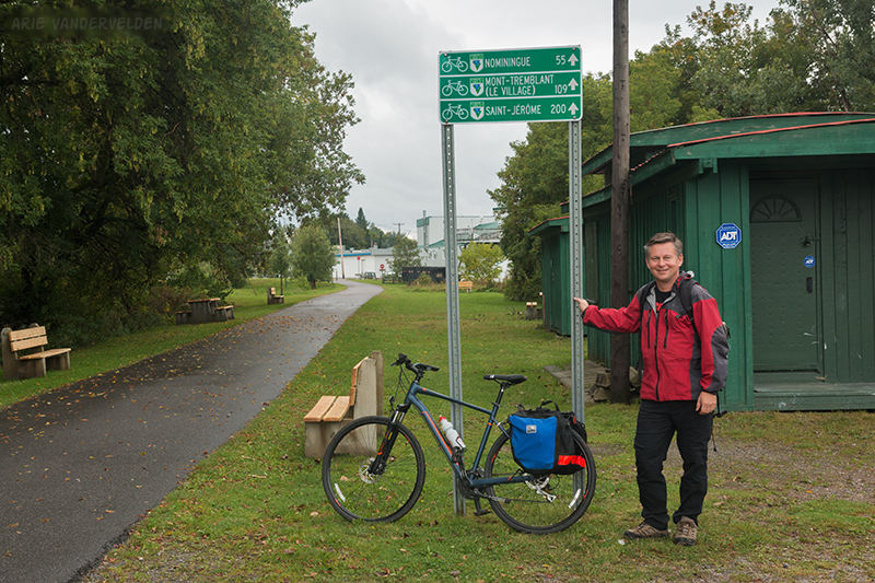
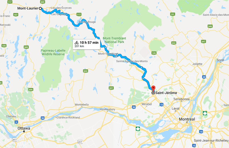
It’s 200 km from Saint-Jérôme to Mont-Laurier, perfect for four or five days of leisurely cycling. Because the path is a railway grade, the gradients are very gentle and the cycling is easy. A bit more than half is paved, and the rest is topped with good quality fine crushed gravel. We chose to ride the trail from north to south (Mont-Laurier back to Saint-Jérôme).
We flew to Pierre Elliot Trudeau airport (formerly Dorval) on the west side of Montréal. From there we took a bus, a subway, and another bus to Saint-Jérôme (see logistics, below). We arrived in the dark and in pouring rain but managed to find our hotel. The next morning we got up early to collect our bikes, to take the shuttlebus to Mont-Laurier, and to start cycling.
Day 1: Mont-Laurier to Lac Saugay
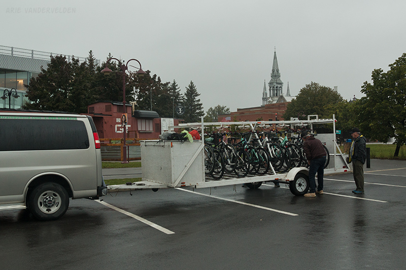
It was an early start. We showed up at the bicycle rental shop at 7:15 am and tried out the bikes they had selected for us. They were really nice Marin hybrid bikes, with back racks for panniers. Just a few small adjustments were needed and we were good to go. The staff loaded the bikes on the trailer, and we and two other couples piled into the van for the 2.5 hour drive to Mont-Laurier.
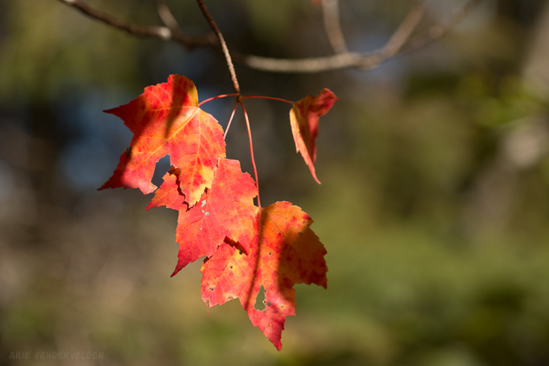
I had planned this trip for the last week of September in the hopes of seeing some of the fall colours that the Laurentians are famous for. Earlier in the week I had checked out the Mont Tremblant webcam, and I was disappointed to find out that the trees were still completely green. Apparently September had been quite warm and fall had not started yet. As we drove down the road, Diana and I looked through the rain-splattered windshield as the wipers were going, and we could see a slight blush of colour on the treetops. Better than nothing!
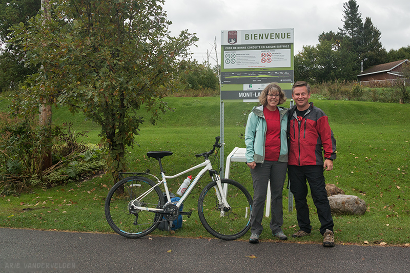
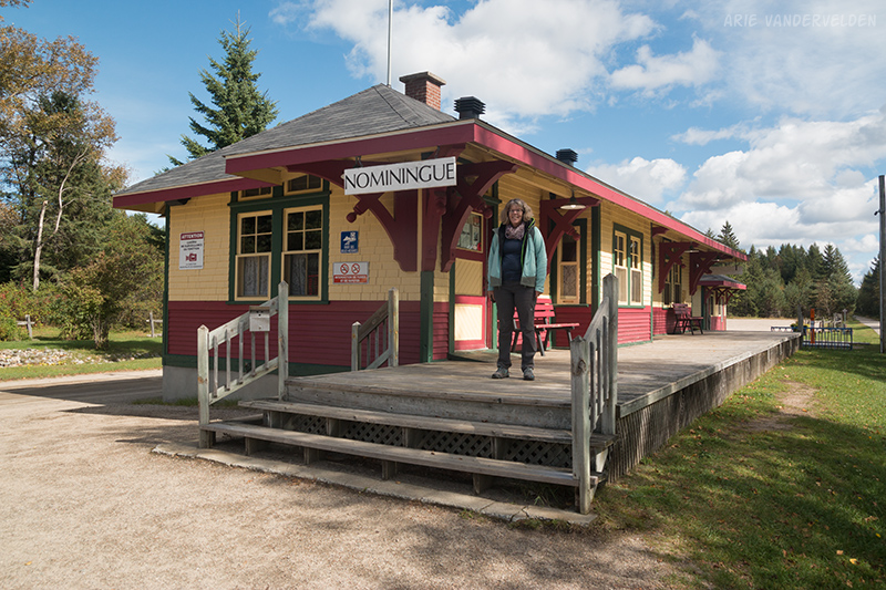
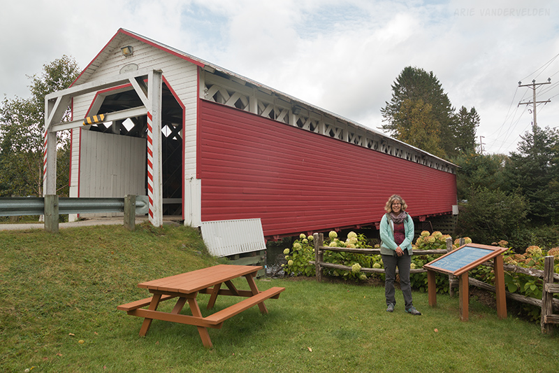
After a pit-stop at Saint-Jovite we continued on for another hour to Mont-Laurier, where the bikes were unloaded at the former train station. We took a few pictures to mark the start of the trip.
As we got going the rain stopped, and it turned hot and humid. We shed some layers on the outskirts of town.
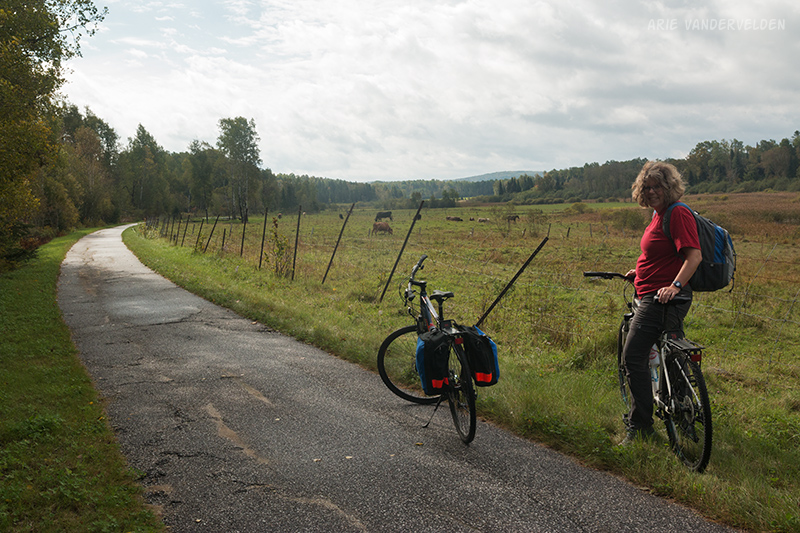
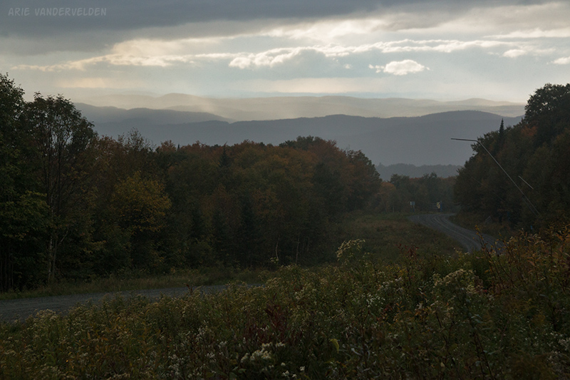
The trail led past some pretty lakes that were lined with cottages and houses. Most of the cottages have docks with pontoon boats, and some houses had float planes tied up to their docks.
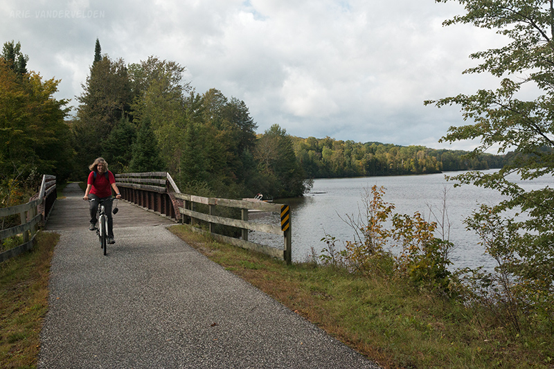
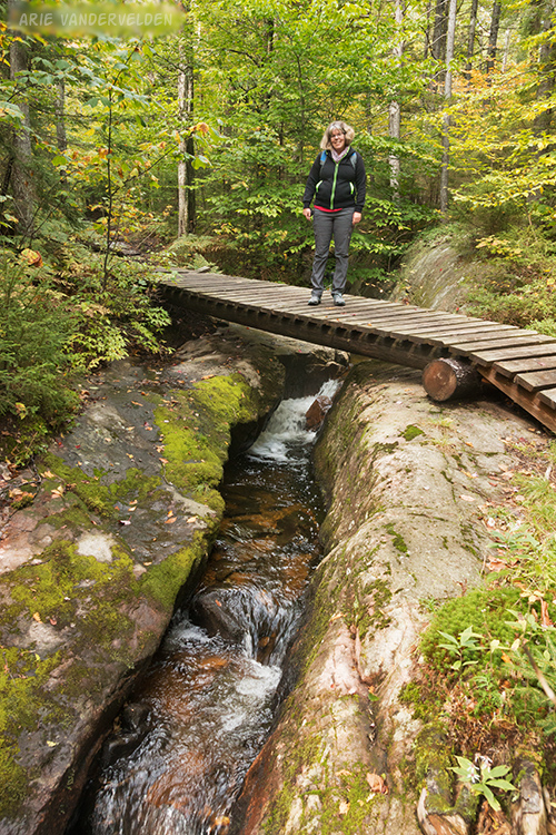
Past the lakes the trail began a gentle climb up into the hills. A local cyclist alerted us to a spring beside the creek where there is good drinking water. It was a good place to take a break.
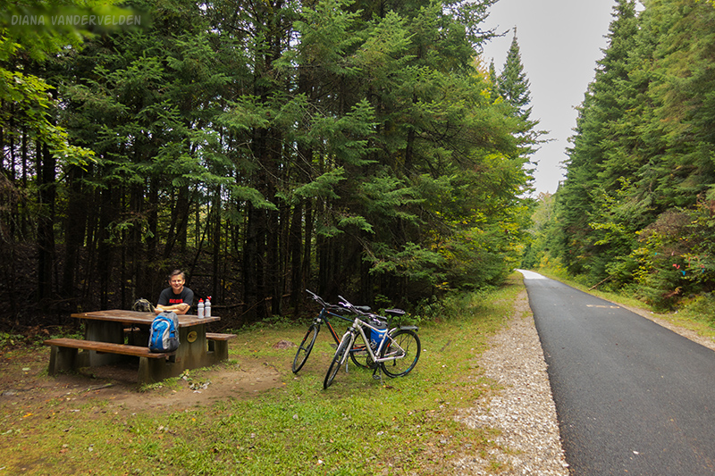
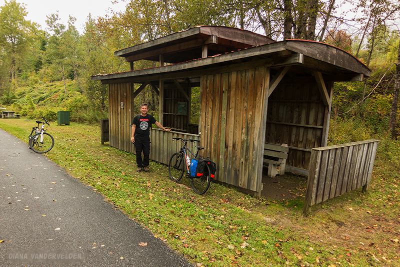
This section of the trail was very well developed. The trail was paved, and there were interpretive signs and picnic benches at regular intervals. Every 5 or 10 km or so was a picnic shelter built in the shape of a caboose. These usually had an outhouse nearby.
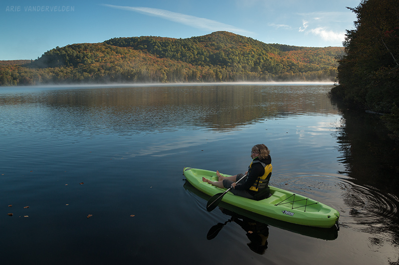
Our stop for the night was at motel Ours Bleu, on the shore of Lac Saugay. The motel had some kayaks for guests, but it was quite windy out on the lake. So instead we visited the local depanneur (convenience store) and bought some supplies for happy hour.
In the morning we woke up to dense fog, but this soon lifted. Only a thin wisp of mist drifted across the lake, and it was cold but perfectly calm. We decided to go for a paddle. I left the camera back in the room, so there are no pictures other than the one I took from the dock. The water was dark brown, almost black, the colour of coca-cola. We paddled around an island, past pretty cottages and hillsides, underneath a bridge, and through a shallow area with lily pads. We heard a loon on the lake the day before, but it must have moved on.
Day 2: Lac Saugay to Rivière-Rouge.
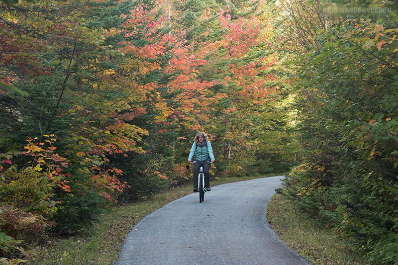
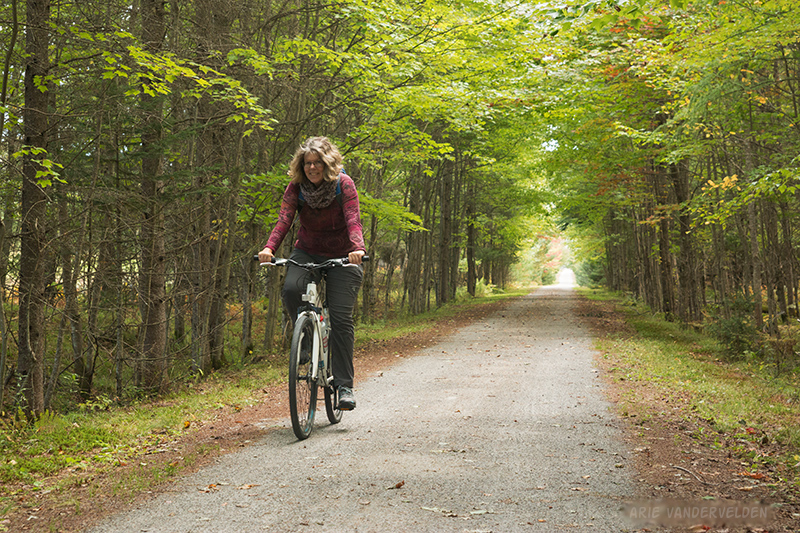
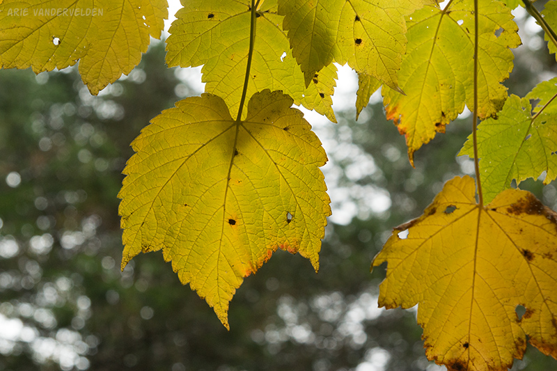
After our paddling we checked out, got on our bikes, stopped for breakfast just down the road, and then set off again on the P’tit Train du Nord. We had a short day ahead of us, and most of the way was a gentle downhill. The trail went through a mixed forest of conifers and deciduous trees. There was spruce, pine, cedar, maple, birch, poplar, and alder. Here the maples were starting to turn orange.
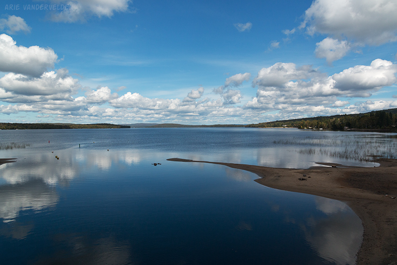
We popped out of the forest at Lac-Nominingue, a town beside a large lake. It was a sunny day with only a few clouds.
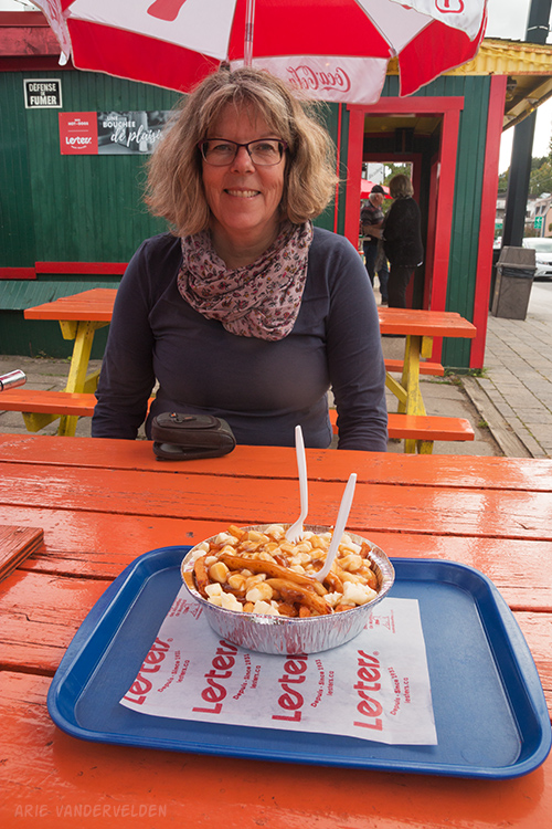
Past Lac-Nominingue we paralleled the highway for a while. We saw the turnoff to our B&B, but we were too early for check-in so we continued on to the town of Rivière-Rouge, Here we found a pataterie, a shack that cooks up poutine. We ordered up a plate and sat and ate it at the picnic tables beside the fry stand. Poutine is fries, gravy, and cheese curds that squeak when you bite into them. We people-watched as the locals stopped by for their order of poutine. It was good fun.
Day 3. Rivière-Rouge to Mont Tremblant.
After a big breakfast at our auberge (inn) we set off on our bikes again. It was cloudy but dry. We cycled past the town of Rivière-Rouge once more, and then paralleled the highway for a while. Near the village of Macaza we crossed the Rivière-Rouge river on a tall bridge.
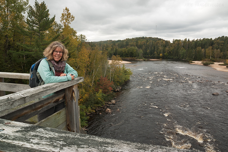
From this bridge we could see another bridge in the distance, a covered one-lane road bridge. We decided on a small detour to check it out, and indeed it was a nice spot. Later on in the day I googled why some bridges were covered – it seems like a big effort to keep the snow off? As it turns out this isn’t the reason at all. When exposed, wooden bridge decks rot pretty quickly and they are expensive to replace. Also, in the 19th century some horses drawing carriages would shy away from the sound of a raging river below, and refuse to cross the bridge. Walls and a roof solves both these problems.
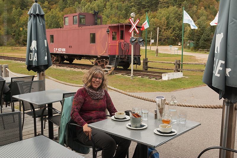
At Village de Labelle the old train station had been converted into a restaurant. We ordered craft beers named after the P’tit Train du Nord, soup, and frites du maison fried in duckfat with homemade mayo. Yum.
Past Village de Labelle the pavement came to an end. The trail passed some pretty countryside, marred in a few places by high-voltage powerline pylons.
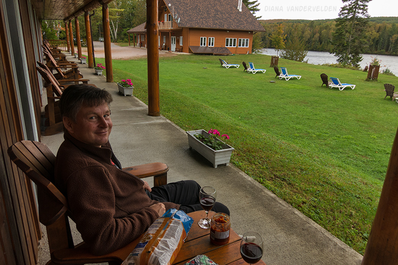
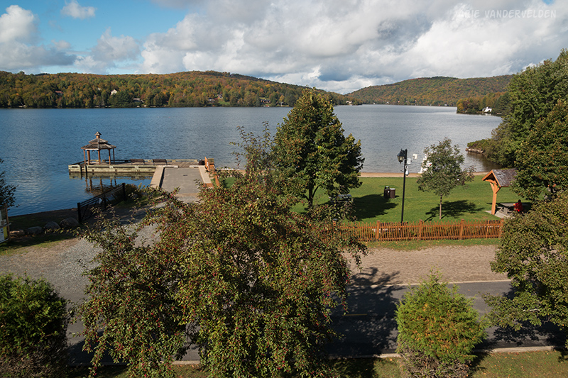
Not far before Mont-Tremblant the trail goes up on a gentle incline, and then levels out at a pretty wetland. Just beyond it circles Lac Mercier. Our hotel was at the far end of Lac Mercier, right beside the bike path. We scored a second-floor room with a balcony that had a view of the lake. It was a great spot for happy hour drinks.
Day 3B. Hiking up Mont Tremblant.
Our hotel at Lac Mercier is considered to be in Mont-Tremblant village. The ski resort is a 4 km detour to the east, and also has a considerable sized village beside it. Even more confusingly, the town of Saint-Jovite along the main highway to the south is also referred to as Mont Tremblant.
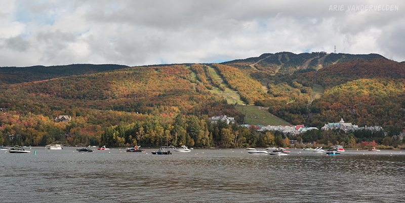
In any case, we had booked an extra day at our hotel at Lac Mercier to allow time to explore the Mont Tremblant ski area. We biked up to the resort and chained our bikes to a lamppost. We were surprised how many people were at the resort; the main street was packed. I waded through the crowds to pick up a leaflet with the hiking trail system. We picked one just above the resort called Ruisseaux, and then turned onto Caps. It was busy, with a line of people walking single-file. We then turned onto Johannsen, and finally found some peace and quiet.
This hiking trail is named after Norwegian ski pioneer Jackrabbit Johannsen. The man blazed many of the ski trails in the Laurentians, and he was still skiing at age 105! Johannsen died in 1987 at the age of 111. The jackrabbit cross-country ski program for kids is named after him.
The first part of the trail had some mud but otherwise was in good shape. Curiously, even though earlier in the day we saw fall colours on this hillside, the forest was mainly still green. I figured out that the treetops turn first, and the lower foliage stays green longer.
The trail map indicated 5 km or so to the ridge so we figured it would take us about two hours. Wrong. The trail soon turned to deep mud, rocks, and roots. I cursed the lack of trail maintenance – a few waterbars would have done wonders here. We reached the ridgetop mid-afternoon, and the top of the gondola was still several kilometers away along the ridge, which had an equally rocky and rooty path. Finally we reached the resort and got some views.
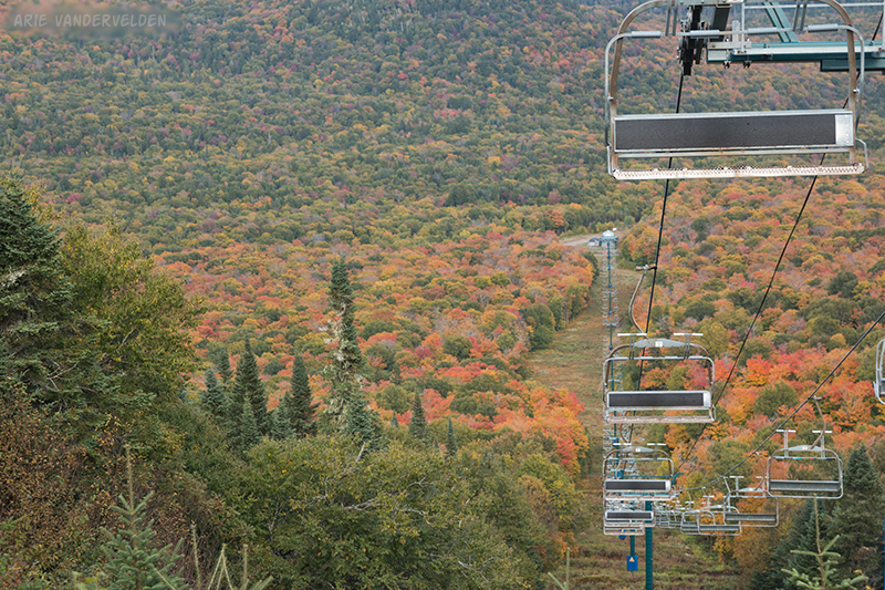
For descent we hiked down the cat track. This is where we should have been hiking all along: there were great views all around, the trees at the edge of the ski runs were turning colour, and no rocks or roots or mud.
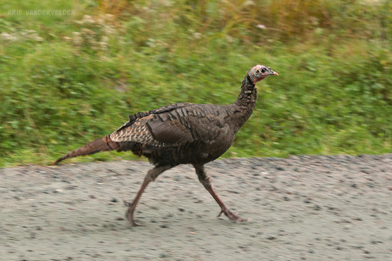
As we started our descent we got caught in a heavy downpour.
In the pouring rain we almost tripped over a flock of wild turkeys. They were taking their chances, given that it was the week before Thanksgiving!
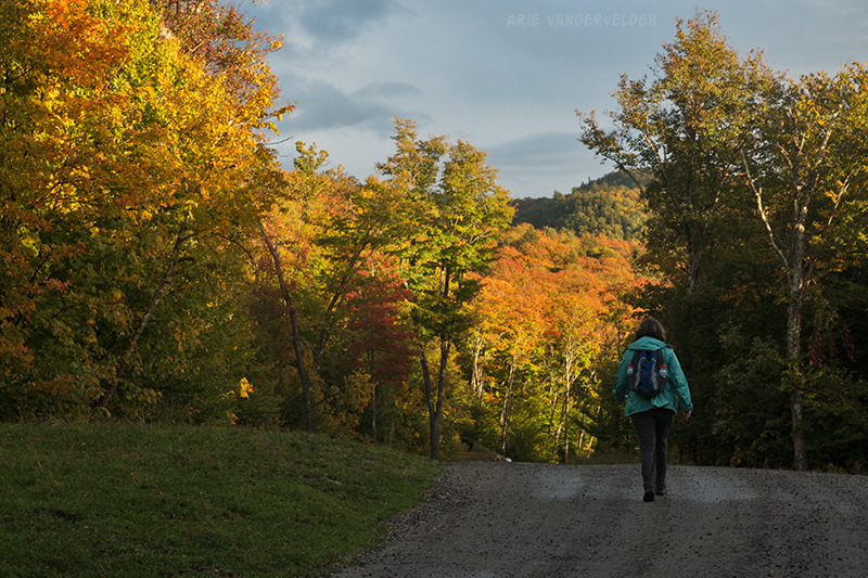
On the bike trip we saw many white-tailed deer, a garter snake, and a family of raccoons. When we reached the bottom of the hill the skies cleared, and the sun lit up the maple trees sideways. It was the best light of the day.
At the bottom we located our bikes and rode back to our hotel, which we reached when darkness fell.
Continue to part 2 of the trip.
Logistics
The P’tit Train du Nord is 200 km long. It can be cycled in either direction. We biked from north to south, which has a very slight downhill advantage. The reason why we chose to go north to south is that the bus runs that way in the morning, allowing you to get the shuttle done and still complete a day of cycling. Going south to north, you’ll probably end up spending a night in Mont-Laurier, which is not necessarily a bad thing I suppose.
We broke it up into five segments, with stops at Lac Saugay, Rivière-Rouge, Mont Tremblant, and Sainte-Agathe-des-Monts. This yields cycling distances of about 40 km, 30 km, 40 km, 40 km, and 50 km, respectively. Many people cycle it in four segments, with stops at Lac Nominingue, Mont Tremblant, and Sainte-Agathe-des-Monts. This yields daily distances of 55 km, 65 km, 40 km, and 50 km respectively.
Note that the cycling path is on google maps, and you can use it to see which towns it passes, and you can use it to estimate distances.
- At Lac Saugay we stayed at motel Ours Bleu. The motel is run by a very friendly Belgian-Italian couple. They have kayaks for paddling on Lac Saugay. Highly recommended.
- In Rivière-Rouge we stayed at Auberge le Saint-Bohème. We got off on the wrong foot during check-in, but later that evening we had a nice conversation with the owners. They serve dinner in their dining room if you ask in advance. Michel is an excellent chef, and his Montreal smoked meat sandwich was superb. Recommended.
- At Mont Tremblant we stayed at Auberge la Porte Rouge. It’s motel-style accommodation, and rooms have great views of Lac Mercier. The restaurant downstairs does a great breakfast. Recommended.
- In Sainte-Agathe-des-Monts we stayed at Auberge de la Tour du Lac. The rooms here each have jetted tubs and a fireplace, and outside are more hottubs and saunas. The auberge offers a package with dinner and breakfast included. The dinner is a six-course affair in an elegant dining room, while breakfast is a basket with muffins, bananas, and juice. Recommended.
Each of these hotels can be booked on major booking sites.
Bikes can be rented from Autobus le P’tit Train du Nord. Their bikes are high-quality Marin hybrids. We were supplied with a repair kit and a chain lock. We elected not to use bike helmets. The company also rents pannier bags but I brought my own.
Their shuttle from Saint-Jérôme to Mont-Laurier departs at 8 am. You don’t have to go all the way to Mont Laurier; you can get dropped off in other towns as well.
The same company also does a luggage shuttle. Each morning you bring your suitcase to the front desk by 9 am, and your suitcase will magically appear in your room at the next hotel. Diana and I shared one suitcase to save cost. To organize the luggage transfer you simply send your itinerary to Autobus le P’tit Train and they will take care of the rest.
We flew to Montreal from Calgary, landing at Pierre Elliot Trudeau airport. From there we took the 747 airport bus to metro station Lionel-Groulx, then metro 2 across town to Montmorency, then bus 9 to Saint-Jérôme. You buy tickets for the 747 bus in the airport at a machine, and this ticket also gets you on the metro. A ticket for bus 9 can be bought at the Montmorency bus station desk. Annoyingly, Mirabel airport is just a stone’s throw from Saint-Jérôme but hardly any flights go there.
For those driving, there is a huge parking lot in Saint-Jérôme. The only accommodation in Saint-Jérôme is a pair of boring chain hotels out by the highway.
This is a Francophone part of Quebec. I tried speaking French when approaching people. When they heard my awful accent, most (but not all) of the people I spoke to immediately switched to English.