This is part two of our Newfoundland trip. Go back to part 1.
Cape St. Mary’s
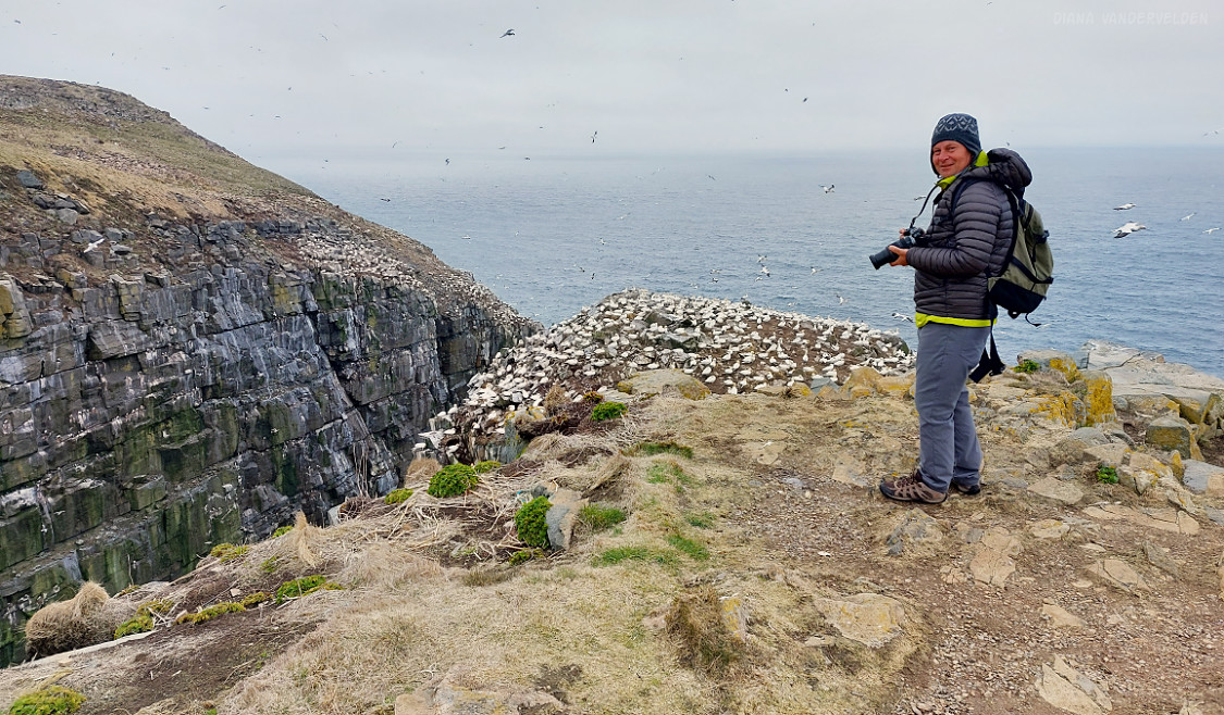
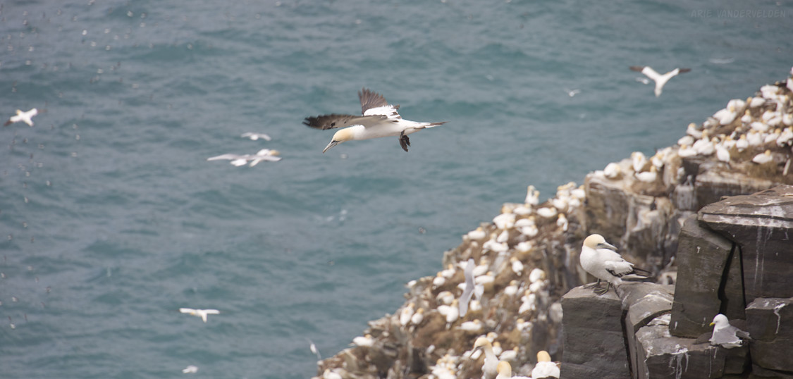
At Cape St. Mary’s, the land comes to an abrupt end. Miles of desolate tundra suddenly give way to sheer cliffs with the seething Atlantic Ocean far below. Here, the third-largest and first-most-accessible northern gannet colony can be visited. Thousands of gannets nest on a rock that is separated from the land by a narrow but deep chasm. We visited on a cloudy and blustery day. Thankfully, the wind kept the fog at bay so we could see these amazing birds.
Bird Rock is about a 1 km hike across the tundra from the interpretive center. At Bird Rock, thousands of birds whirl around in the air currents, cry and honk for their mates’ attention, and otherwise contribute to the hustle-and-bustle. It was an amazing place – a Serengeti of the north, in a way.
We were able to get quite close to the gannets. This was a good thing, since I only had 240 mm on the telephoto end of my lens. I really enjoyed photographing the gannets.
Bird Rock is densely populated. We were told that most years there are even more birds, but a bird flu pandemic took its toll the year before.
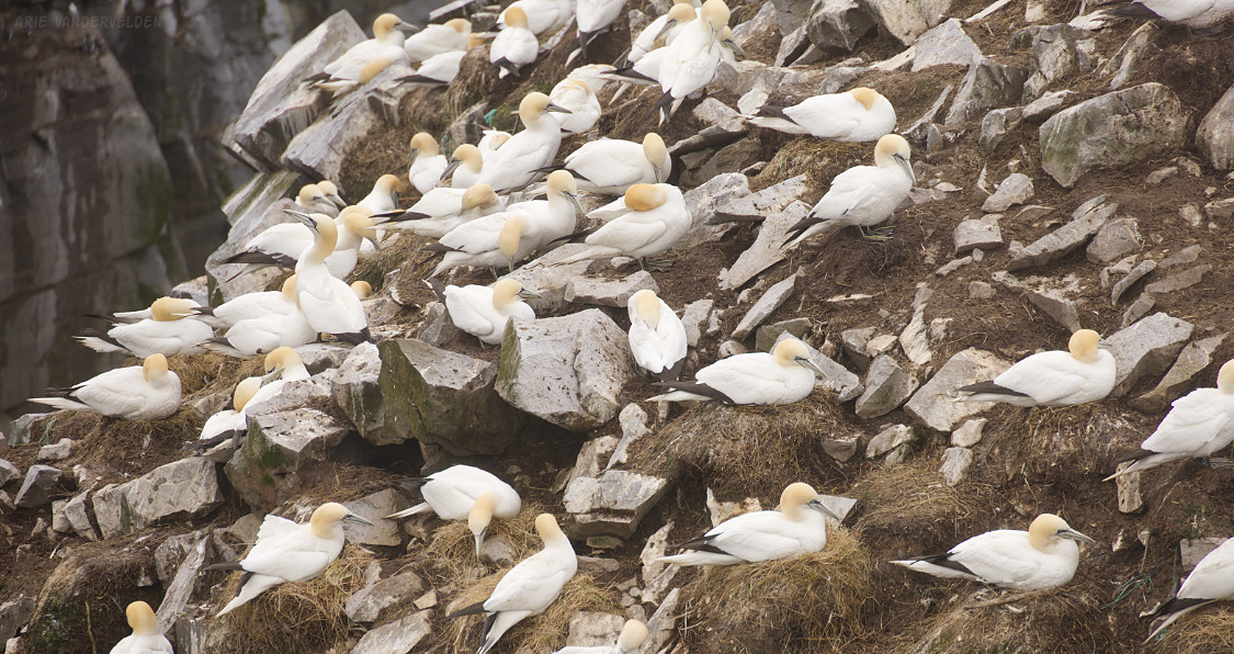
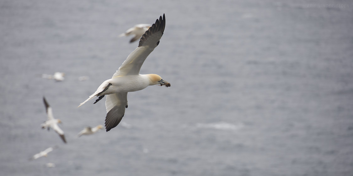
The gannets were building nests, and we saw them flying around with nesting material, which they were busy collecting from a nearby field.
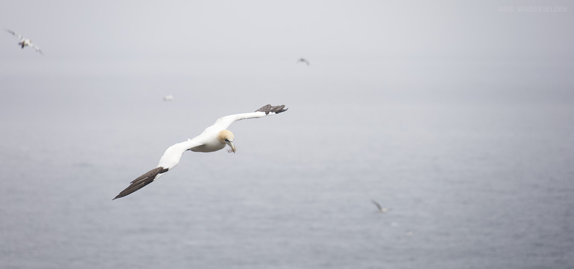
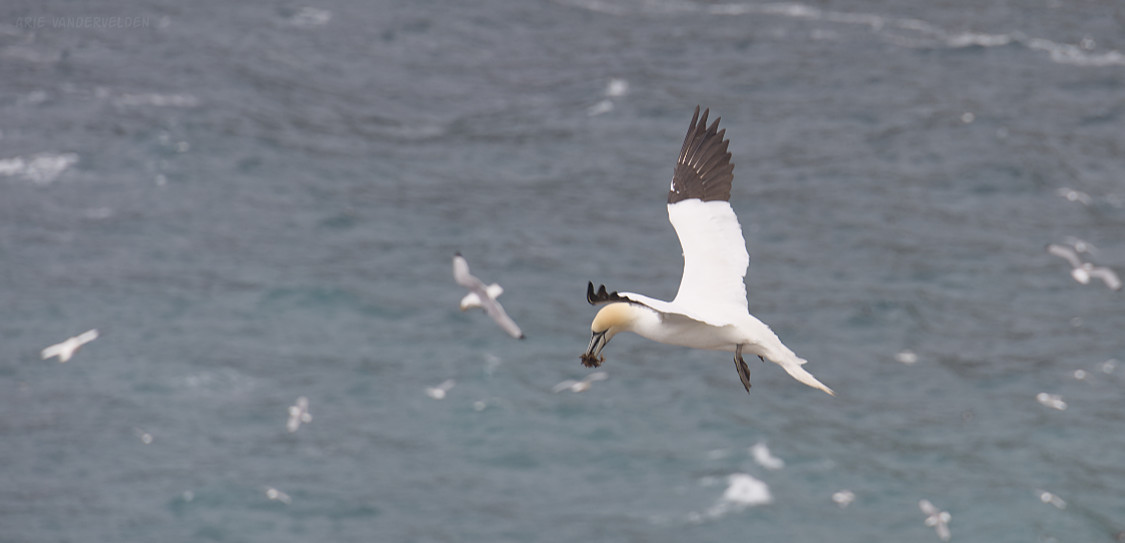
Coming in for the landing, which was tricky business with the swirling winds.

Gannets spend most of their lives at sea – in the middle of the North Atlantic – coming ashore only to breed. They are amazing creatures.
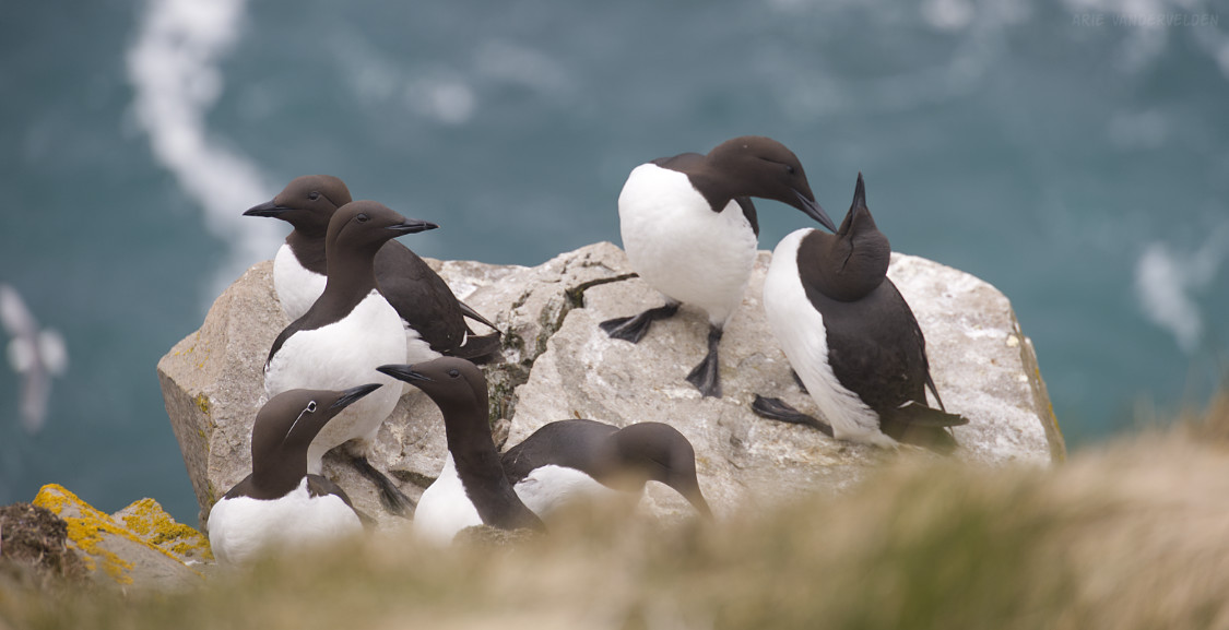
On some lower ledges were common murres, another type of sea bird. Murres are much smaller than gannets.
Point Lance
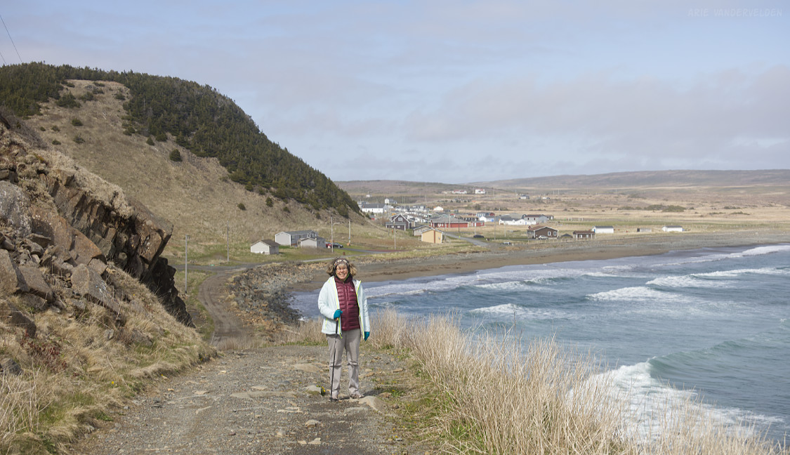
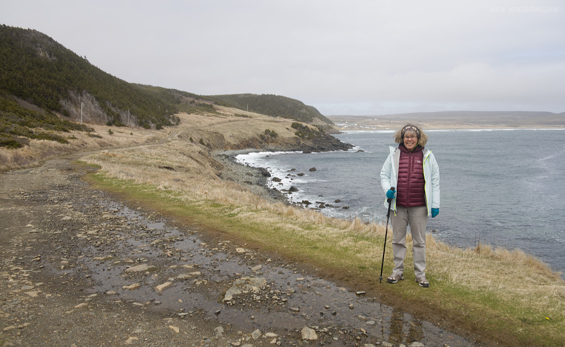
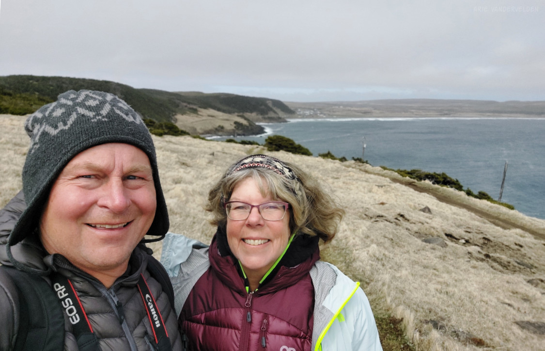
We drove to Point Lance, a village at the end of a dead-end road. We had planned a walk on Point Lance’s beach, but it was high tide, and the beach was all rocks and no sand. We were about to turn around when I spotted a little gravel road going up a shoulder beside the bay. This road ended up being a great short hike, with wonderful open views of the ocean. The road led to Tilts, a place where fishing vessels were once unloaded. These days, the road isn’t used much anymore.
St. Shotts
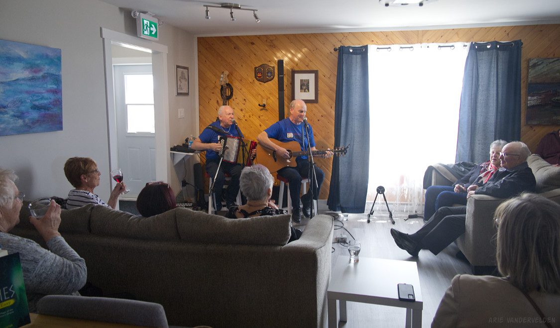
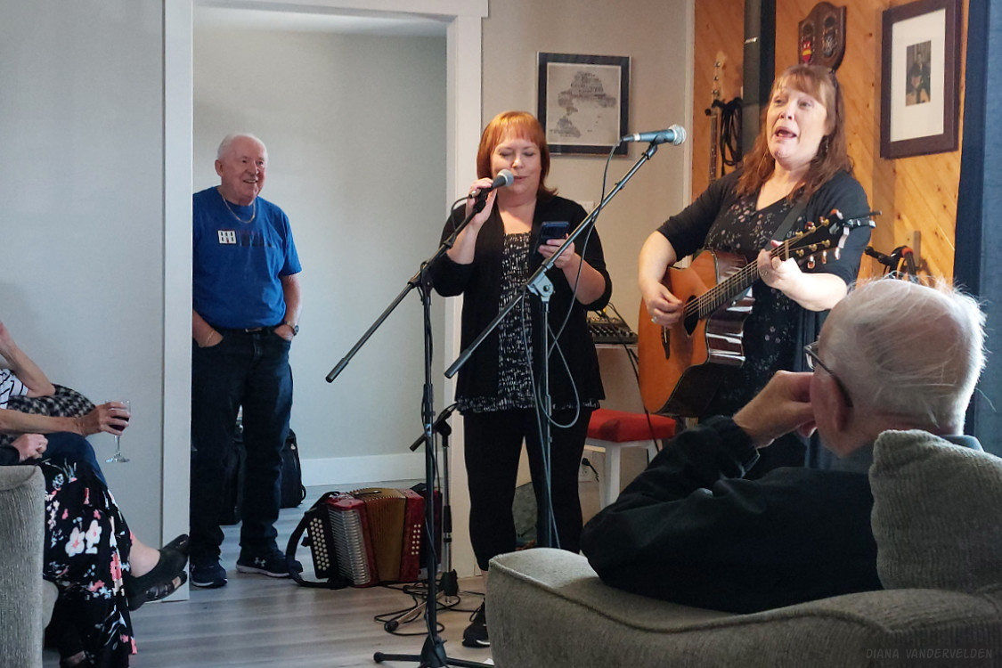
St. Shotts is yet another small community at the end of a lonely road stretching across the tundra. The reason we visited St. Shotts was to stay at B&B the Keepers Kitchen. B&B owner Michelle Myrick, who comes from a long line of lighthouse keepers, is trying to breathe new life into this shrinking community. Our stay coincided with a kitchen party at her house, and we were invited. We jumped at the chance of attending an authentic Newfoundland kitchen party.
Headlining the kitchen party were the folk duo of Sean Sullivan on guitar, and Sheldon Thornhill on accordion. The duo gained national attention in 2018, when a video of them taken at Toronto Pearson airport went viral. Their flight to St. John’s had been delayed, and when they looked around the waiting lounge they spotted nothing but bored-looking Newfoundlanders. So, they pulled out their instruments and started an impromptu kitchen party.
At the St. Shotts kitchen party, Sean and Sheldon played a mix of Irish and Newfoundland folk songs. We were struck by how closely this part of Newfoundland is tied to Ireland, culturally. The other bit that struck us is that almost every Newfoundland folk song features a Newfoundlander away from The Rock but longing to be home. Sean and Sheldon explained this to us specifically, to reinforce the message. I don’t think I’ve ever encountered a people with such a strong sense of identity and belonging. The locals at the kitchen party knew the lyrics to every song and sang along. We tried our best to sing along with the refrains. We really enjoyed watching the locals enjoy themselves so much.
B&B owner Michelle Myrick and her sister Jean sang a few songs as well. This song was about berry-picking on the tundra at Cape Pine, a nearby lighthouse, and then getting lost in the fog. Sheldon Thornhill looks on.
Also, an elderly gentleman stood up and recited from memory The Papisher and The Prod, a poem by John McKearney. We were told that such poetry recitations are an important part of Newfoundland culture that’s at risk of dying out.
Mistaken Point
Mistaken Point is a world-famous fossil locality on the very southeastern tip of Newfoundland. The fossils preserved here are those from soft-bodied organisms of the late Precambrian era. Before this, the most complex forms of life on earth were algae, which ruled our planet for several billions of years. Then, about 580 to 560 million years ago, there was an explosion of life. Suddenly, complex organisms appear in the geological record. Some look like worms, others like millipedes, and others yet like sea pens and sea fans. For some reason, evolution proceeded by leaps and bounds during this time. These earliest organisms didn’t have shells or skeletons or exoskeletons that are easily preserved, so these types of fossils are extremely rare. Hard-bodied organisms such as the trilobites of the Cambrian period are much more readily preserved and much more common.
The fossil locality is a UNESCO world heritage site, and access is strictly controlled. The only way to visit the locality is with a guide. Luckily, we managed to snag two spots at the last minute. Very lucky, we were told, because these tours often book up months in advance.
The tour begins with a 2 km hike to the site, which is along a coastal cliff.
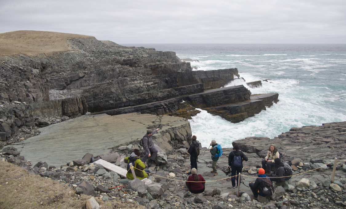
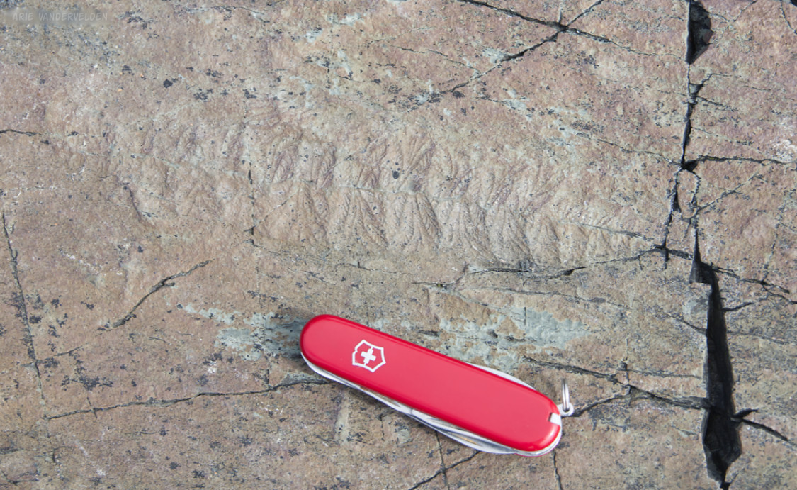
The fossil site is a bedding plane. In order to walk on the bedding plane, we were asked to remove our boots and walk on the surface with our socks. This avoids abrasion of the fossils. Here, Diana is trying to identify some fossils.

The fossils itself were everywhere, and quite clear. Swiss army knife for scale.
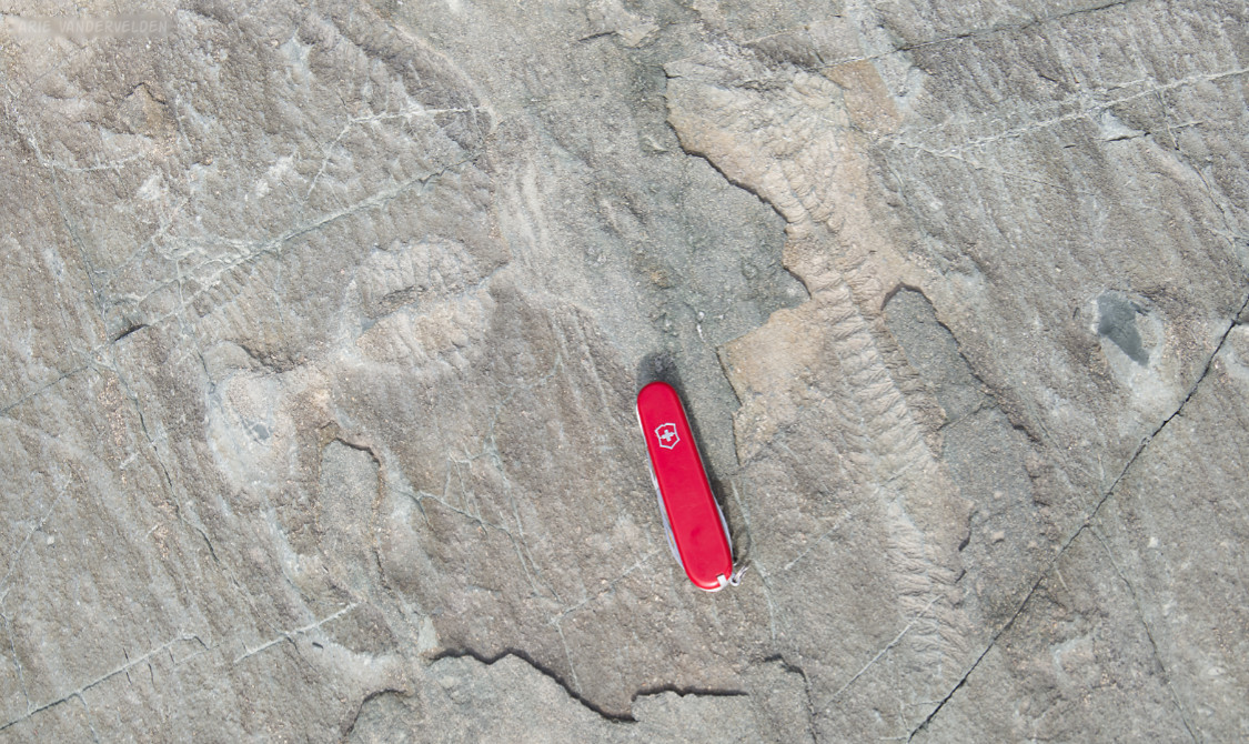
These kinds of soft-bodied fossils have prompted geologists to create a special geological period: the Ediacaran period, named after the Ediacaran Hills in Australia where these types of fossils were first found.
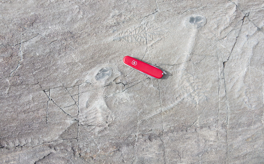
The Mistaken Point fossils are very well preserved.
Ferryland
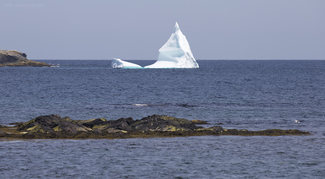
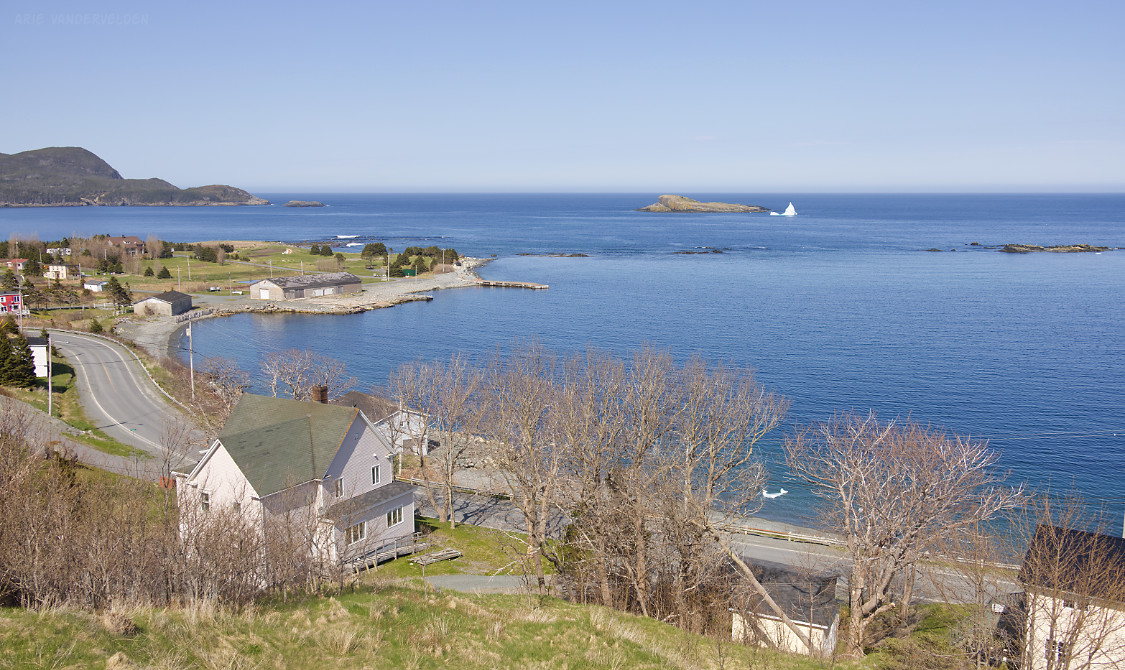
In April, a large iceberg ran aground at Ferryland, making the news. Local B&B owner Charlie Dunne was interviewed by CBC about the iceberg. This wasn’t the first iceberg to run aground here; a photo from a 2017 arrival made it onto a postage stamp. Inspired by the awesome photos in those news reports, we booked three nights at Dunne’s B&B. Sure enough, when we arrived the iceberg was still there. It was much smaller than shown in the April news report, of course, having melted and spalled for two months. Still, it had a graceful pointed shape. It had us ooh-ing and aah-ing. The fun part was that we could see the iceberg from the window of our B&B room.
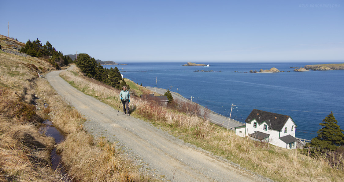
It was a beautiful day, and we did a short hike on an abandoned railroad grade above the main road through Ferryland. This trail had awesome views of the iceberg and the surrounding area.
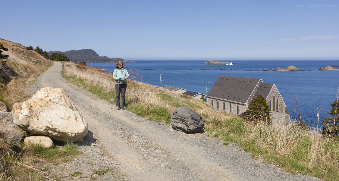
Enjoying the sunshine and the beautiful views.
Note the small piece of ice near the shoreline. It probably broke off the main iceberg.
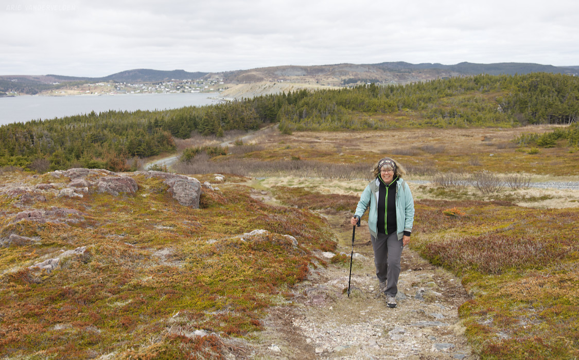
We spotted a peninsula with a lighthouse at the end. It is possible to drive halfway to the lighthouse, but we decided to simply walk.
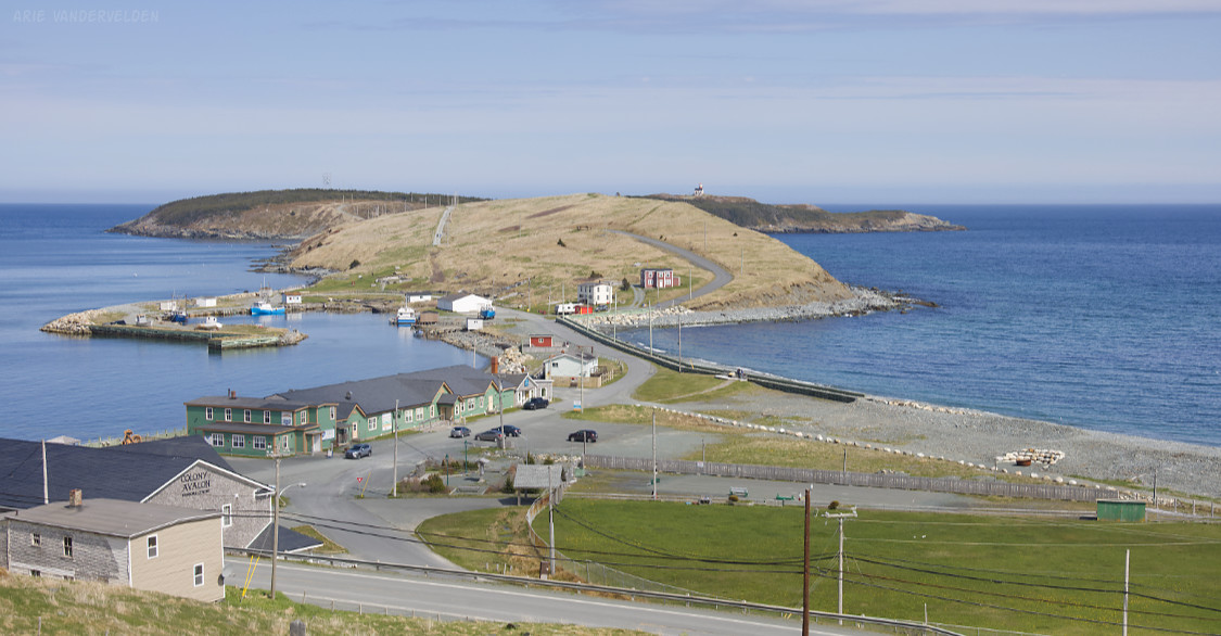
Surprisingly, the trail to the lighthouse led through a forest before emerging onto open slopes.
Approaching the lighthouse.
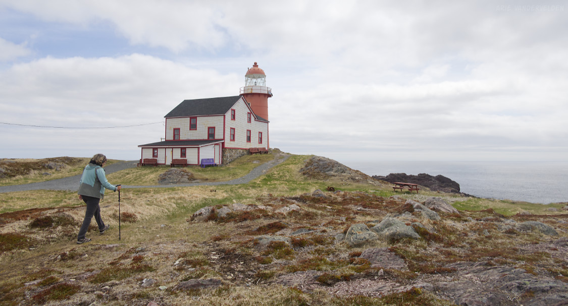
Behind the lighthouse were some nice views of the local geology. Here, layers of late Precambrian rock have been tilted on end.
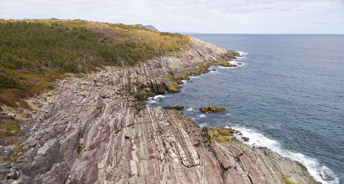
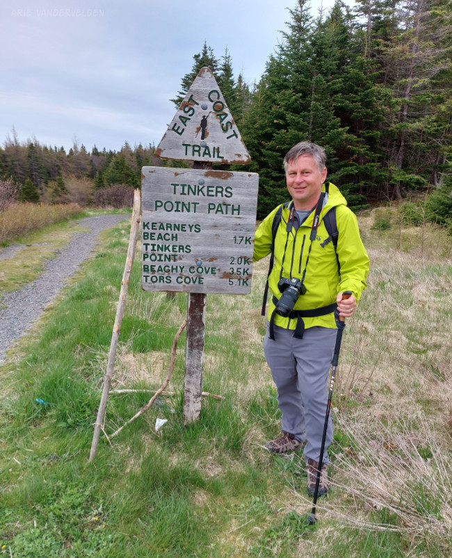
Tinkers Point
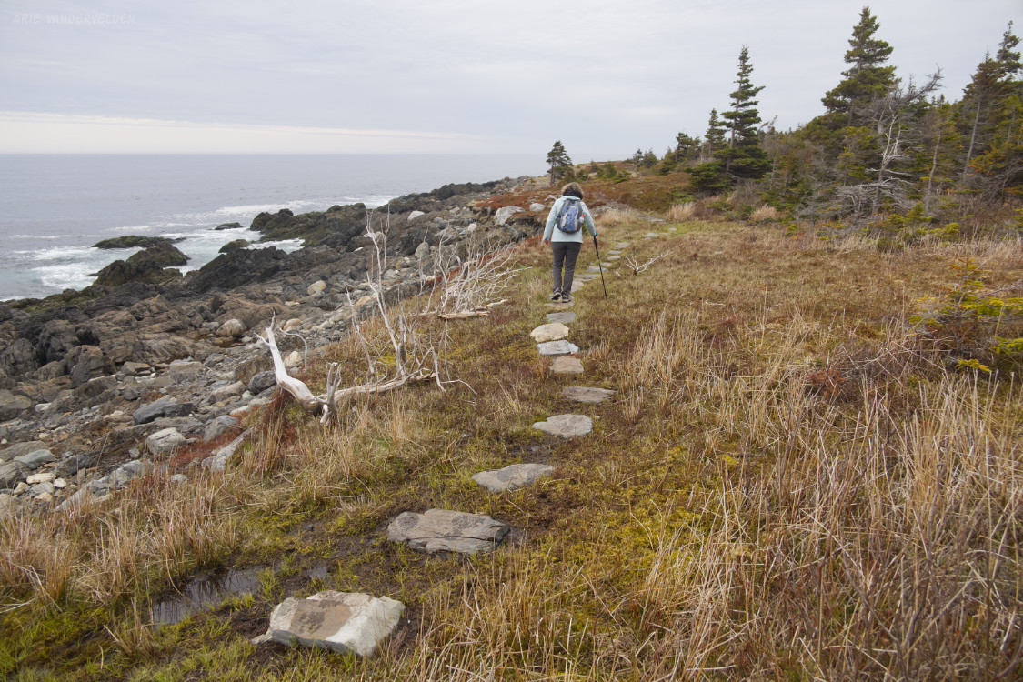
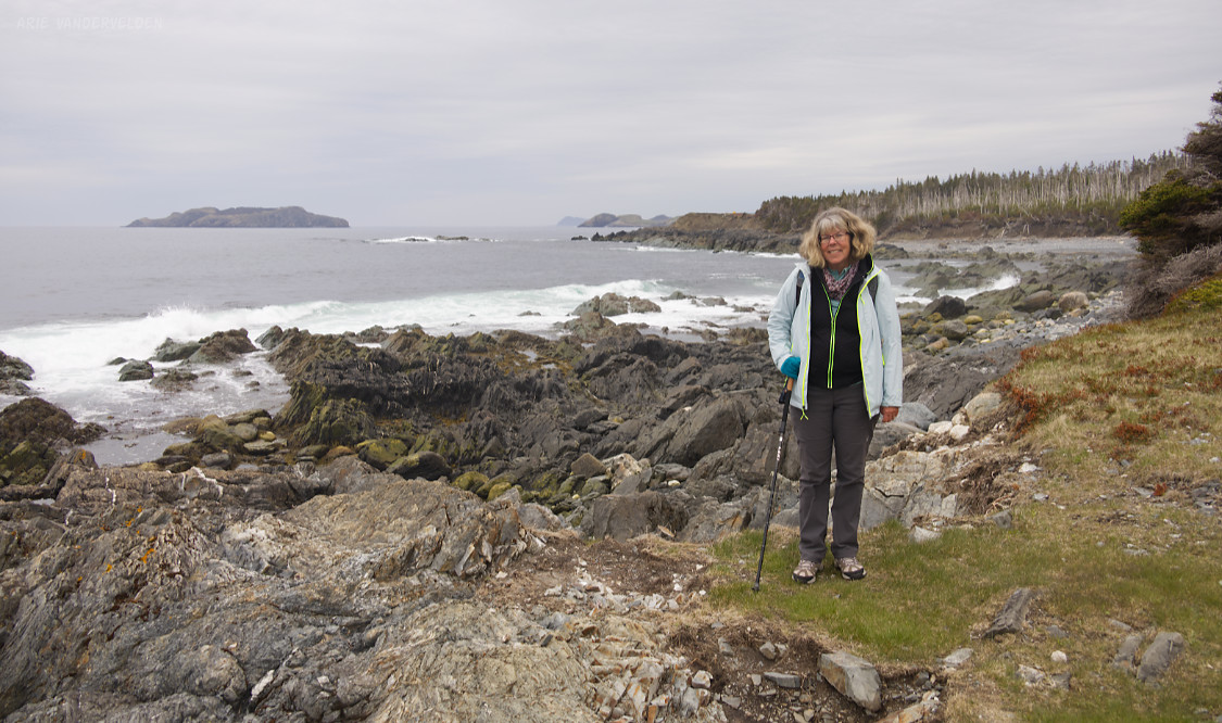
We hiked a section of the East Coast Trail, going from Mobile to Tors Cove and back again, via Tinkers Point.
This section of the East Coast Trail is very well constructed.
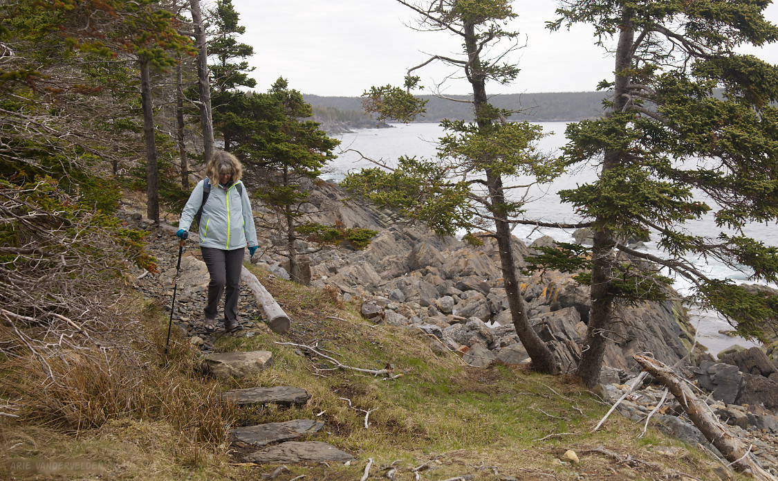
We had coastal views almost all the way.
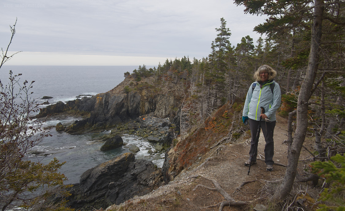
There are no tall coastal cliffs here. This makes the hike more intimate, with the waves crashing on rocks right beside us.
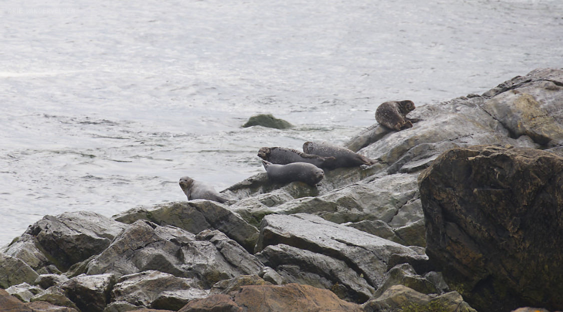
Seals resting on a rock.
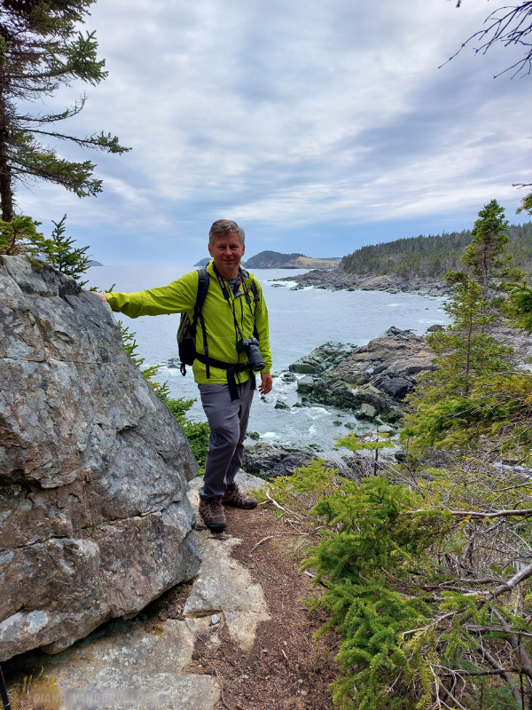
Taking in the views. We had a great time hiking this trail, and I can’t wait to come back to Newfoundland to hike more sections of the East Coast Trail.
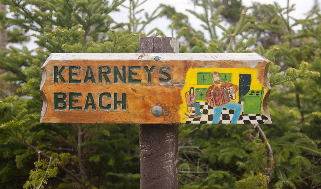
The sign at Kearney’s beach features some folk art depicting a kitchen party. I just love this sign – you know you’re in Newfoundland when you see a sign like this.
Approaching Tinkers Point.
There was a bench at Tinkers Point. From here we could see a minke whale in the bay by Tors Cove.

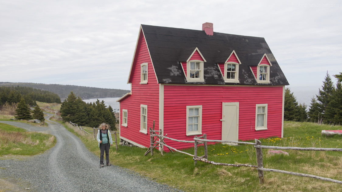
There were some saltbox houses on the outskirts of Tors Cove. Saltbox houses are a traditional style of house.
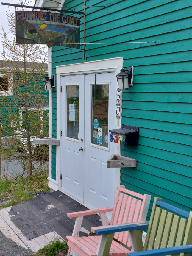
Running The Goat is an independent little bookshop and printing press in Tors Cove. We bought several books at this wonderful little shop.