Jeju is a volcanic island south of mainland Korea. It is a place where Koreans like to go to get away from it all, and they do so in great numbers. When we first visited Jeju in late November / early December of 2024, we didn’t have high expectations given the mass tourism situation. With this in mind, we only allotted a week and a half on Jeju, and this got cut even shorter by a three-day storm. But – we did get a few sunny days, and we did get to hike some of the Olle trails. To our surprise, the Olle trail system was wonderful, connecting quiet little fishing villages and traversing pretty farmland. The accommodations were great, the food was awesome, and the locals were very friendly. We really liked what we saw, and we vowed to come back.
So in November of 2025 we returned to Jeju, this time allowing three full weeks for hiking. We had a wonderful time. Despite some rainy days we managed to get at least some hiking done each day for three weeks straight. We didn’t do the Olle trails in order; rather, we jumped all over the island and hiked some over here, some over there, some clockwise, some counterclockwise. For the purpose of this blog post, I’ll present them in geographic order rather than in a time-sequential order as we hiked them.
Before I begin, here is a bit more about the Olle trails. The main Olle trail is a coastal hiking path that circumnavigates Jeju Island. It is divided into 21 stages, each about 15-20 km long. So each stage can be done as a day-hike. The Olle trails are numbered starting at the eastern tip of the island, and then going around in a clockwise manner. The endpoint of Olle 1 is the startpoint of Olle 2, and so on. The end of Olle 21 connects to the start of Olle 1 to complete the circle. In a way, the startpoints/endpoints are arbitrary and you can start hiking anywhere you like, and oftentimes we did just that. On the other hand, the startpoints/endpoints often have info centers, parking, handy bus connections, and so on.
In addition to the main coastal path there are also inland variations. There are also trails on small outlying islands. In total there are 437 km worth of trails. In the end we hiked about 75%-80% of the main trail around the island. We’d love to go back again some day to hike the remaining bits, as well as repeating our favorites.
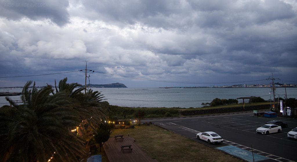
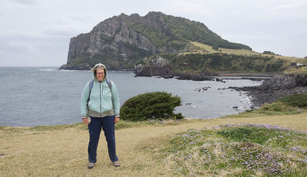
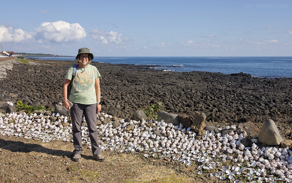
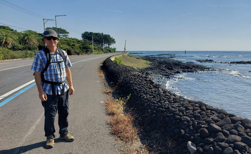
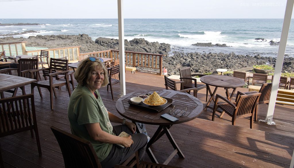
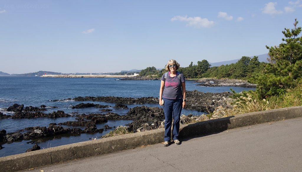
For the Olle trails at the eastern tip of Jeju Island, we based ourselves at Arumdaun Resort, a hotel just outside of Seongsan. Most of the time we stayed here the weather was stormy, with dark clouds and high winds. Aside from a few showers and some drizzle, there was not much precipitation so we were good to go for hiking. Our room had a nice view of the ocean, and the Olle 1 trail ran right along the shoreline.
Olle 1
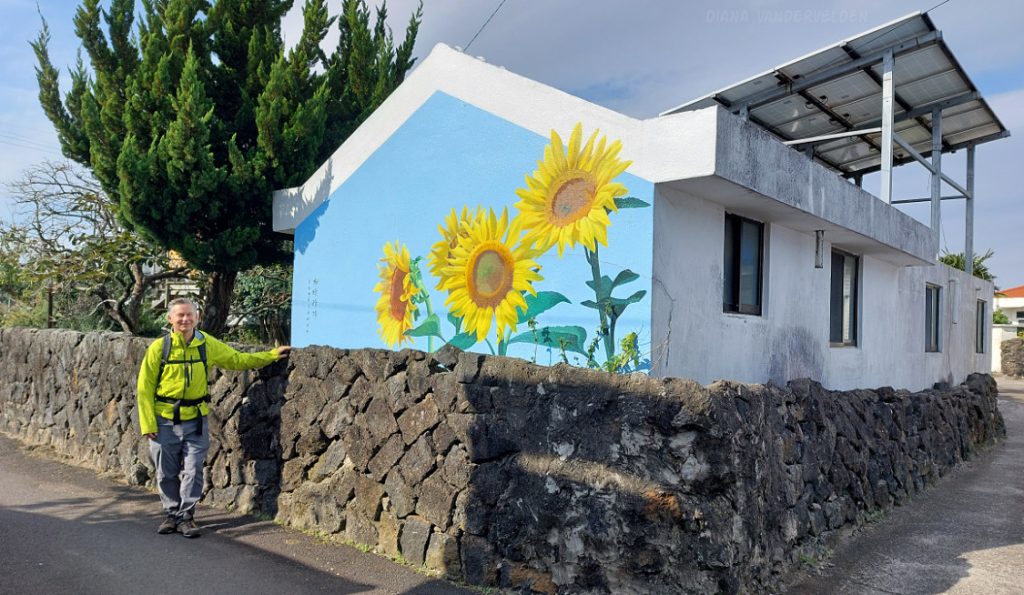
Olle 1 tours around the eastern town of Seongsan and its surrounding hills. We started our day by turning left (north), hiking along the shoreline to the village of Jongdal-ri. This is an artsy little village with some interesting floral murals.
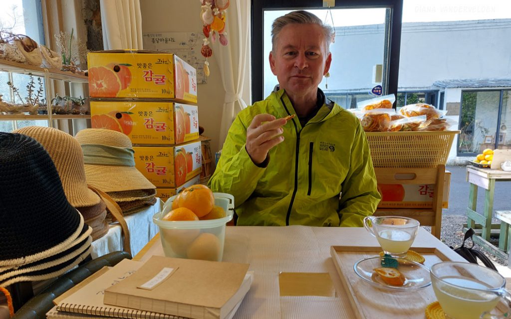
In the village were a few shops selling bits and bobs. We entered one shop and struck up a conversation with the shopkeeper. He was a very friendly fellow. He gestured for us to sit down, and he made us some tea. We bought some dried tangerine slices from the shopkeeper and proceeded on our way. Those tangerine slices, by the way, turned out be be an excellent trail snack.
Continuing on, we crossed the highway and hiked through some radish fields.
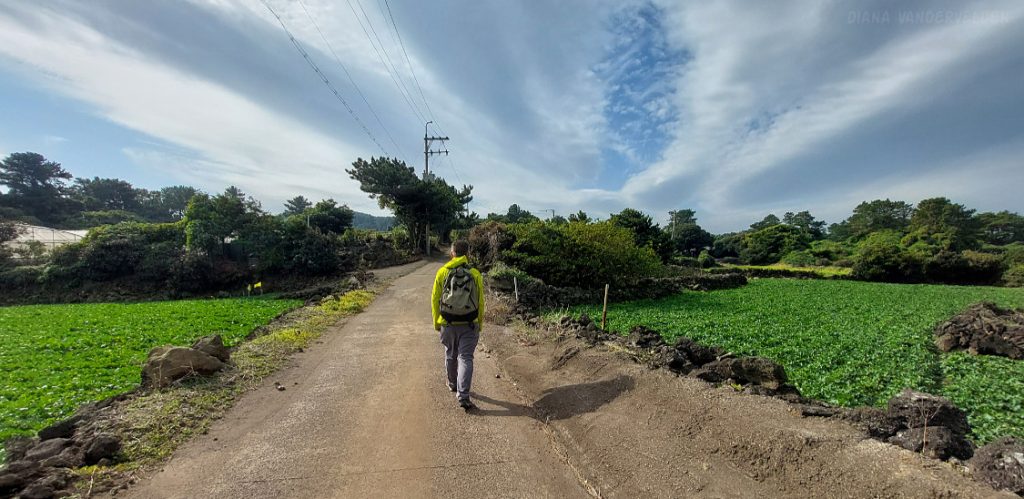
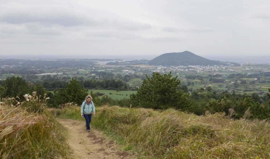
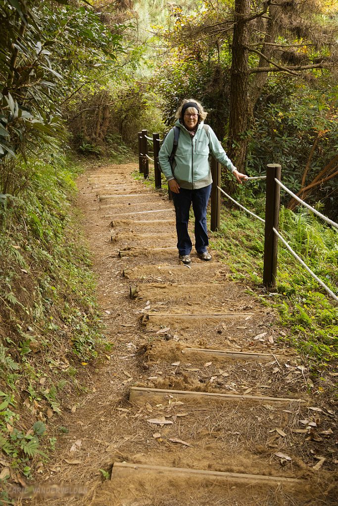
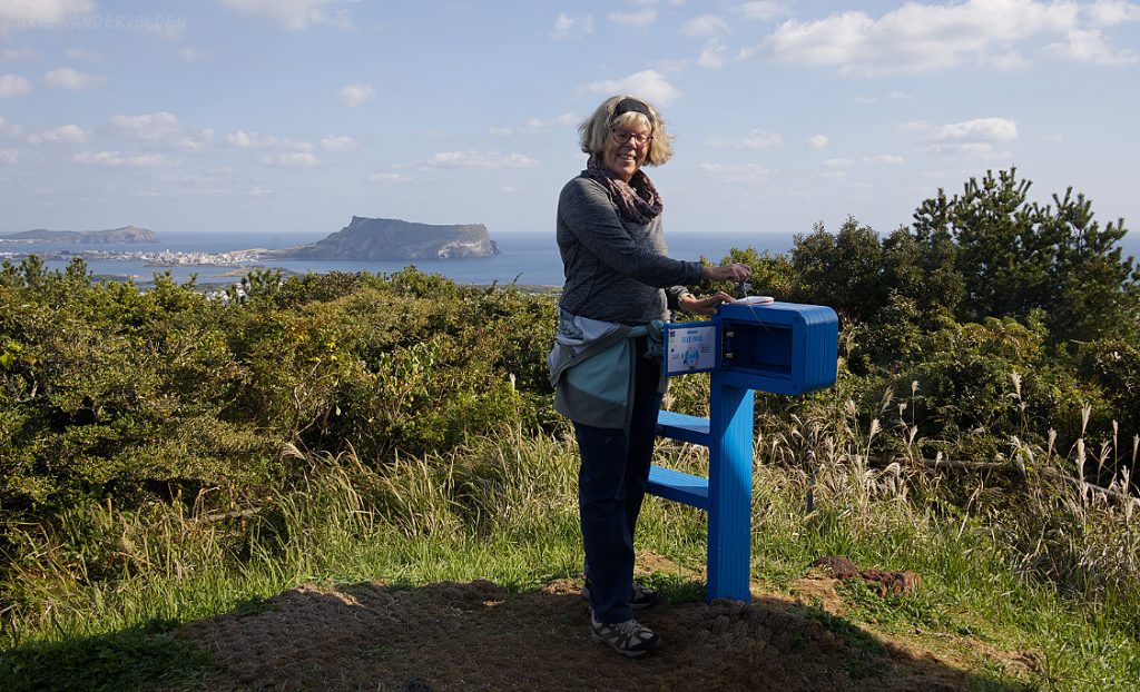
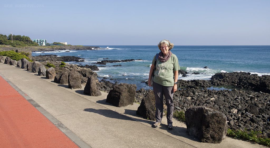
The trail then turned uphill and ascended Al Oreum. An oreum is a volcanic cone. The oreum was covered in tall grass and pine forest. It was windy near the summit.
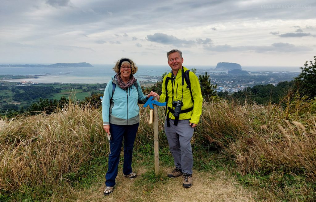
There were a few Korean hikers on the summit, and despite the language barrier we took turns taking each other’s pictures. Note the Olle trail signpost.
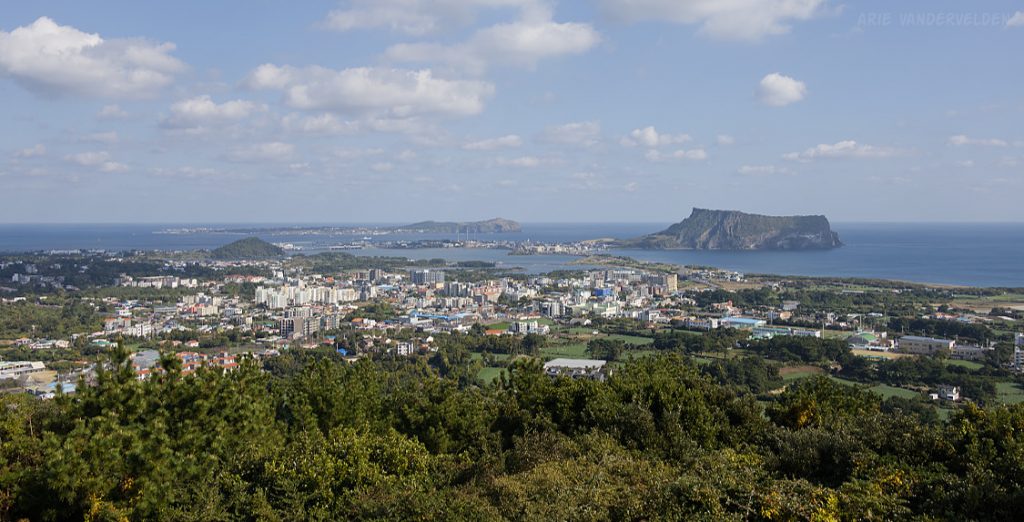
The trail descended to a col, and then went up again to Malmi Oreum, another volcanic cone. From the top there were some good views towards Udo Island.
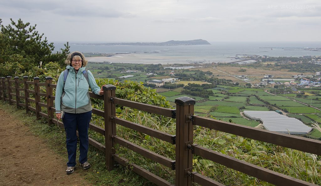
A steep descent led to the endpoint of the trail and an information center.
The information center was closed for lunch, and three Korean women hikers were sitting on a bench having their lunch. We greeted them and they wanted to share their lunch with us. They offered us a baked sweet potato and a peeled persimmon. Not wanting to eat their lunch we tried to refuse, but they would have none of it. The potato and persimmon were tasty and hit the spot. It was yet another example of the kindness and generosity of the Korean people we met. After this cultural exchange we re-crossed the highway and went back to our hotel to regroup.
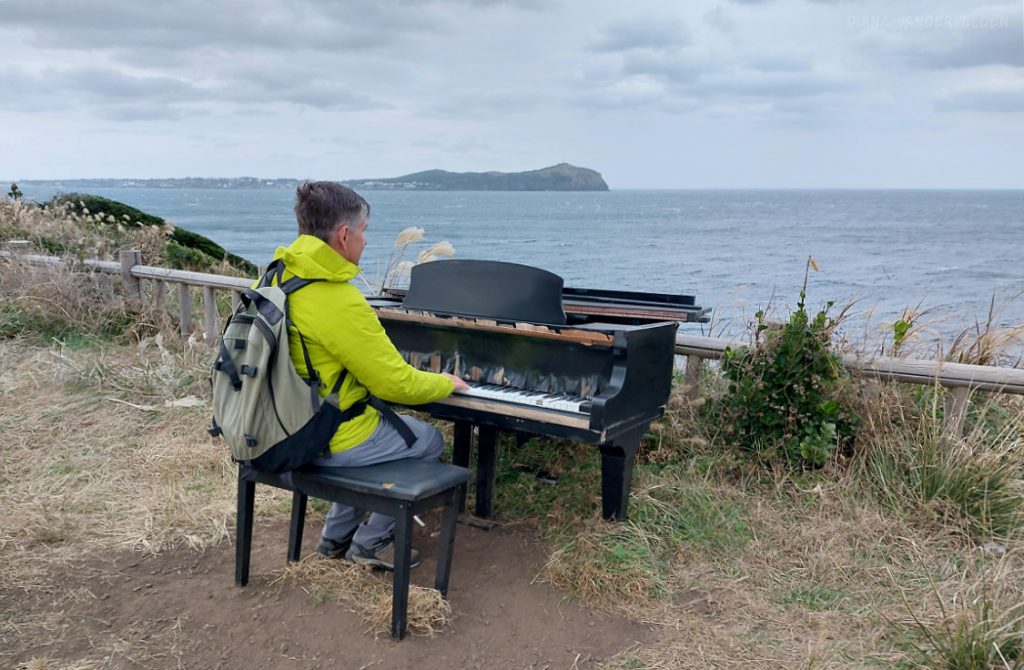
Later that afternoon we went out again. Instead of turning left we turned right, towards Seongsan town and Ilchulbong Oreum. The top of Ilchulbong Oreum is a popular place to see the sunrise. It was very windy when we approached Ilchulbong, and we decided to climb it another day. The trail to the top isn’t part of Olle 1 anyways.
Instead I played a few ditties on a random piano sitting on the edge of the cliff.
Olle 2
Olle 2 has two parts: a circular walk around some brackish-water wetlands near Seongsan, and an inland hike across Daeusanbong Oreum to Onpyeongpogu Village. We hiked these two sections on two different days.
We hiked around the wetlands on a stormy, windy day. These wetlands are known as being wintering grounds for spoonbills, a large bird with a bill the shape of a serving spoon. We did not see any spoonbills, but I did spot a kingfisher. This brilliantly coloured bird is quite skittish, and the one and only picture I managed to get was just barely sufficient to confirm my identification, but it’s far too blurry to reproduce here.
We hiked the second part of Olle 2 on a sunnier day, starting at the far end (Onpyeongpogu Village) and hiking back to Seongsan. There was a pretty flower display at this junction.
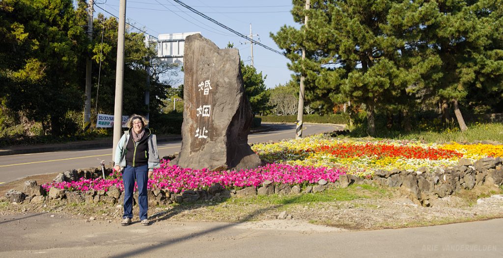
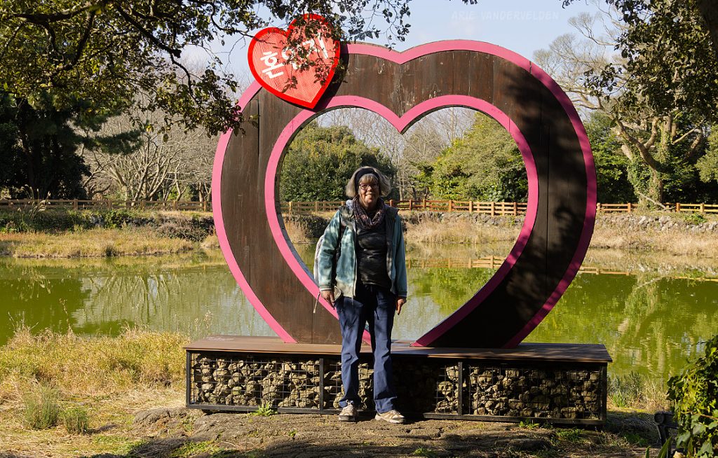
Ahead was Hon-Inji, which is Korean for Wedding Pond. According to myth, the three founding demi-gods of Jeju called Ko, Yang, and Bu emerged from the ground here and married the three princesses called Samgongju. Their weddings took place at the pond.
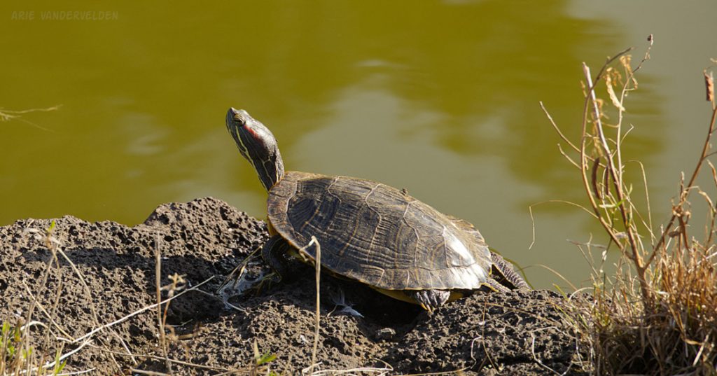
This turtle was sunning itself on the bank of the pond.
Beyond Hon-Inji, the Olle 2 trail followed farm roads through the countryside.
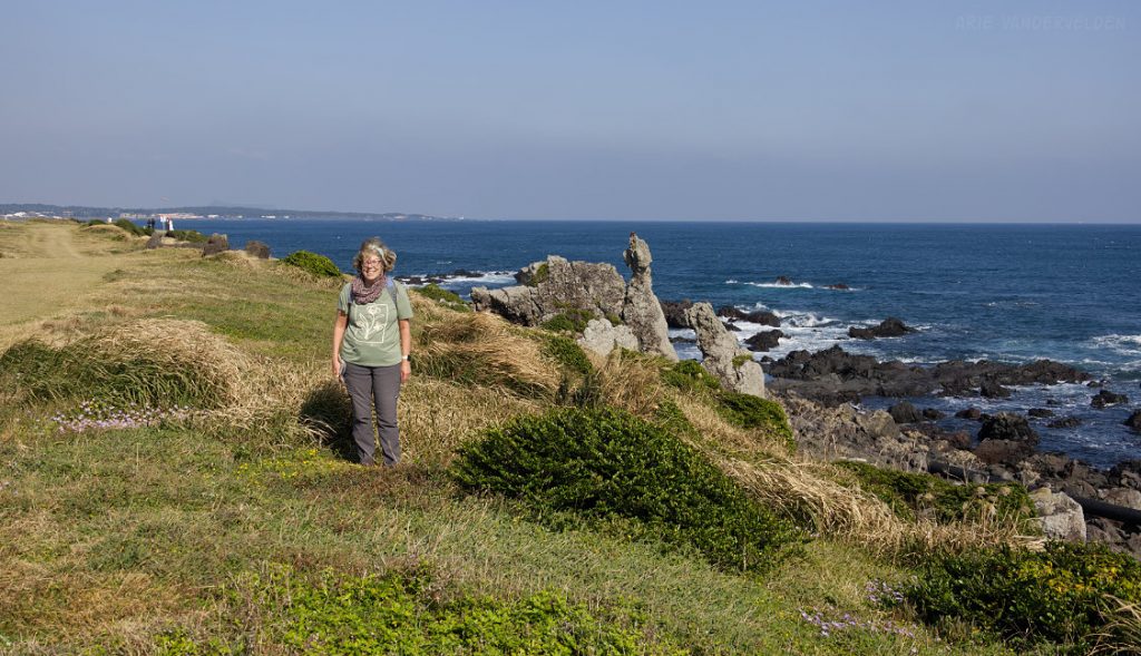
Just beyond, the trail entered a forest and began to ascend steeply. It led to the summit of Daesusanbong Oreum, a volcanic cone. At the summit was a stamp box.
There was also a viewing tower sticking out above the forest canopy. There were some great views towards Seongsan.
A steep descent led to suburban Seongsan, and we found our way to the wetlands loop which we had hiked previously, thereby completing this section of the Olle trail.
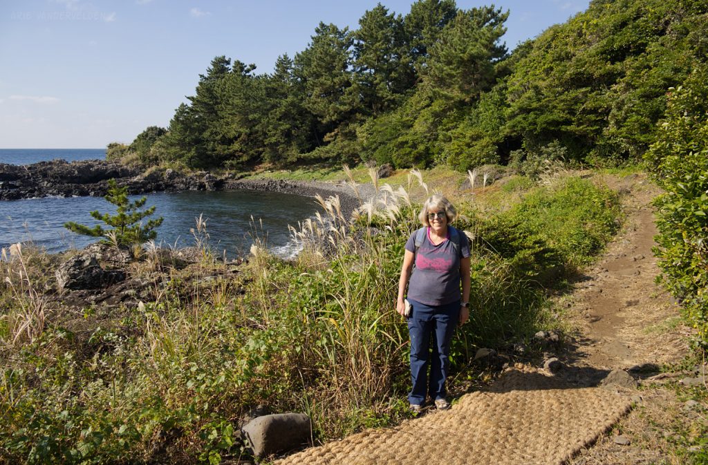
Olle 3
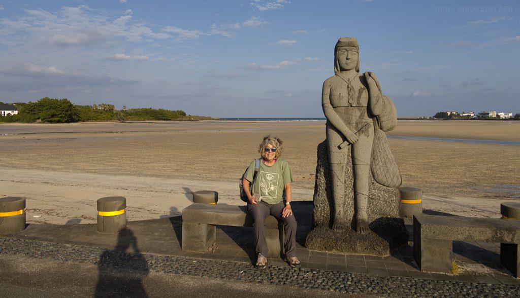
Olle 3 is a coastal hike. We started our walk at pretty Pyoseon Beach.
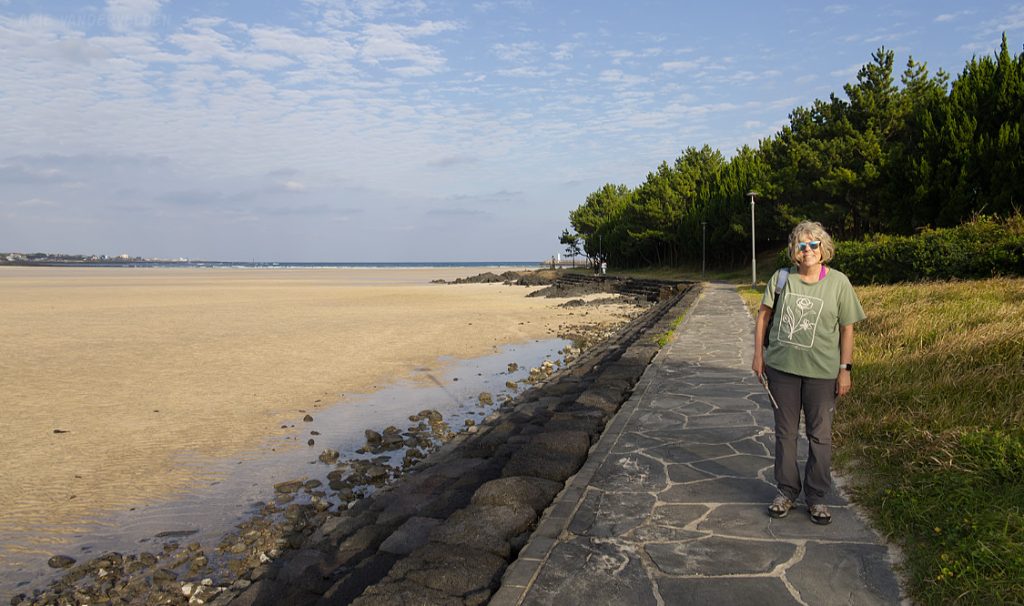
The tide was out, revealing a huge area of yellow sand.
Haenyeo statue, Pyoseon Beach.
We hiked around the bay towards a headland. Palms and flowering yucca lined the shore.
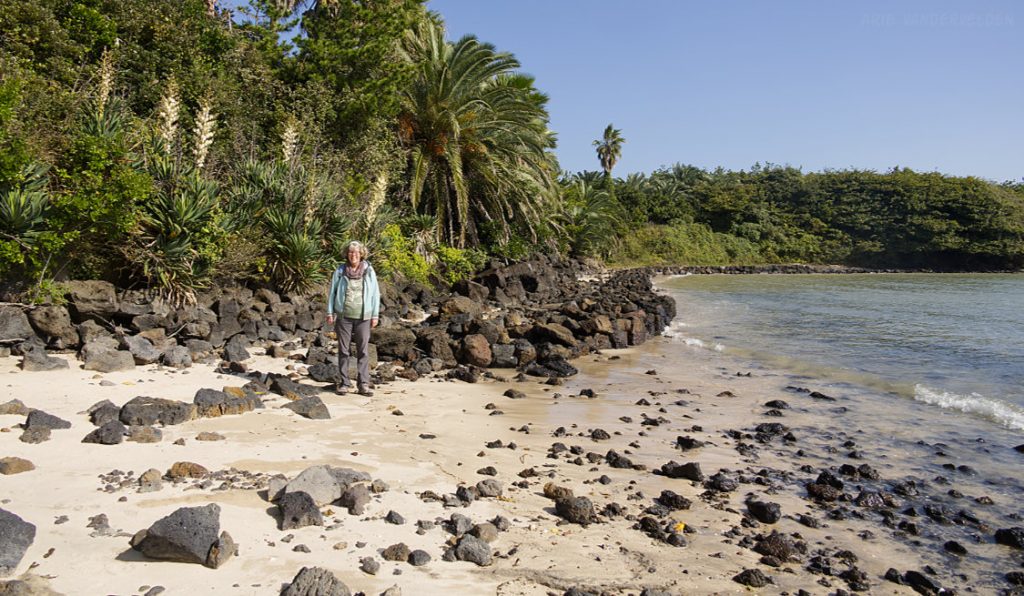
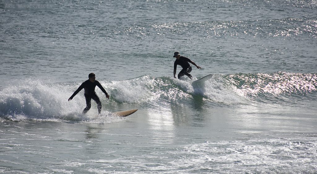
Around the headland was Sogeummak Beach where people were surfing a nice beach break.
It was an exceptionally pretty spot. At a location like this, you’d expect heaps of development behind the beach. But no, this is Jeju. Behind the beach was a cabbage field.
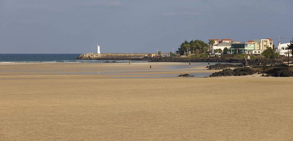
We hiked along the shoreline to a place marked Ch’onmi-ch’on on Google Maps. There is a ford through an inlet here that is dry at low tide and flooded at high tide. When we came up to it it was impassable so we detoured inland, to the highway and bridge, and then back out to the coast.
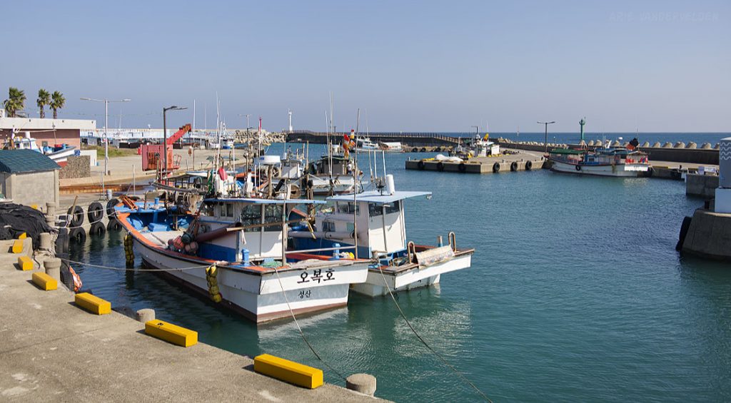
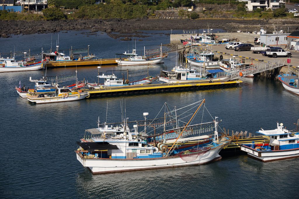
Ahead was a pretty little port.
A bit further on was an area where the shoreline had pastureland behind it. It was a unique spot on Jeju – in most places are vegetable cops, or houses, or fish farms, or ramshackle roads. This was one of the few areas we encountered with grasses. The local name for it is Sinpung Sincheon Bada Mokjang. The place is popular with newlywed couples, who come here to have their pictures taken.
Here I am approaching Jueodong Port.
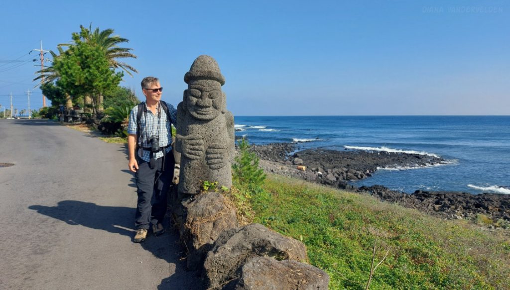
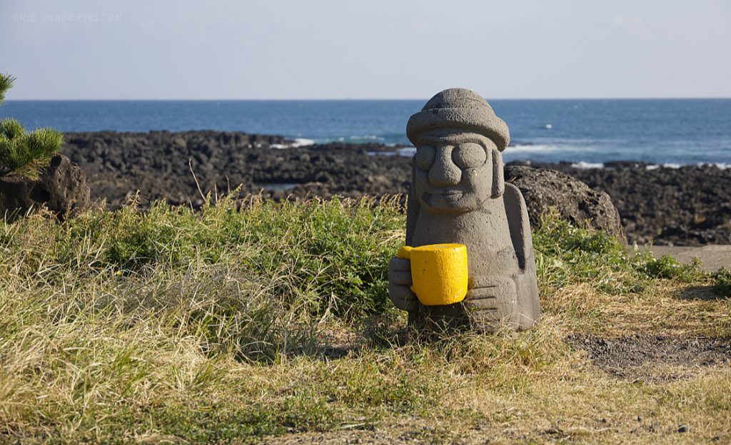
A Dol Hareubang stands guard outside of Jueodong Port. Dol Hareubang are a symbol of Jeju island. The origin of these lava stone statues is shrouded in mystery. I previously wrote about Dol Hareubang when reporting on our 2024 visit.
Yes, Dol Hareubang and tangerines are emblematic of Jeju Island. But what Jeju Island is most famous for is its Haenyeo women divers. The Haenyeo harvest seafood from the ocean floor by breath-hold diving. These women kept the Jeju people from starving during and after the war, and they’ve kept up the tradition. Many Haenyeo are in their 70s or even older, but we saw younger recruits as well.
At Jueodong Port we were lucky enough to observe a group of Haenyeo going to work.
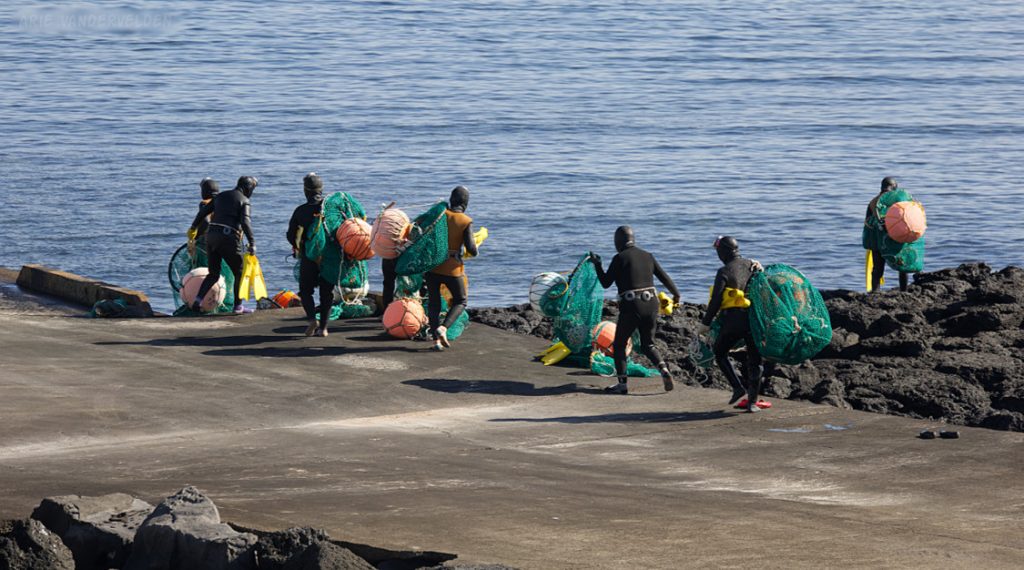
Each of the Haenyeo has a float, a net for holding the catch, and a number of tools to catch crustaceans and to pry shellfish from the rocky seafloor.
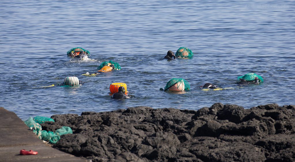
Haenyeo diving down. These Haenyeo were taking advantage of the calm conditions that day.
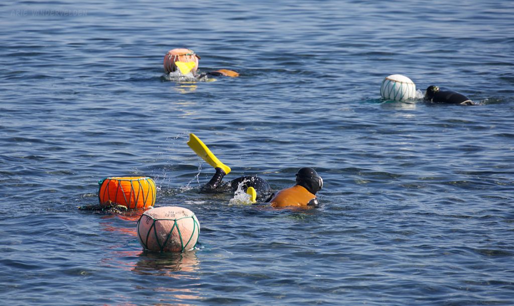
After watching the Haenyeo for a while we continued on. The hiking was along the shoreline. It was a beautiful sunny day. Life is good.
Olle signpost with a cabbage field in the background.
Near the end of Olle 3, there was a short inland detour leading Onpyeongpogu, a fishing village. We found a restaurant and had a nice meal to celebrate finishing Olle 3. The lady running the restaurant was really friendly.
Olle 4
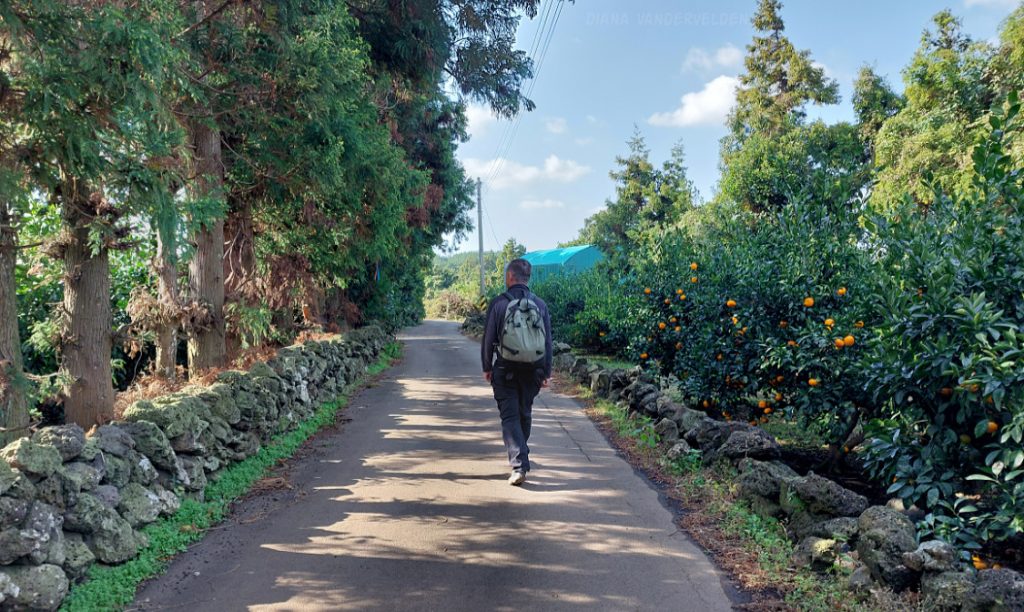
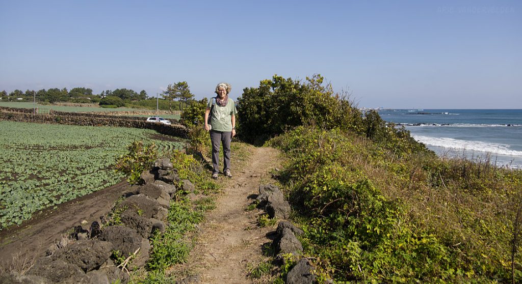
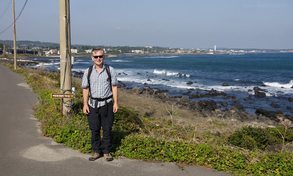
Olle 4 is a pleasant coastal hike. We had beautiful weather when we hiked it. Here is Diana just outside of Namwon, the start of this leg.
Nice coastal hiking.
Even a Dol Hareubang has to have his cuppa joe.
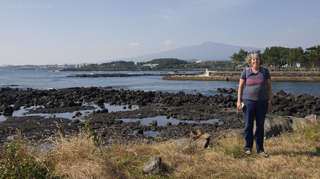
It was a clear day, and there were good views of Mount Hallasan, the volcano at the center of Jeju Island.
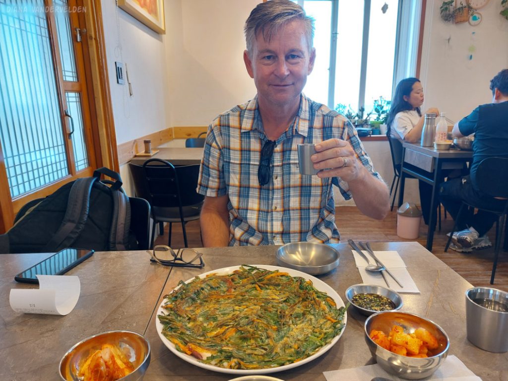
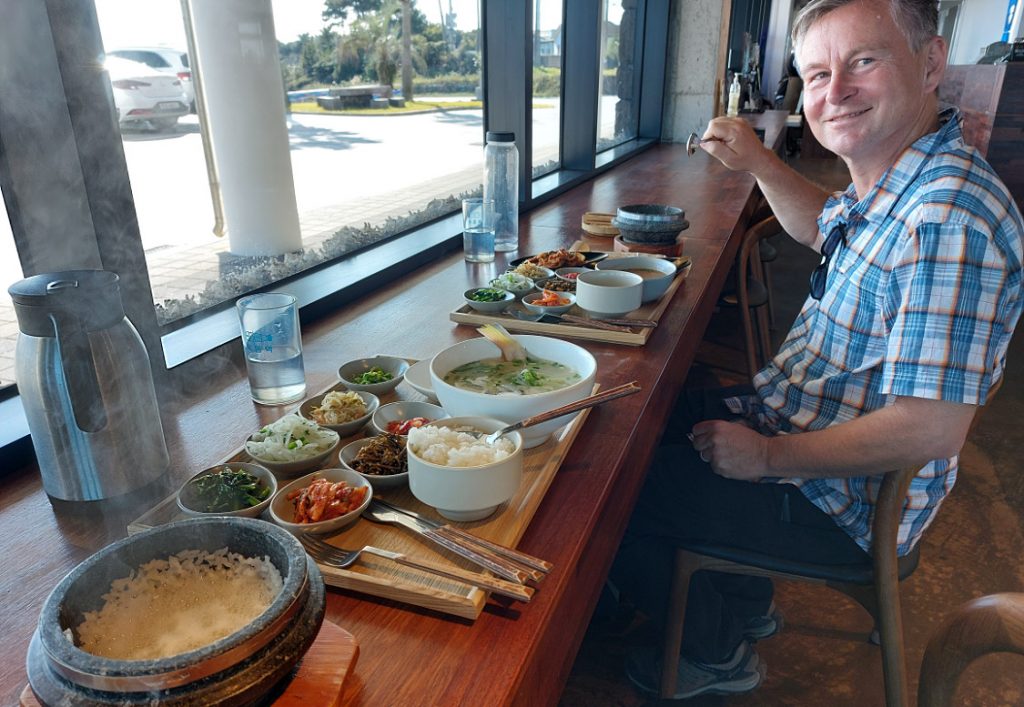
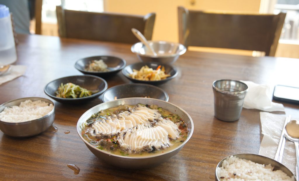
We stopped for lunch at a restaurant specializing in okdom. The waiter spoke decent English, but he went and got the chef whose English was flawless. The chef explained that Okdom is called Red Tilefish in English, that red tilefish is a Jeju specialty, and that his restaurant specializes in different preparations of this species of fish. Diana tried it as a fish soup, and I had fried fish. Oh my it was good – the fish was expertly cooked, of course. The flesh was very delicate in flavour. The side dishes added a variety of sour, salty, spicy, and sweet notes. We finished every morsel, and we congratulated the chef before we left.
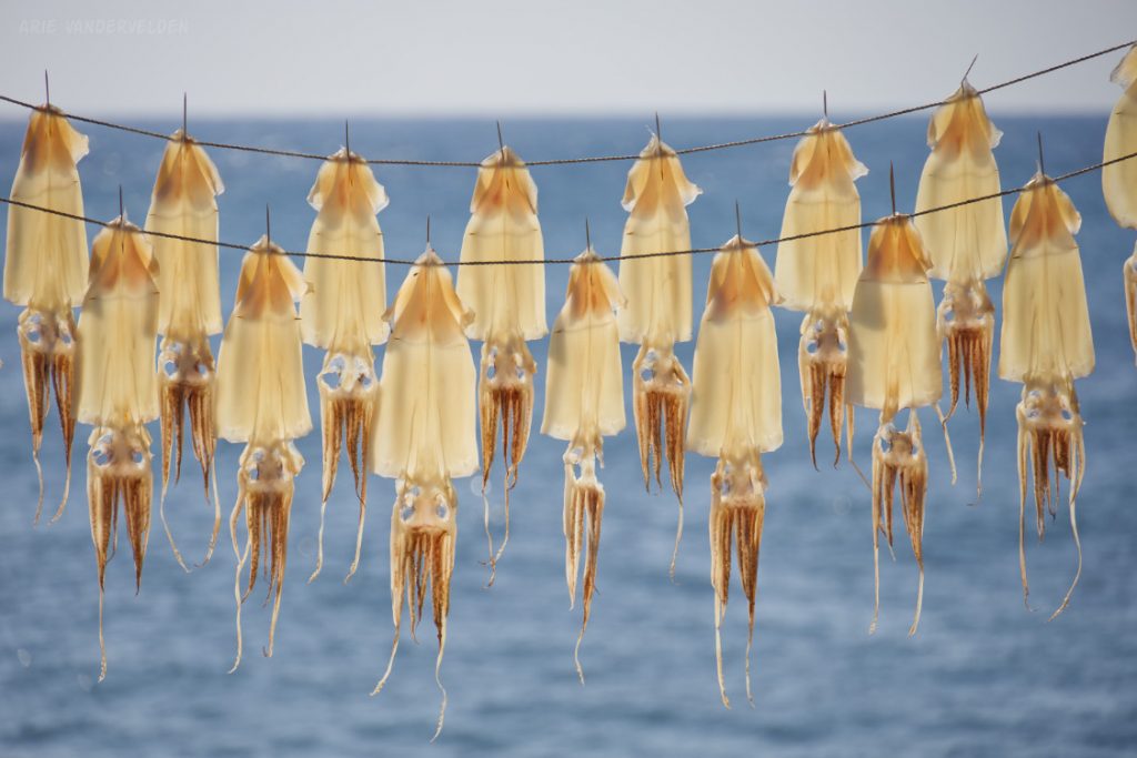
We came upon a lady hanging squid to dry in the sun.
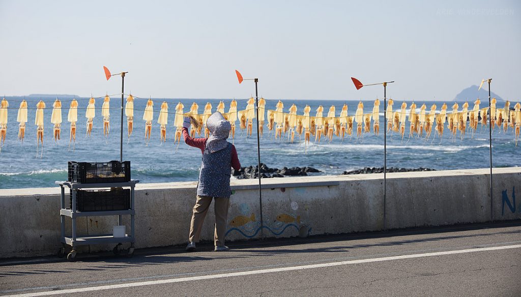
Squid, drying in the sun.
The trail continued along the shore. There were a lot of fish farms in this area (aquaculture). These typically are concrete basins with black or dark-green plastic canopies. They emit gurgling noises and funky smells, and they spew effluent into the sea. They are located in ramshackle areas, there is often a lot of discarded plastic around, and they lend a distinctly industrial feel to the coastline. The fish farms aren’t Jeju’s quaintest sight. But, it was a sunny day, and we enjoyed the views towards the sea.
Even in areas with fish farms, if you look carefully, there is beauty everywhere.
Just before Pyoseon and the end of the Olle, we spotted a cafe that had bingsoo – Korean shave ice. We decided to treat ourselves and got a large order to share. It was almond flavoured, and had red beans on the side. It was absolutely delicious.
Olle 5
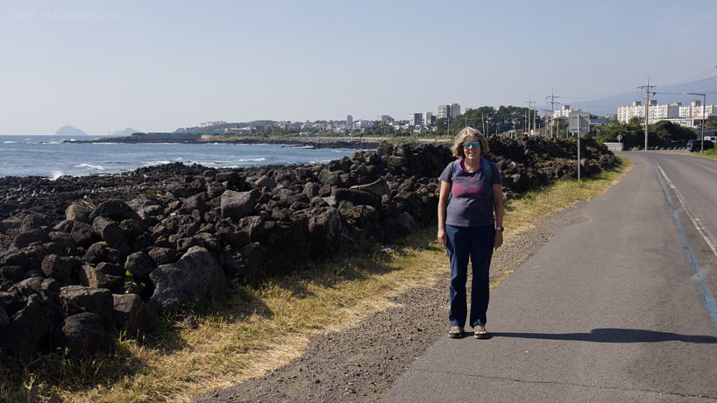
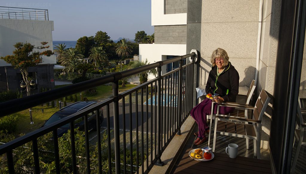
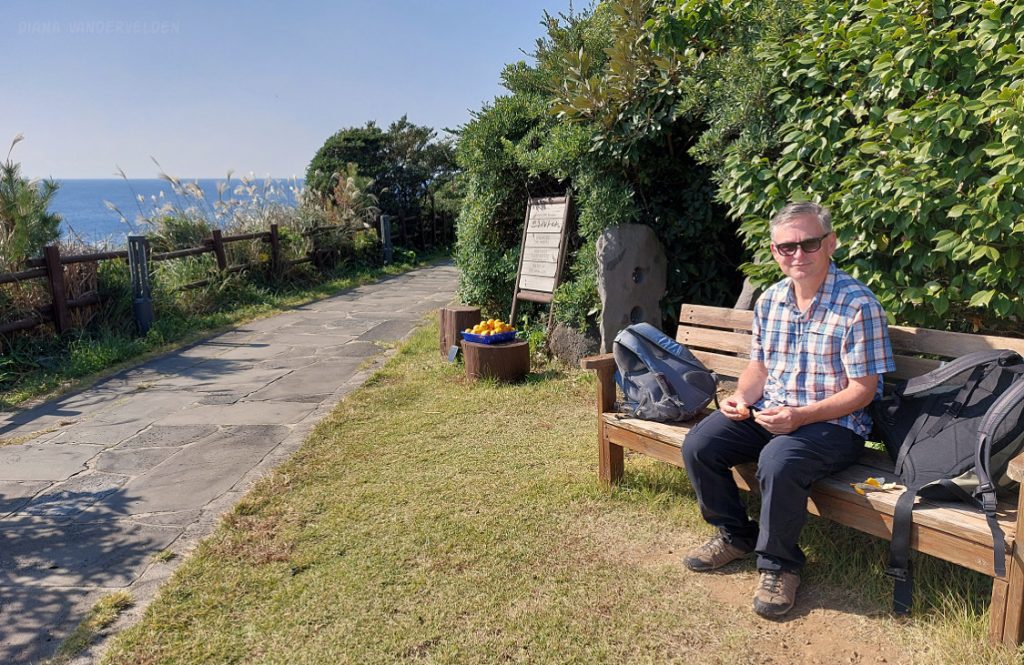
To hike Olle 3, 4, and 5, we based ourselves at a small apartment-hotel called Orojeju, just west of the larger town of Namwon. We weren’t front-row to the sea, but we did have sea views and we could hear the waves sloshing in a bay just a stone’s throw away. And: Olle 5 ran right in front of the hotel. Each morning we had our breakfast on the balcony before heading out for the day.
First, I’ll talk about the route to the left, to Namwon. Between our hotel and Namwon were two huge resorts, each taking a different approach to Olle hikers. One resort had a nice paved pathway, with viewpoints along the way. The other resort had everything fenced off, leaving Olle hikers to scramble on the rocks by the shoreline.
The other resort had a paved walkway welcoming hikers. Spreaking of welcoming – someone had set out a basket of freshly picked oranges for passersby. How generous and nice!
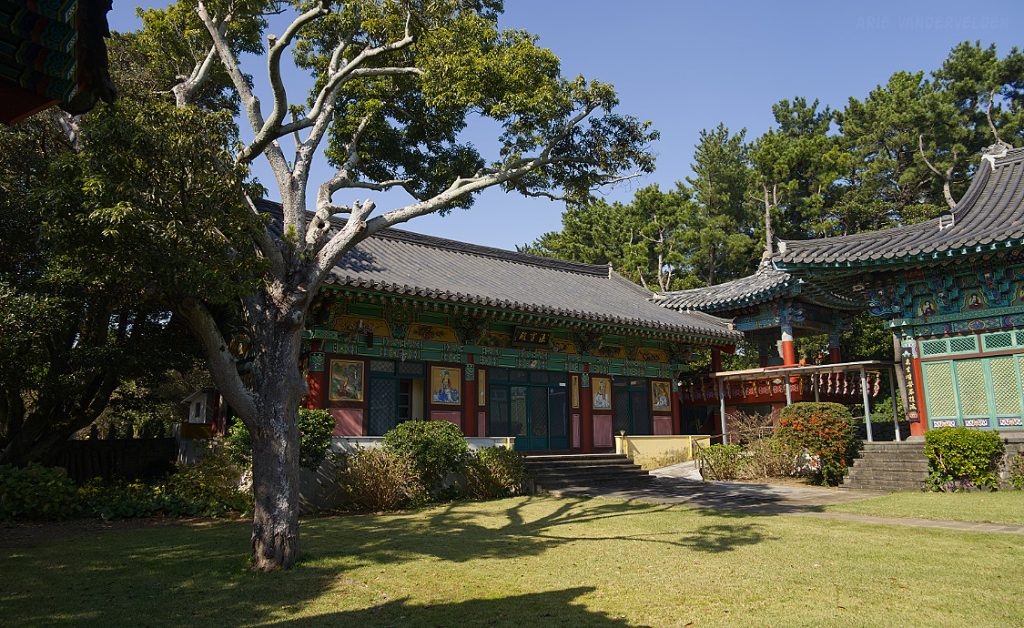
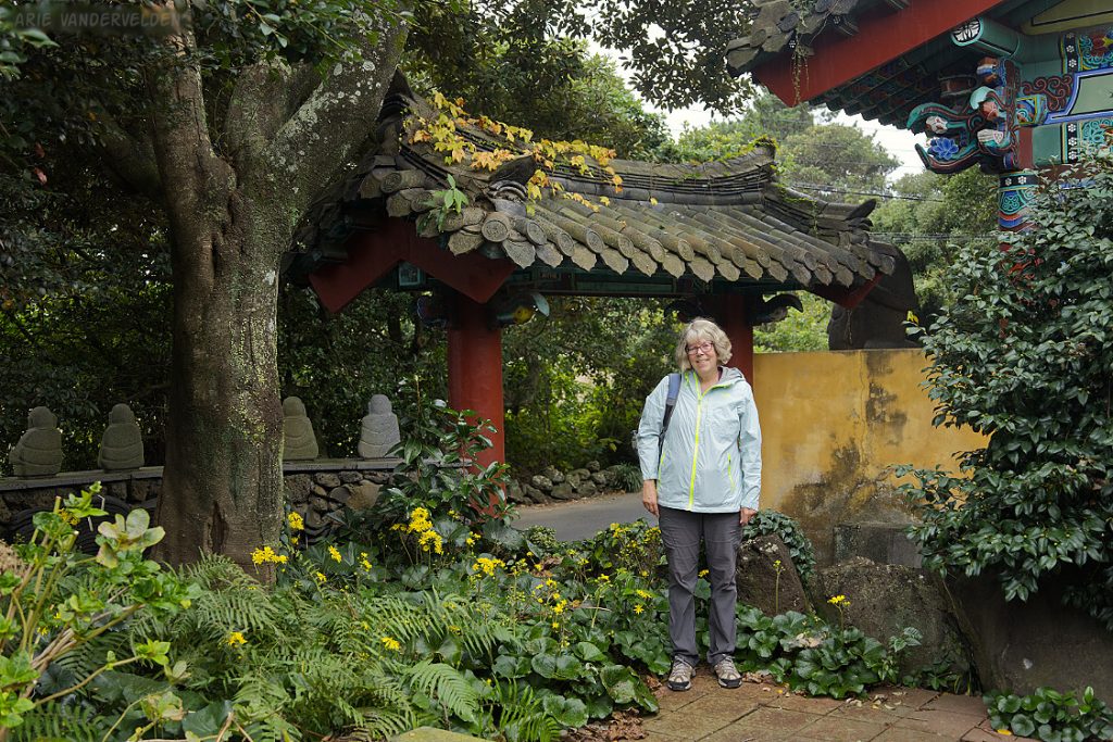
Tucked in behind the two resorts, behind a greenhouse full of orange trees, was a Buddhist shrine called Seong Wangsa Temple. Of the temples we visited in Jeju, this was our favorite. It was a peaceful, powerful spot.
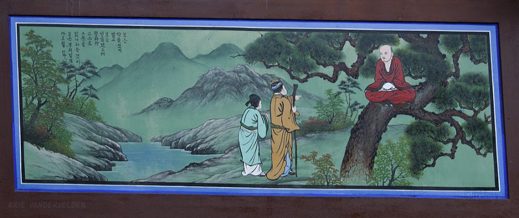
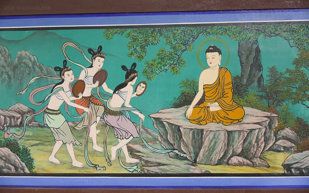
There were frescoes painted on the sides of the building, most of them depicting scenes from the life of the Buddha. Paintings of this type are common on Korean Buddhist temples, but I found these ones to be particularly evocative and well done. Here are two people consulting the Buddha.
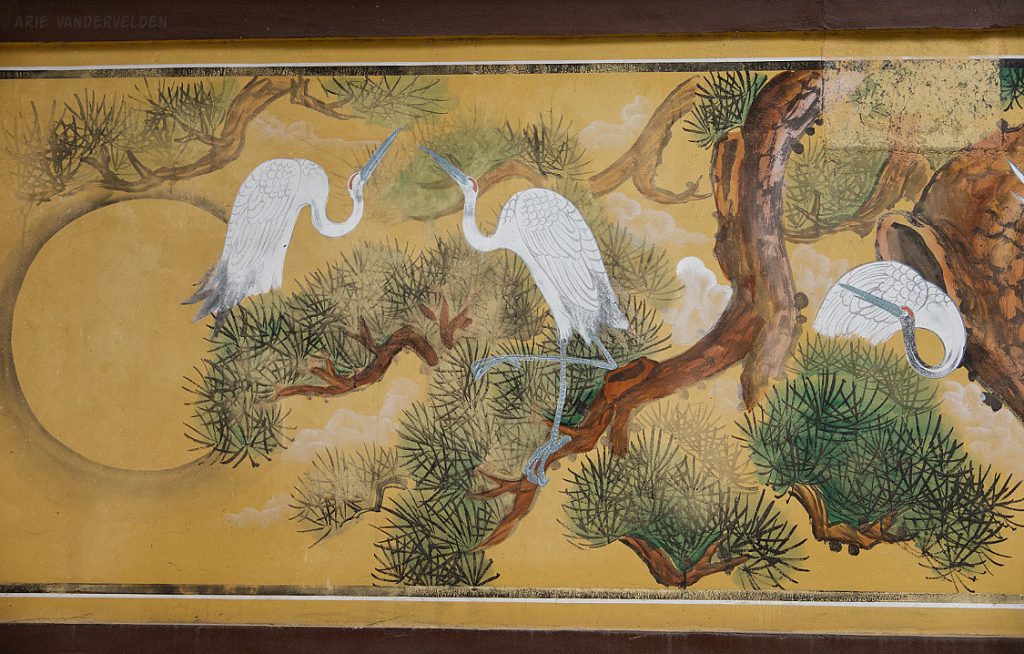
Cranes.
Vanity.
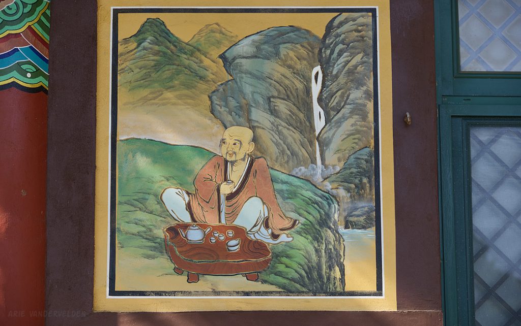
Tea drinker.
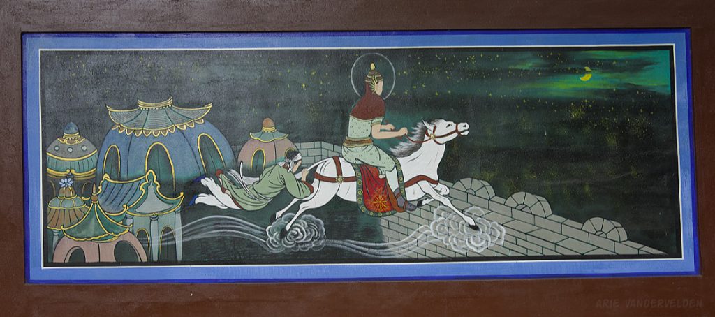
Riding through the sky on a moonlit night. I’m sure there must be a story behind this scene but I haven’t been able to find it yet.
We returned to this temple on a rainy day, hiking the detour trail around the resort rather than scrambling on the rocks by the shoreline.
On another day we left our hotel and turned right. It was another beautiful day.
There was a section of undeveloped shoreline, with a nature trail along it.
At Wimi Harbour, there was a huge pedestrian bridge straddling the harbour entrance. Curiously, the Olle trail did not make use of the bridge but led hikers around the harbour.
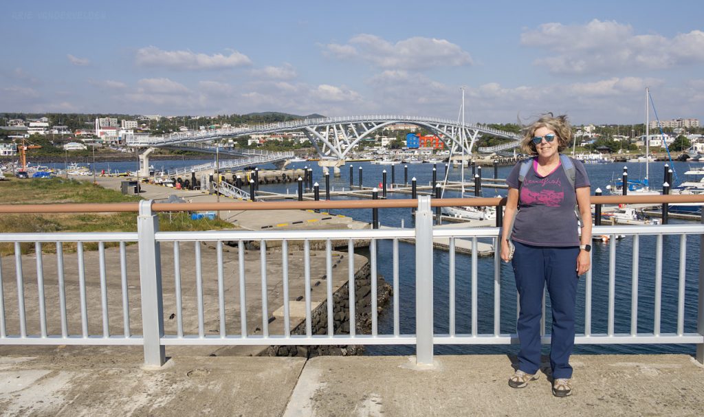
We hiked this leg as an out-and-back, so we hiked around the harbour outbound and we crossed the bridge when going back. There were nice views of the harbour and volcano from the top of the bridge.
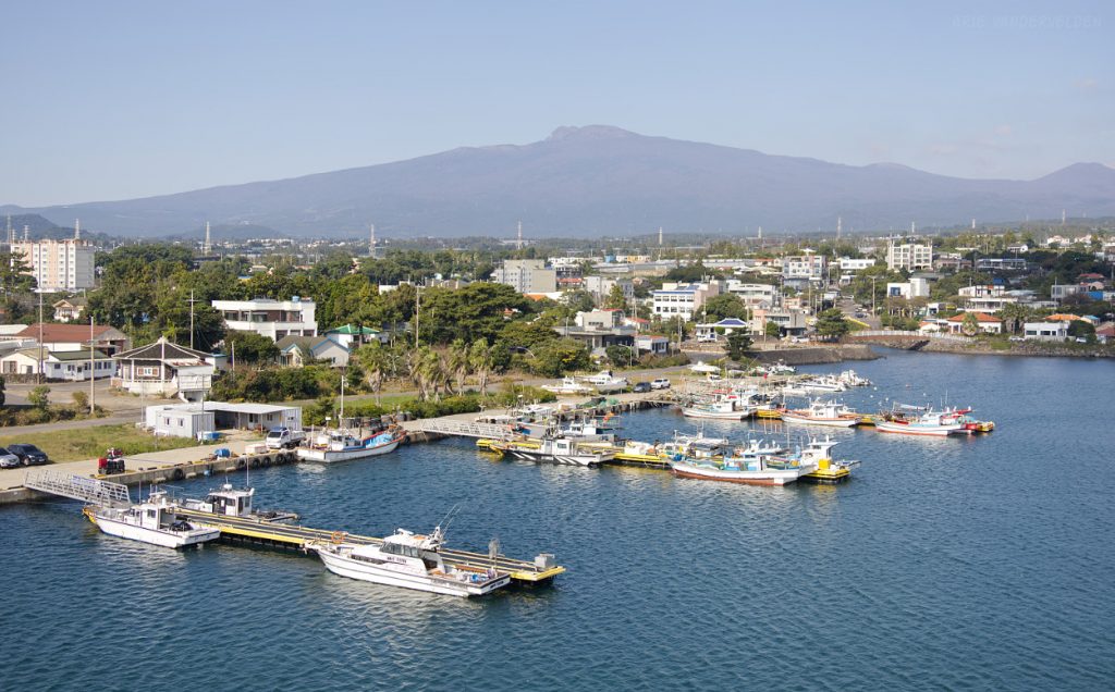
Protected mooring for fishing vessels.
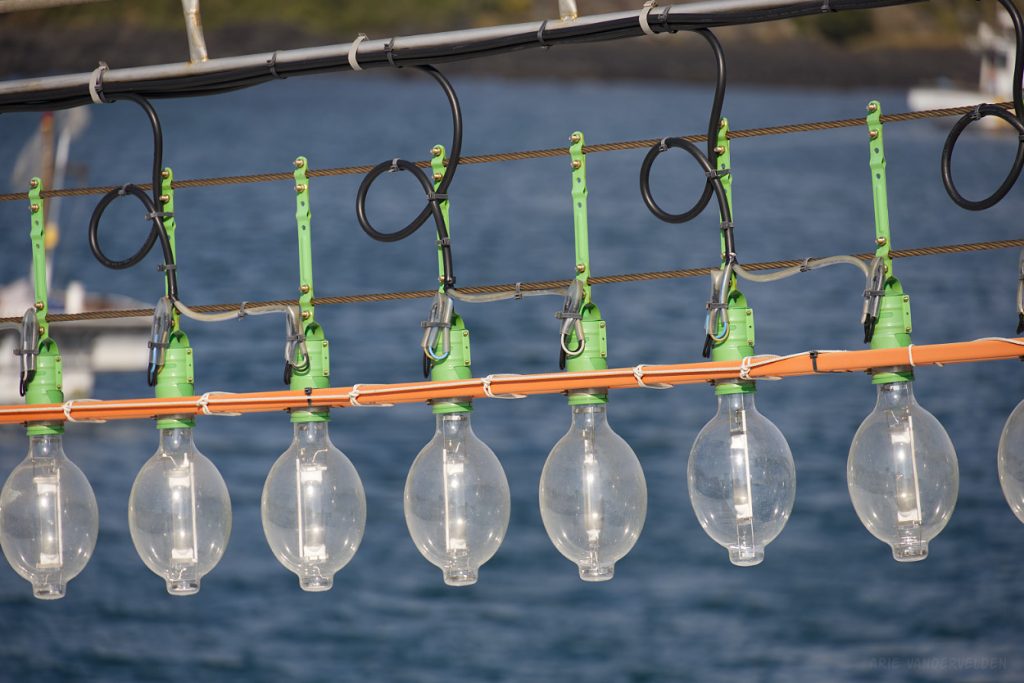
Most Jeju fishing vessels have strings of lights. These lights attract squid and fish at night, which are then scooped up using nets on side booms. This is much more environmentally friendly than bottom-trawling or gill-net fishing.
As we hiked on, we reached our far point of our 2024 Olle hike. For a report on our hike from here of Olle 5, 6, and 7 to Seogwipo, look here.
Meanwhile we were getting hungry for lunch. The village we were in had several restaurants, but all except one were closed for the day. The restaurant that was open was packed full of people, which we took as a good sign. It was a seafood restaurant, and the daily catch was written on a chalkboard. Unfortunately, many dishes were crossed out because they had sold out, which left us with some more adventurous options. We decided to go for it and order raw sliced abalone.
The abalone was somewhat rubbery, but we figured we’d get through it. The waiter saw us picking at it and came over, shaking his head. “mix, mix, mix” he told us, and proceeded to stir the dish. As it turned out, below the abalone were herbs and an acidic liquid, and stirring turned the dish in a Korean ceviche. This changed everything – the dish was now delicious.
Go to part 2.
Logistics
In last year’s blogpost I wrote some tips about travel to and around Jeju.
Most of the hikes we did were point-to-point. We would drive to a starting location, hike, and then take a bus back to our starting point. We did a few out-and-back hikes as well.
To navigate Jeju, you need to install the Naver Maps app on your phone. Due to security reasons, most functionality of Google Maps is not available in South Korea. You need Naver Maps. Be sure to install “Naver Maps” rather than “Naver” because Naver is a Korean social media app. Naver Maps gives directions for driving and walking. It indicates the Olle trail. It suggests bus routes and gives departure times. Plus, when driving, it indicated speed cameras which are as common in Jeju as magpies in Calgary.
The Olle hiking guidebook can be downloaded here.
Olle 1 is 15.1 km. Olle 2 is 15.6 km. Olle 3 (coastal option) is 14.6 km. Olle 4 is 19 km. Olle 5 is 13.4 km
Here is a map of Jeju Island, showing the Olle trails (numbers) and places we stayed.