The Rotary-Mattamy Greenway is a 140 km long cycling path that loops around the city of Calgary. The vast majority of the loop is on dedicated cycling paths, with some sections on sidewalks or roadways. The trail traverses some of Calgary’s finest parks, provides access to Calgary’s best birding spots, leads past gritty and grimy industrial areas, and goes through mile after mile of drab and dreary suburbs. We first cycled the Greenway in the summer of 2020, as a way of keeping us sane during the Covid-19 pandemic. After cycling the trail we felt like we got to know our city a lot better! We visited many neighborhoods that we otherwise would have no reason to go to. We decided to give the Greenway another go this year (summer of 2025).
In 2020 we did the loop as a series of out-and-back trips, starting our next leg at our previous turn-around point. So for each of the legs we cycled the Greenway clockwise to a turn-around point, and then counterclockwise back to the car. In theory this should yield a total distance of 280 km, but with overlaps and side trips we cycled quite a bit more than that. This year we are using the same approach of out-and-black trips. We cycled 330 km in 10 stages.
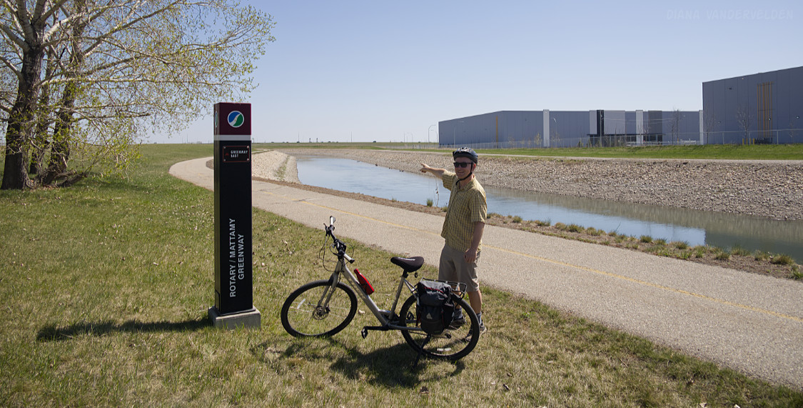
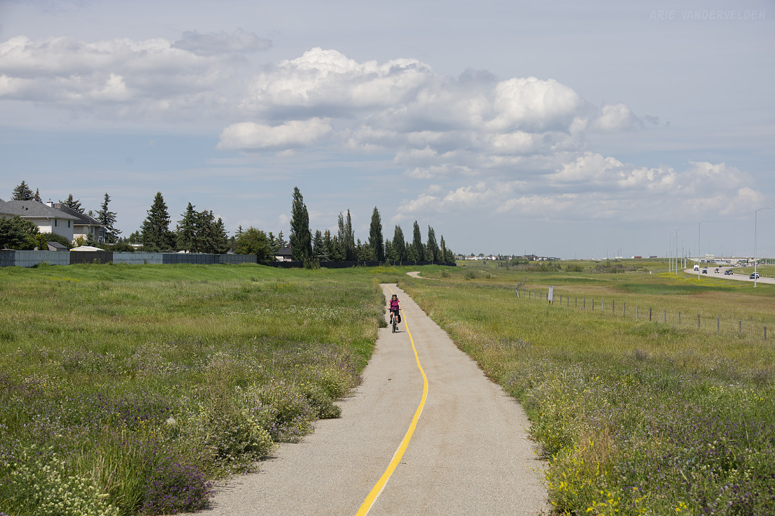
Chestermere Canal Pathway
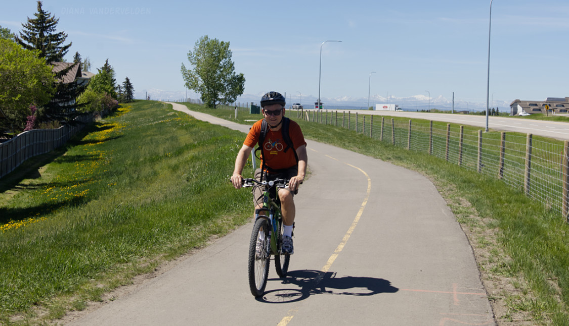
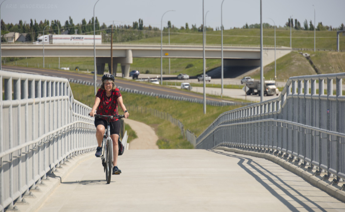
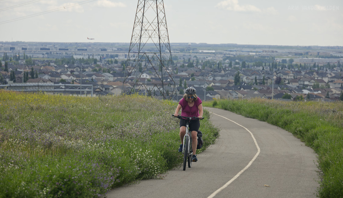
Being a loop, the Greenway has no predefined starting point. We chose to begin by cycling the Chestermere Canal Pathway, which overlaps the Greenway for 4 km.
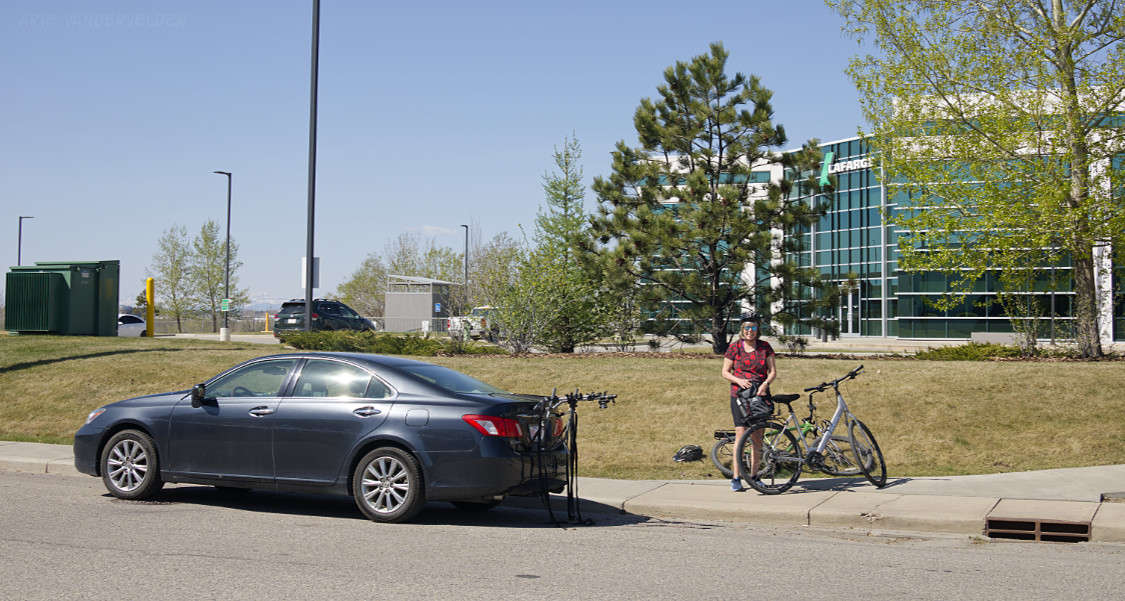
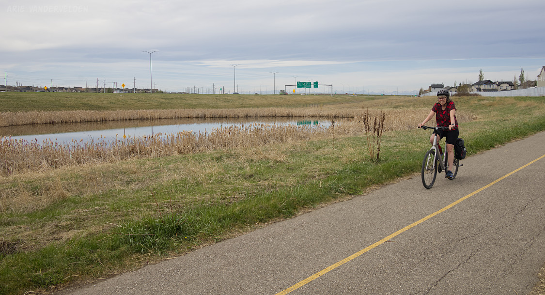
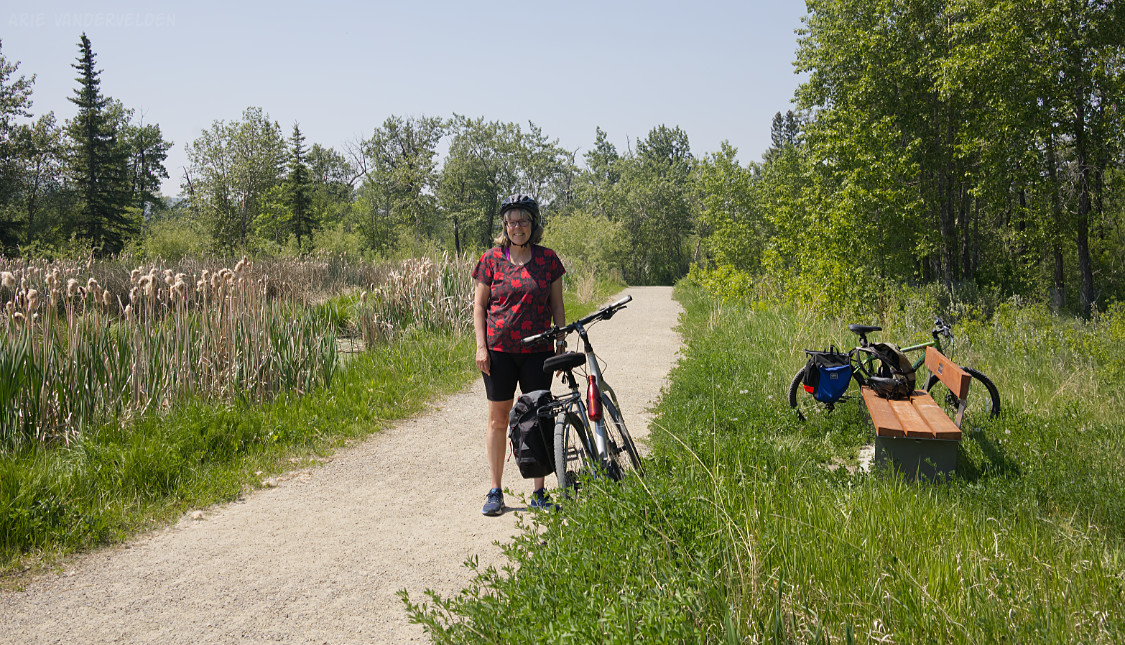
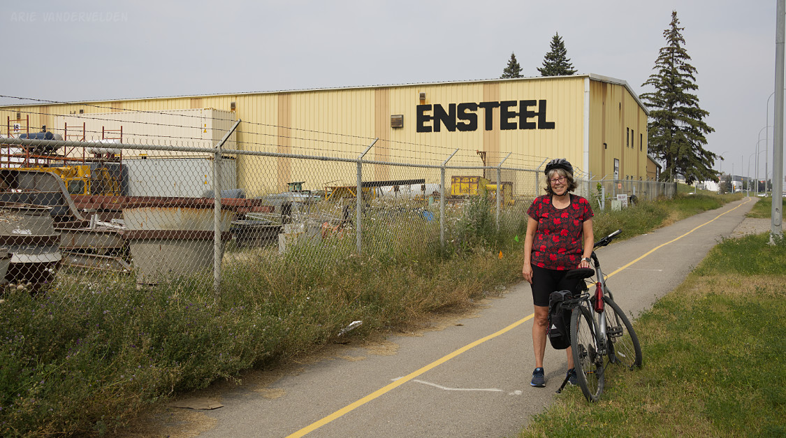
The Chestermere Canal Pathway is one of our favorite bike rides in Calgary. We like to park on the 5100 block of 22 Street SE, on the street in front of the Lafarge office. From here it is 21.5 km to Chestermere, or 43 km return. Here we are getting ready to go cycling.
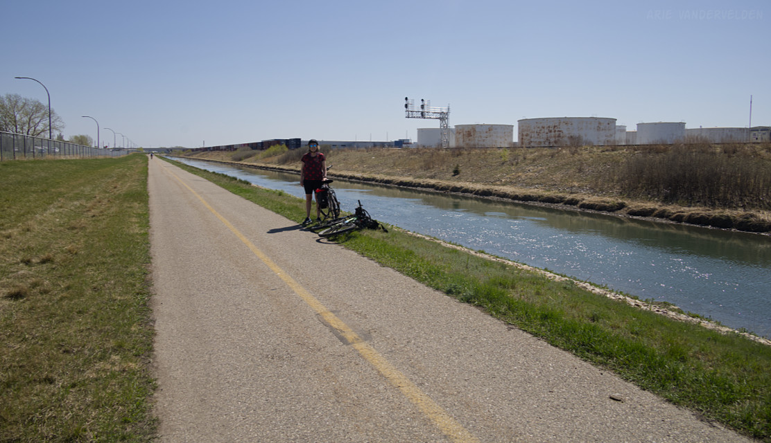
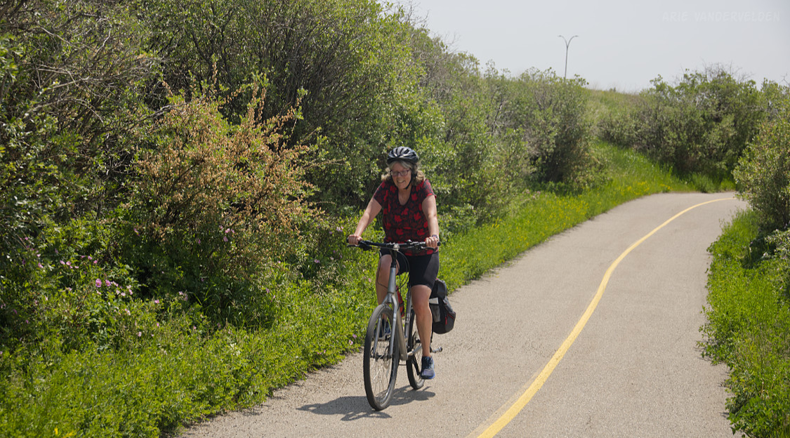
The Chestermere Canal Pathway is perfectly flat. It leads past industrial areas, but the immediate surrounding area is a greenspace. The pathway crosses most major roadways through underpasses.
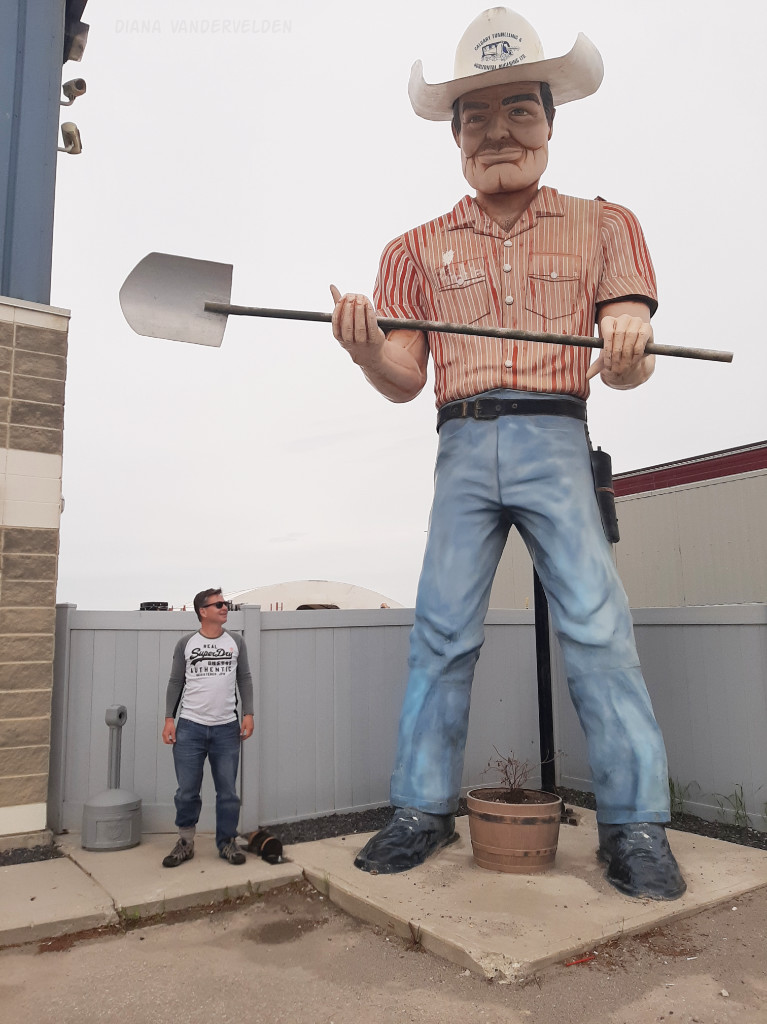
At 52nd Street the Canal Pathway meets up with the Greenway. At the next underpass, which goes below 106th Avenue, be sure to check out the giant statue in front of Calgary Tunneling and Horizontal Augering. You can see it from the pathway, but it’s worth a short detour to see it close up.
There is a Greenway marker post at 68th Street, but not at 52nd Street where the junction is. Strange. But this isn’t an isolated aberration. The Greenway is poorly marked in many locations, so it is recommended to study the route beforehand and to keep a map handy on your cellphone.
Shepard Wetlands
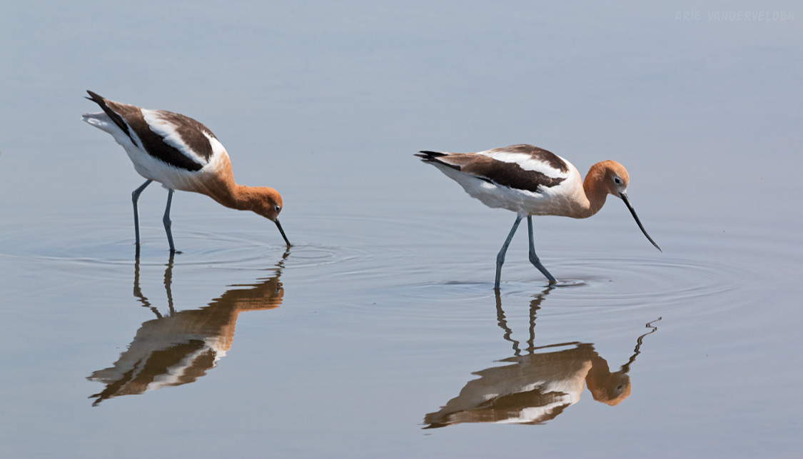
Just past Stoney Trail there is a junction. The Chestermere Canal Pathway goes straight ahead while the Greenway heads south towards the village of Shepard. There are some excellent wetlands along this stretch that are great for birdwatching. At 114th Avenue the trail recrosses Stony Trail and heads south along some beautiful wetlands. These shallow, alkaline ponds used to attract wading birds like Avocets and Stilts, but the past few years these ponds have been dry.
Here are some Avocets, Shepard wetlands, photographed in 2021.
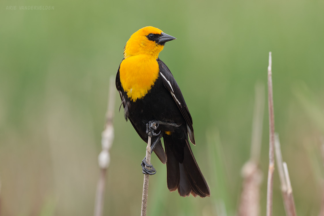
Yellow-headed blackbird, Shepard wetlands.
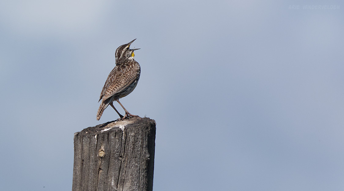
Both in 2020 and 2025 I saw western meadowlarks in this area. These birds have a beautiful song that to me epitomizes summer. These birds are skittish and hard to photograph.
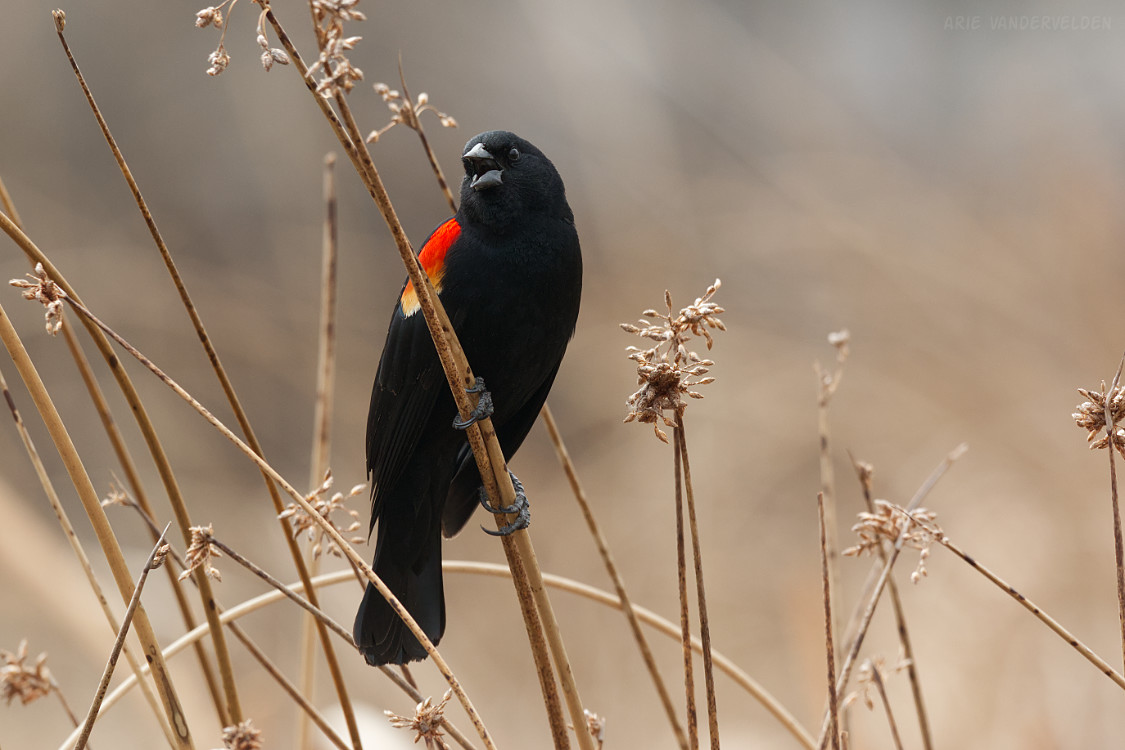
The Greenway keeps going south, past ponds full of bullrushes and noisy red-winged blackbirds, wrapping around the community of Copperfield. It follows a greenspace that borders Stoney Trail. It does not cut through the community of Copperfield, as some maps suggest.
The Greenway now turns west for a short distance. It crosses Stoney Trail at 52nd Street and enters the community of Auburn Bay on Auburn Bay Drive. It turns left onto a pathway going around a ball diamond. This pathway goes past a school, past another school, crosses Auburn Bay Avenue, and then heads south on a pathway between people’s back yards. Greenway signage is poor in this area, but in general the trail heads south, towards the South Health Campus hospital.
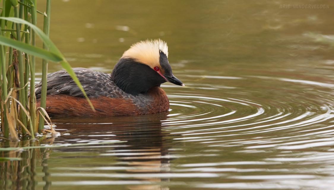
Auburn Bay has some nice ponds that attract birds. Here is a horned grebe, which I photographed in Auburn Bay.
Fish Creek Provincial Park
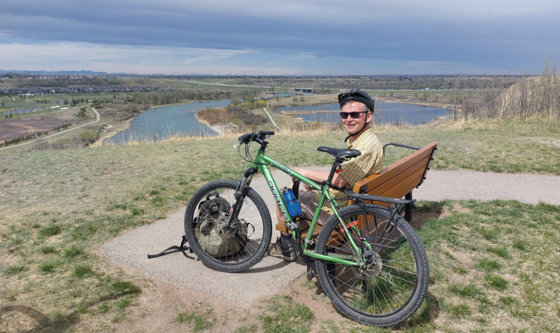
At the South Health Campus Hospital, the trail turns west, following the sidewalk beside Seton Boulevard. It crosses Deerfoot Trail and then follows Cranston Avenue. At a downhill, the Greenway turns right onto a pathway and follows the escarpment above the Bow River. Views abound here.
The Cranston escarpment is a good place to stop for lunch.
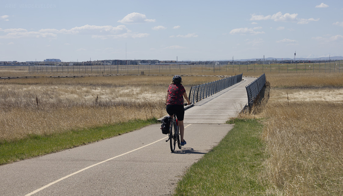
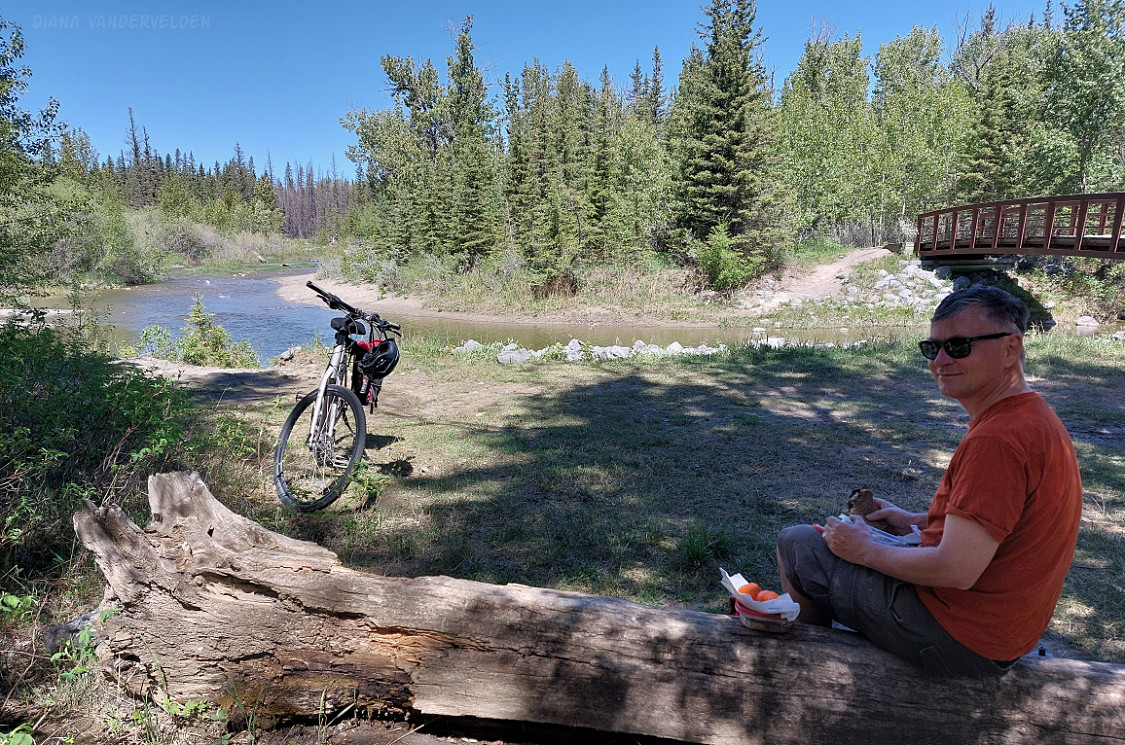
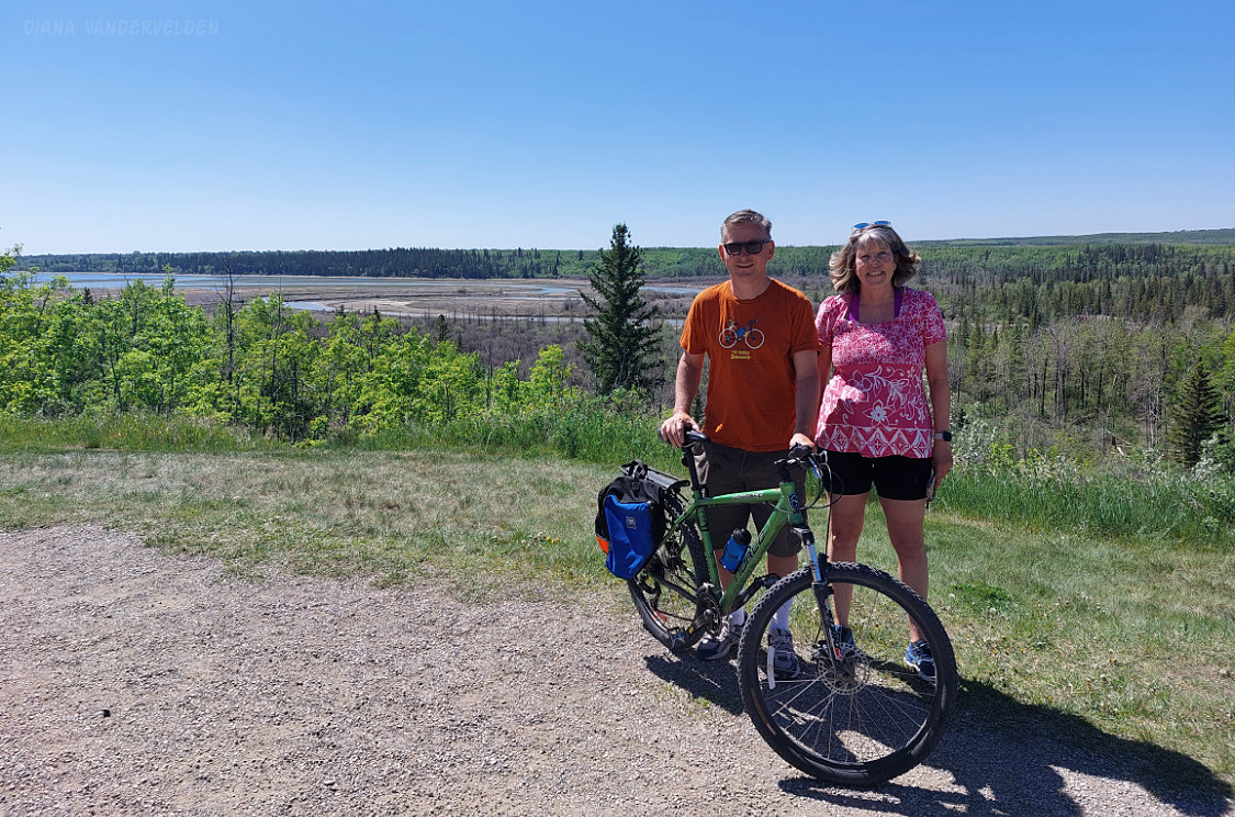
The Greenway heads down a steep ravine to the Bow River and into Fish Creek Provincial Park. There are storm water ponds here that are popular with birds. The Greenway then heads upriver through a beautiful cottonwood forest to a bridge.
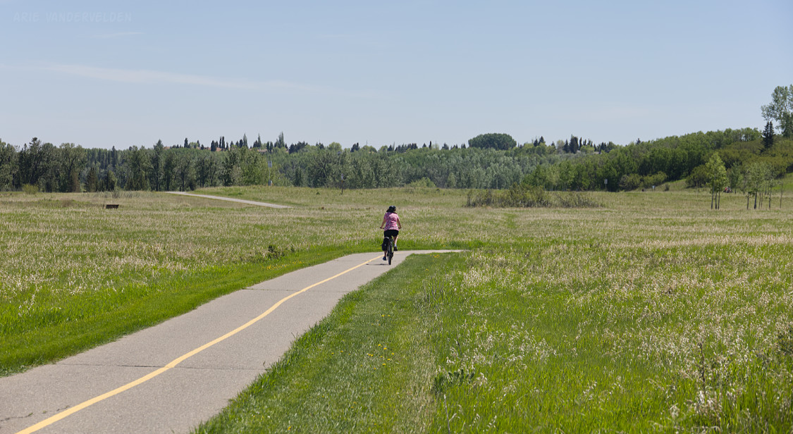
On the west side of the bridge, the path follows Fish Creek upstream. Fish Creek Park encompasses two very distinct environments: east of MacLeod Trail the valley consists of open grasslands, and west of MacLeod Trail the trail goes through a forest of dense coniferous trees. In many places you cannot see any houses, and it is hard to believe you’re cycling through a city of 1.5 million people. This is a place where you can get away from it all.
Here is east Fish Creek Park:
and west Fish Creek Park:
Two completely different environments.
Glenmore Park
As the Greenway approaches Tsutina Trail, it climbs out of the Fish Creek Valley and starts heading north on a pathway between the community of Woodbine and Tsutina Trail. The pathway keeps climbing upward until it tops out at Anderson Road. There are some nice views of the mountains in this area.
The Greenway then does a long and gradual descent into Glenmore Park, passing the community of Oak Ridge. There are underpasses at Southland Drive and 90th Avenue. At Glenmore Park the Greenway enters a beautiful aspen forest. This area is especially pretty at the end of September, when fall colours are at their peak.
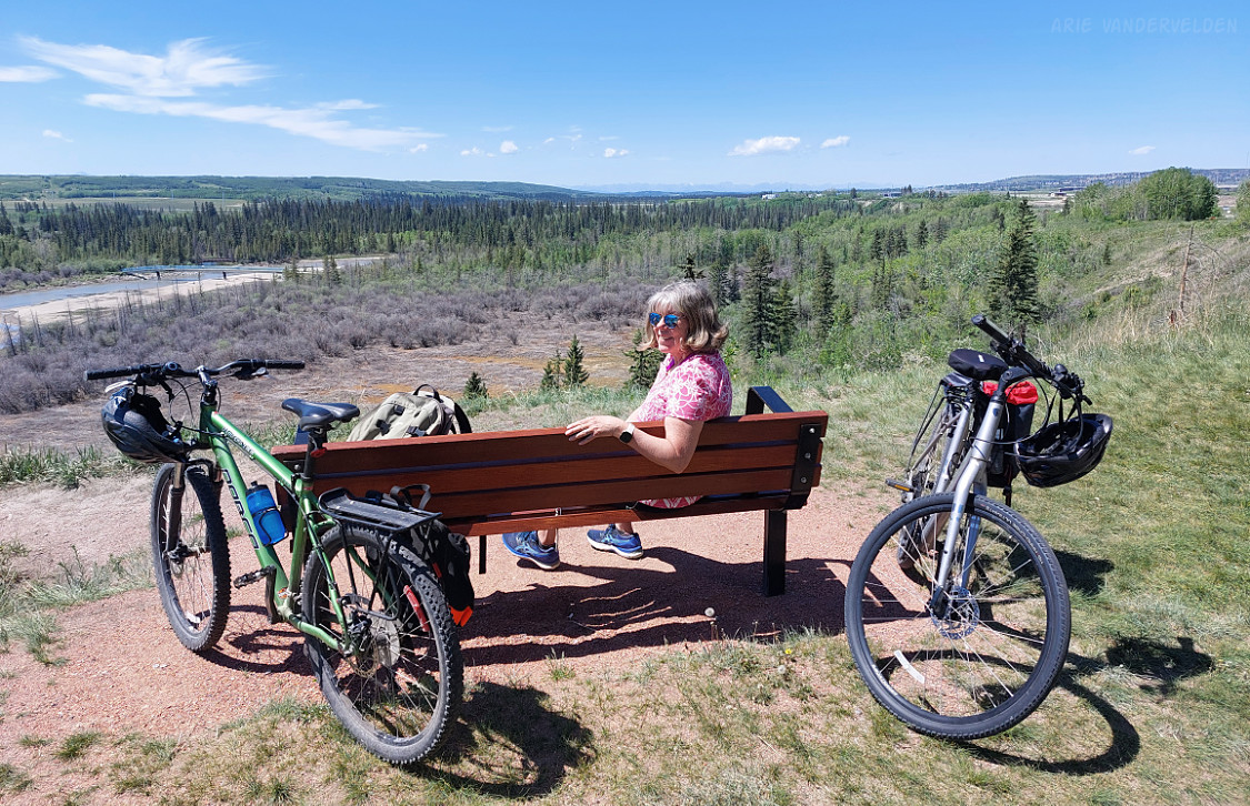
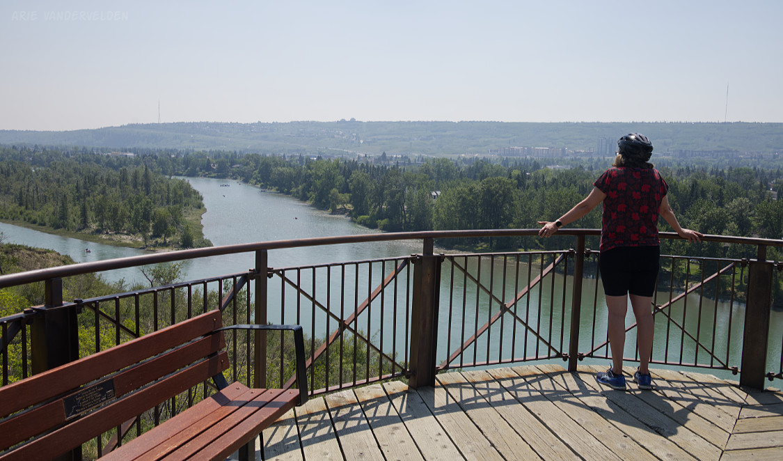
A steep hill leads down to the Elbow River floodplain, which is covered in very dense vegetation. Small birds love this type of environment, and in the springtime these woods are filled with birdsong. Just beyond the Elbow River bridge, the trail climbs out of the valley and heads up to the escarpment overlooking Glenmore reservoir. This is another place where you can’t tell you’re in the middle of the city. The only thing visible is greenery, not houses and pavement.
The views here are some of the finest in Calgary. It was a beautiful day, and we lingered on one of the benches.
The next bit is confusing. There is a signpost pointing to the east, but actually the Greenway heads north along 37th Street. Cross Glenmore Trail and turn left (west) on 46th avenue which heads into the community of Glamorgan. 46th avenue does not have a pathway along it, so proceed on the street. Turn right (north) on 50th Street and left (west) on Richmond Road. There is very little signage in this area, and some of the signage is wrong. Next, the Greenway circles Signal Hill Mall and heads up towards Battalion Park. At Battalion Park, painted stones depict regimental numbers of battalions that trained in this area during World War 1. The Greenway points up a set of stairs, which top out at a pathway just below the regimental numbers. There are views here across south Calgary and the Tsutina Reservation. The battalion numbers, however, are best viewed from a distance.
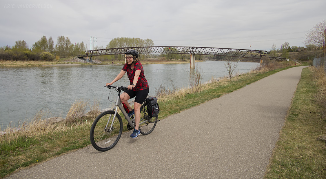
The Bow River
The Greenway now heads north, beside Sarcee Trail. There is a wide strip of greenery and this section is nicer than you’d think. There are excellent views towards downtown. The Greenway crosses 17th Avenue, and at Bow Trail it crosses kitty-corner to Edworthy Park. The Greenway follows the road leading down to the Bow River. If cycling counterclockwise, this is one of the steepest and longest hills on the Greenway.
Once at the Bow River, the Greenway goes through Shouldice Park, Dale Hodges Park, Bowmont Park, and Baker Park. These parks are my “home territory” of the Greenway because I regularly cycle through them from my home in Dalhousie.
Dale Hodges is a relatively new park. This former gravel pit has been transformed into a wetland that manages stormwater. When the park first opened in 2019, it was still freshly bulldozed and bare and unattractive; however, in the past two years the vegetation has matured and birds have moved in in droves. The park is home to dozens of noisy red-winged blackbirds. Dale Hodges Park is named after alderman Dale Hodges, who served on Calgary’s city council from 1983 to 2013. Dale Hodges played a key role in establishing city parks such as Bowmont Park, Baker Park and Nose Hill Park. Thanks Dale!
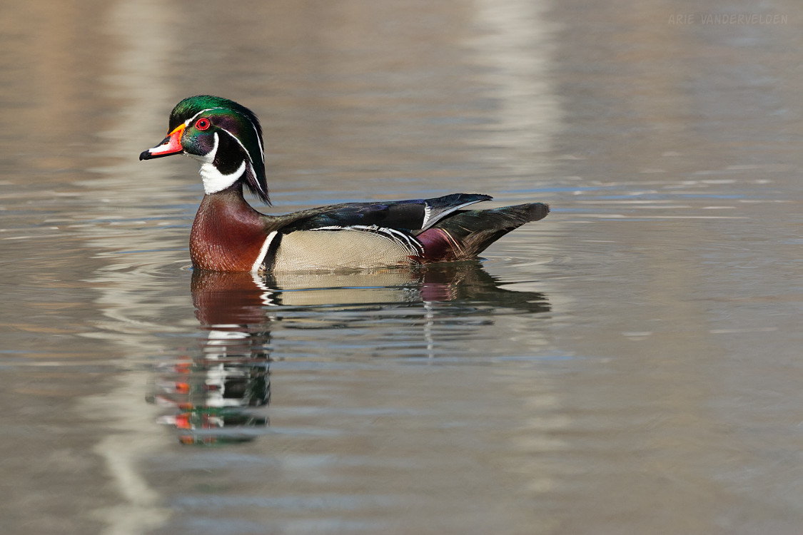
I spotted a wood duck in one of the ponds of Dale Hodges Park. This bird is rare in Alberta.
Taking a break in Dale Hodges Park.
One fun thing to do in Dale Hodges Park is to hunt around for benches with “guerilla placards” with some funny inscriptions, which a man and his son created and secretly installed on some neglected old benches. When the City got wind of this they promptly removed them and called it vandalism. This sparked a public outcry, and the city relented and reinstalled the plaques.
In Bowmont Park, the Greenway does a roller-coaster up and down the Bow River embankment. There are some nice views along the way.
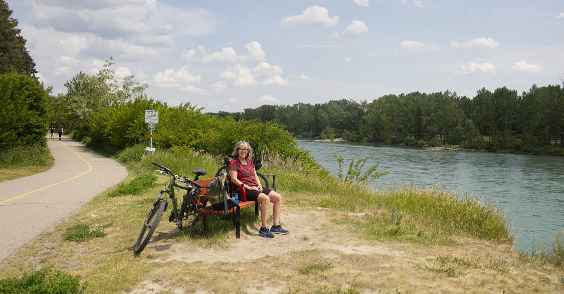
Past 85th Street, Bowmont Park turns into Baker Park. Baker Park is a popular spot for playing disc-golf and for launching rafts on the Bow River. There are some lovely benches overlooking the Bow River. It’s a good spot to take a break before the next section, which requires some effort.
Beacon Hill
Below the Stoney Trail bridge across the Bow River, the Greenway leaves the Bow River pathway system and heads north, towards Beacon Hill / Spy Hill. Beacon Hill is a 200 m ascent, and as such this section is a good workout.
First, the Greenway crosses the CPR railway tracks on a bridge.
The Greenway then goes through a tunnel underneath Nose Hill Drive, and then heads west along Nose Hill Drive. Frustratingly, the trail heads downhill towards the Home Depot before heading uphill on a sidewalk beside Tuscany Hill. Tuscany Hill is a busy road in a south-facing gully, and cycling uphill is a hot slog on a sunny summer day. This section could have been avoided with a path angling uphill in a northwesterly direction from Nose Hill Drive. Alas, this is not the way it is.
From the top Tuscany Hill, the trail heads south along the escarpment. There are some nice views here. The trail then heads into Tuscany and follows a path between people’s back yards. It then meets up with the 12-Mile Coulee Trail, where scenery instantly improves. This section is a joy to cycle. At Tuscany Boulevard the Greenway jogs east a bit before continuing up 12-Mile Coulee. Again, this section is a pleasure to ride.
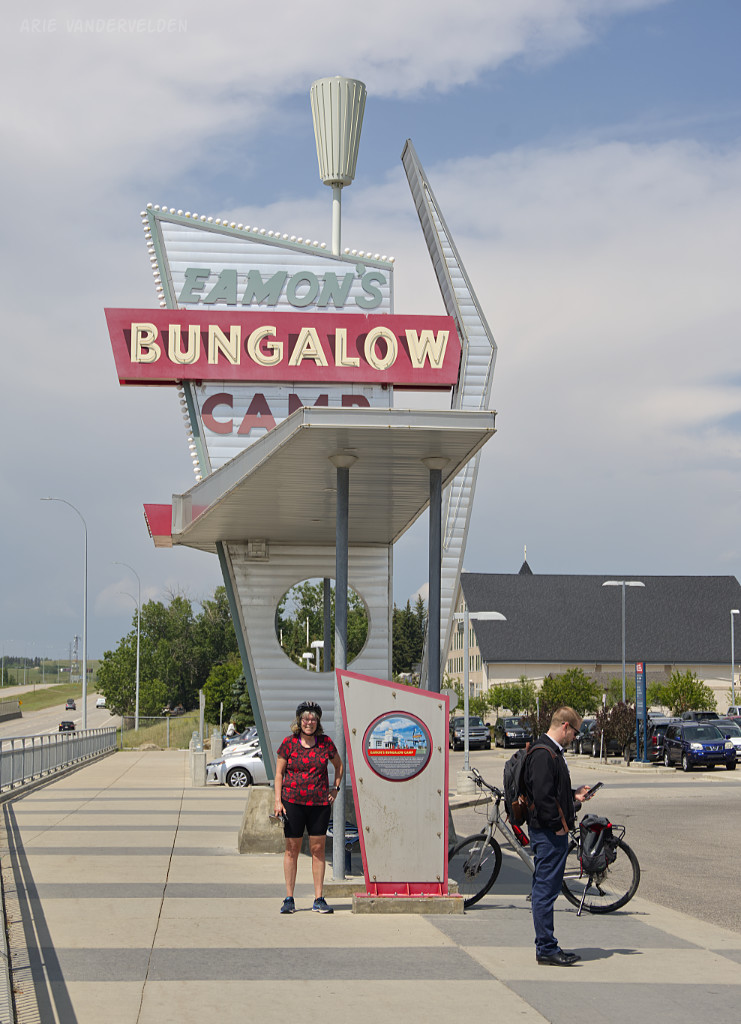
The Greenway pops out of its pleasant surroundings at the Tuscany LRT Station. Here, the highlight is the 1950s neon sign from Eamon’s Bungalow Camp, which was once located on this site. While posing for pictures here, we got photo-bombed by an oblivious commuter staring at his phone while waiting for his bus.
On the Royal Oak (north) side of the station, the Greenway continues on by heading northeast alongside Stoney Trail. The surroundings are pretty, and there are some nice stormwater ponds. Then begins a long winding uphill. Our legs were still burning from all of the uphill through Tuscany, and as a result this section was a bit of a grunt. The Greenway tops out near the pedestrian bridge that connects Royal Oak with Arbour Lake. The Greenway does not cross this bridge; rather, it heads north towards Country Hills Boulevard. There are some nice views towards the south from here.
Country Hills Boulevard at 112 Avenue is crossed at a light. Many large trucks use this road, so expect to get a lungful of diesel smoke before making it to the other side. The Greenway appears to be heading down 112th Avenue, but instead it ducks into a connector behind the Shoppers Drug Mart and leads on to a very pleasant greenspace. There are some pretty storm water ponds, and there is a disc-golf course. Next, the Greenway follows a pathway behind some car dealerships. It then follows a pathway bordering 112th Avenue and Inland Athletic Park. This is the summit of Beacon/Spy Hill. At Sarcee Trail you must go downhill to a crossing before climbing up again towards Stoney Trail.
Now begins a screaming fast and long downhill. It is pretty much all downhill from here to the bottom of Symons Valley. First, the trail goes beside a Home Depot and a Costco before descending a steep hill on a switchback. Here is Diana catching her breath when we climbed back up when going the other way.
The Greenway keeps going downhill, passing the community of Sherwood. It crosses Crowchild Trail, and then descends a gully that bisects the community of Kincora. Eventually, the trail bottoms out at Symons Valley Road. There are some nice greenspaces at the bottom of Symons Valley, and there are some good spots here to take a break. Going the other way, this is a good spot to whet your whistle before starting the long climb up to Beacon Hill.
The Northern Suburbs
Next, the Greenway heads into the community of Evanston, using a pathway beside busy Symons Valley Parkway. After cresting a gentle hill, the Greenway descends towards 14th Street and the community of Carrington, which at the time of writing was very much under construction. Greenway signage is poor in this area.
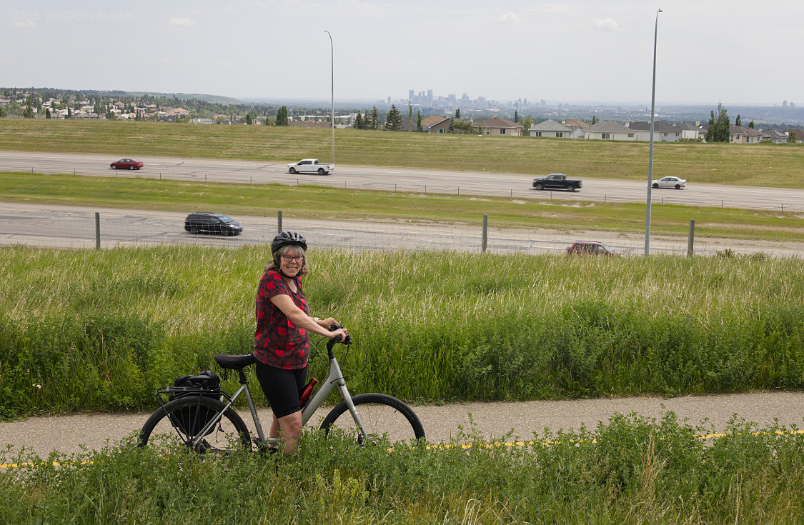
The Greenway heads south along the east side 14th Street to the wide green belt along Stoney Trail. There is a mish-mash of bike trails at Harvest Hills Boulevard, and signage is absent. The idea is to cross Harvest Hills Boulevard and to keep heading east along the Stoney Trail green belt. The Greenway climbs a prominent hill with a communications tower on top. To the south there are views of the city and downtown, while to the north are farm fields with cereal crops, soon to be turned into suburbs I suppose.
From the communications tower there is a long downhill run to 11th Street East. In this area the Greenway passes through fields of alfalfa and sweet clover, and the scenery is quite nice despite its proximity to Stoney Trail. East of 11th Street East, the Greenway follows a gravel road to an underpass where Stoney Trail crosses Nose Creek. This area feels quite dodgy – piles of discarded mattresses fill the ditches, and cars with blacked-out windows sit and idle beside the road. We minded our own business and continued on and quickly as we could. On the south side of Stoney Trail, we followed 15th Street East southward across the train tracks. A short distance ahead, 15th street becomes paved and has a bike path alongside it. There are a few Greenway signs to encourage you along.
At Country Hills Boulevard, the Greenway turns east. This turn has a signpost, and signage is a bit better from here on. Going beside Country Hills Boulevard, the Greenway crosses Deerfoot Trail and the turns north at Barlow Trail. At first, car dealerships and warehouses line Barlow Trail, but soon it goes past the edge of development and into open country. The roads and exits have already been paved here, awaiting development. This is a good spot for watching planes com in to land. The Greenway turns east at 118 Avenue North. Soon it crosses Metis Trail and enters the community of Skyview Ranch.
Little India
Skyview Ranch, and the suburbs to the south of it (Cityscape, Saddle Ridge, Taradale, Castleridge, Falconridge, Temple, Whitehorn, Rudle, Pineridge) have a sizeable population of Indian immigrants. For this reason I dub it Calgary’s Little India. This region also has a reputation for being a magnet for destructive hailstorms. This area first got pounded by a storm in June of 2020, which caused $1.2 billion in damage, mainly to homes’ siding and shingles. Many houses looked like this – note the shredded siding and the stacks of shingles on the roof.
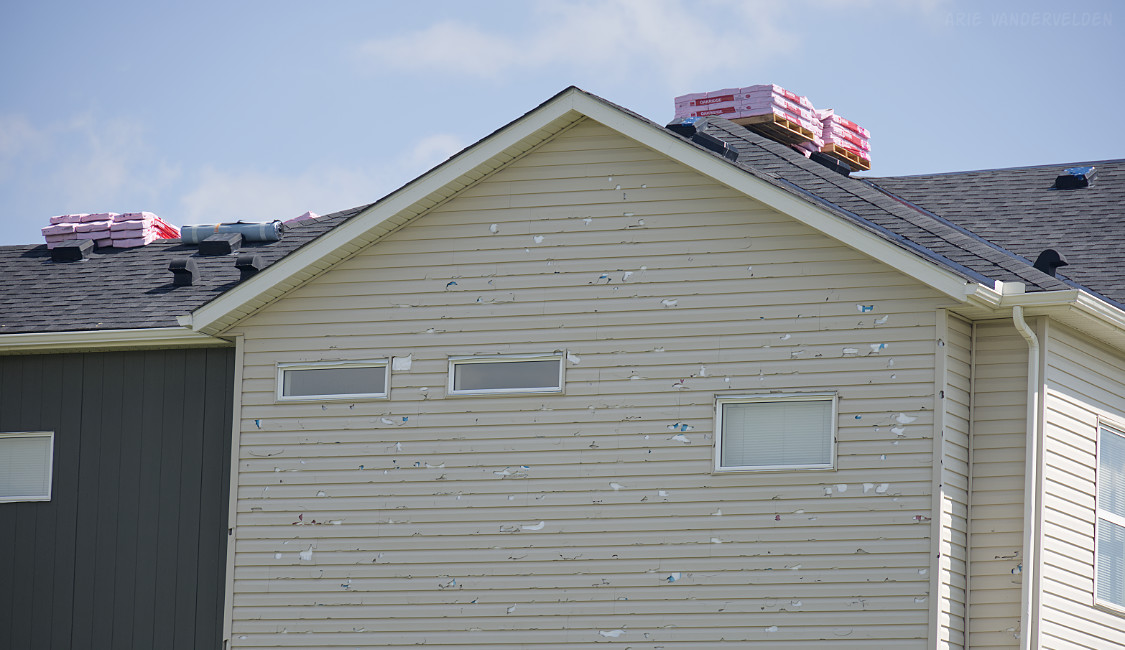
$1.2 billion seems like a huge and arbitrary number, but when we cycled through this area a few months later we were struck by the immense scale of the damage. House after house, street after street, neighborhood after neighborhood – the damage just went on and on. A single picture of one side of a house doesn’t begin to communicate the scale of the disaster. Then in August of 2024, just when most of the damage had finally been repaired, another storm struck the very same area. This one is estimated to have caused $2.8 billion in damage.
Heading east along 118th Avenue North, we came to the intersection with Skyview Ranch Road. Here, the bike path ends, and there is no signage. We continued east on a sidewalk, which took us to the intersection with Red Embers Gate. There is a signpost here, and it pointed to the south, to a bikepath leading through a greenspace. It goes past a school, and then heads alongside 52 Street East, and ends up at a large wetland. The Greenway goes counterclockwise around this wetland. At the south end there is a signpost with confusing signage, and it took us a while to figure out which way we’re supposed to go. We headed south for 100 m to Cityscape Drive, turned left, and after 100 m we turned right onto a bike path. This took us to the intersection of Airport Trail and 60th Street East. Note, none of this is signposted. We crossed the intersection on the east side, and after 100 m we found another signpost, pointing left into the community of Saddle Ridge. Head east on Saddlecrest Way, and then turn left onto Saddlecrest Boulevard. This latter junction is not signed. Then, just after a school, there is a signposted turn to the left onto a bike path. This bike path leads to the corridor between Stoney Trail and the communities that comprise Calgary’s Little India.
Once on this pathway the navigation becomes trivial: just follow the pathway southward along Stoney Trail. Ironically, Greenway signposts are plentiful here. At major road crossings the pathway veers west a bit to get to the nearest intersection.
The cycling is pleasant along Stoney Trail. One highlight along this stretch is Taradale Gardens, where there is a memorial to Manmeet Singh Bhullar. Bhullar was an MLA and community leader who was tragically killed one winter night when he stopped along a highway to help out a stranded motorist. Bhullar was then struck and killed by another vehicle. The gardens where his memorial is located are very nice, and it’s a nice place to stop and rest.
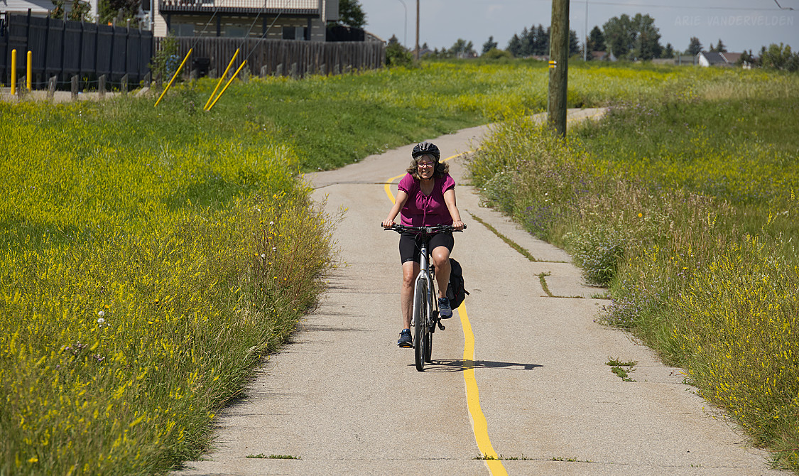
Cycling the Greenway just north of 16th Avenue North.
South of 16th Avenue North, the Greenway circles the communities of Abbeydale and Applewood by going along the green buffer along Stoney Trail. At the south end of this, the pathway cuts through Applewood for a short distance to come to a crossing of 17th Ave South (International Avenue) at 70th Street East. Just to the south of this intersection, the bikepath comes to a T-junction that has no signage. The Greenway goes to the left (east).
Foothills Industrial Park
South of 17th Avenue South, the Greenway circles the east Calgary landfill. The surroundings look nice and there is lots of green space, but some offensive odors did waft towards the bike trail when we rode it. At the intersection of Peigan Trail and 52nd Street, the Greenway appears to come to end. We crossed kitty-corner and rode south along 52nd Street, as maps of the Greenway suggest doing. Note that 52nd Street is the main feeder to a busy industrial area, and on weekdays this thoroughfare is choked with traffic. For this reason I suggest riding this section on a Sunday, when the area is mostly deserted.
There is no Greenway signage along 52nd Street. South of 94 Ave South, we followed a small connector that joins with the Chestermere Canal Pathway, completing our loop along the Greenway. It was not exactly a glamorous ending to our tour around Calgary, but we did it! Maybe at some point in the future this section will be re-aligned. 52nd Street isn’t exactly a “green” place for the Greenway, and the corridor along Stoney Trail would be a much more pleasant option. This would complete the Greenway.
Logistics
Here is a map of the Greenway, courtesy of the Calgary Parks Foundation: